
Wintry for now, Christmas week thaw ahead
40s likely for Twin Cities, southern Minnesota Christmas week

Go Deeper.
Create an account or log in to save stories.
Like this?
Thanks for liking this story! We have added it to a list of your favorite stories.


Happy holidays Minnesota!
I’m getting that holiday feeling these days. The weather maps keep a wintry touch on the weekend, but a major pattern change next week will send another gush of mild Pacific air into Minnesota.
In the meantime, we deal with a light wintry mix across much of Minnesota Friday night into early Saturday.
On the map below, the National Oceanic and Atmospheric Administration’s latest High-Resolution Rapid Refresh model shows the system between 6 p.m. Friday and 6 a.m. Saturday.
Turn Up Your Support
MPR News helps you turn down the noise and build shared understanding. Turn up your support for this public resource and keep trusted journalism accessible to all.
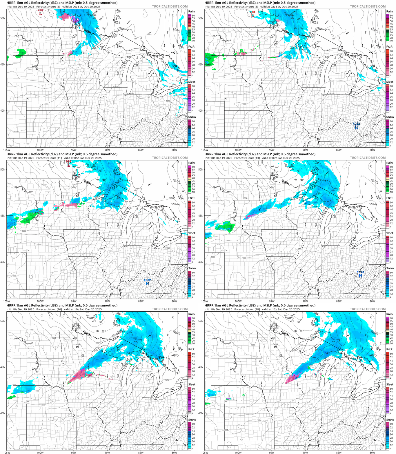
Winter weather advisories are up for far northeastern and northwestern Minnesota. Here’s the National Weather Service bulletin:
Southern Cook-
Including the cities of Grand Marais
138 PM CST Fri Dec 19 2025
...WINTER WEATHER ADVISORY IN EFFECT FROM 6 PM THIS EVENING TO 6 AM
CST SATURDAY...
* WHAT...Lake enhanced snow expected. Total snow accumulations
between 2 and 5 inches. Winds gusting as high as 35 mph.
* WHERE...Southern Cook County. This includes the Tribal Lands of
the Grand Portage Reservation.
* WHEN...From 6 PM this evening to 6 AM CST Saturday.
* IMPACTS...Plan on slippery road conditions.
Here’s the advisory from northwestern Minnesota:
Including the cities of Thief River Falls, Grafton, Drayton, Red
Lake Falls, Crookston, Middle River, Warren, Roseau, East Grand
Forks, Grand Forks, Cavalier, Newfolden, and Hallock
1236 PM CST Fri Dec 19 2025
...WINTER WEATHER ADVISORY REMAINS IN EFFECT UNTIL 8 PM CST THIS
EVENING...
* WHAT...Snow and widespread blowing snow. Additional snow
accumulations up to one inch. Winds gusting as high as 45 mph.
* WHERE...Portions of northwest Minnesota and northeast North Dakota.
* WHEN...Until 8 PM CST this evening.
* IMPACTS...Plan on slippery road conditions. Widespread blowing
snow, frequently reducing visibility below a half mile, will make
travel dangerous, especially in open country. The hazardous
conditions could impact the Friday evening commute.
* ADDITIONAL DETAILS...Brief whiteout conditions are possible.
The Twin Cites and the rest of Minnesota will see a light wintry mix of snow, sleet and some freezing drizzle overnight into early Saturday.
Highs this weekend will be mostly in the 20s.
Christmas week thaw!
A warm front blowing into Minnesota Monday morning may trigger some light snow, but after that it’s all mild weather news next week. Another gush of mild Pacific air will push temperatures to 20 degrees warmer than normal once again.
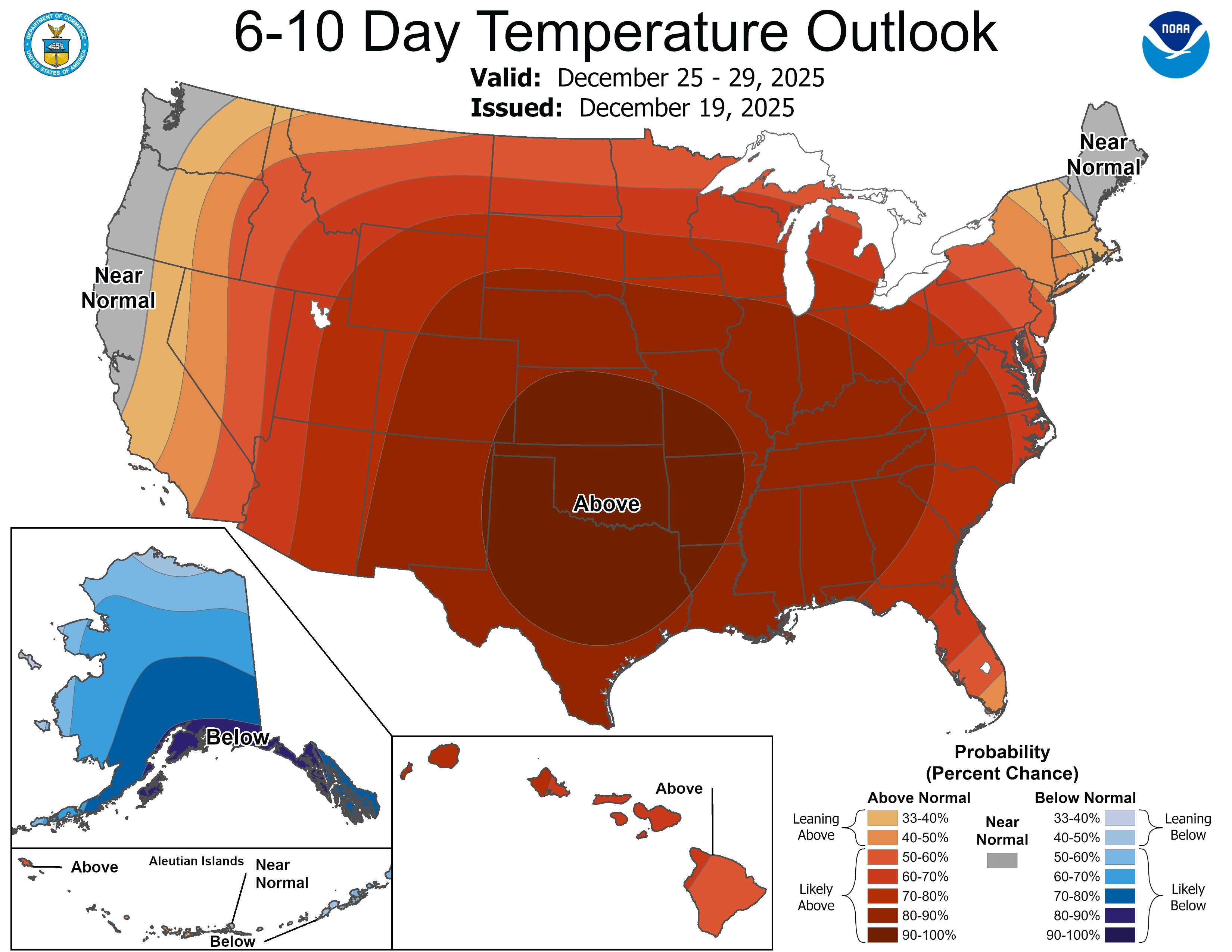
Highs Monday and again in the day surrounding Christmas look likely to reach or exceed 40 degrees in the Twin Cities and southern Minnesota.

A few models crank out 50s for southwestern Minnesota on Christmas Day!
Overall, travel looks good next week after Monday morning’s snow chance. We can always get some fog late at night and in the mornings that can lead to icy roads. Keep an eye out for that on untreated surfaces next week.
Have a great holiday week Minnesota!

