
Chilly Monday with more snow possible Tuesday and Wednesday
More cold air moves in for the start of the new year

Go Deeper.
Create an account or log in to save stories.
Like this?
Thanks for liking this story! We have added it to a list of your favorite stories.


We remain in the track of weather systems with another round of snow showers Tuesday and Wednesday. Temperatures will be briefly warmer Tuesday before falling again Wednesday.
Chilly Monday with more snow showers on the way Tuesday followed by more cold air
Winter weather advisories persist through much of Monday for central and southern Minnesota due to blowing and drifting of snow. All falling or accumulating snow is long done. There’s also a wind advisory through 12 p.m. Monday for the northern part of the North Shore.

Our latest snow storm is done leaving several or more inches of new snow in its wake. The Twin Cities officially received 5.8 inches. Mankato received 9 inches. Generally the heaviest snowfall was across central and southern Minnesota into western Wisconsin.

It also came with some pretty high wind gusts which contributed to blizzard conditions across southern Minnesota Sunday. Morris clocked a 60 mph wind gust Sunday afternoon.
Turn Up Your Support
MPR News helps you turn down the noise and build shared understanding. Turn up your support for this public resource and keep trusted journalism accessible to all.

We’ll see decreasing clouds Monday with some afternoon sunshine. Temperatures will not move much. We’ll remain in the teens and single digits mostly.

Northwest winds will be blustery Monday morning but should gradually decrease from about 15-30 mph to 10-15 mph by afternoon.
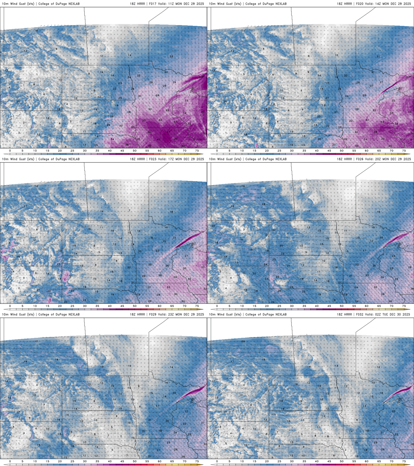
Tuesday will be briefly warmer ahead of the next clipper system. Southwest Minnesota could be above freezing with low 30s and 20s for most of the rest of us.

We remain in the track of most weather systems, being on the edge of the coldest and mild air, which means more snow showers are likely to develop Tuesday. Another clipper will move through Wednesday with a slightly different track.
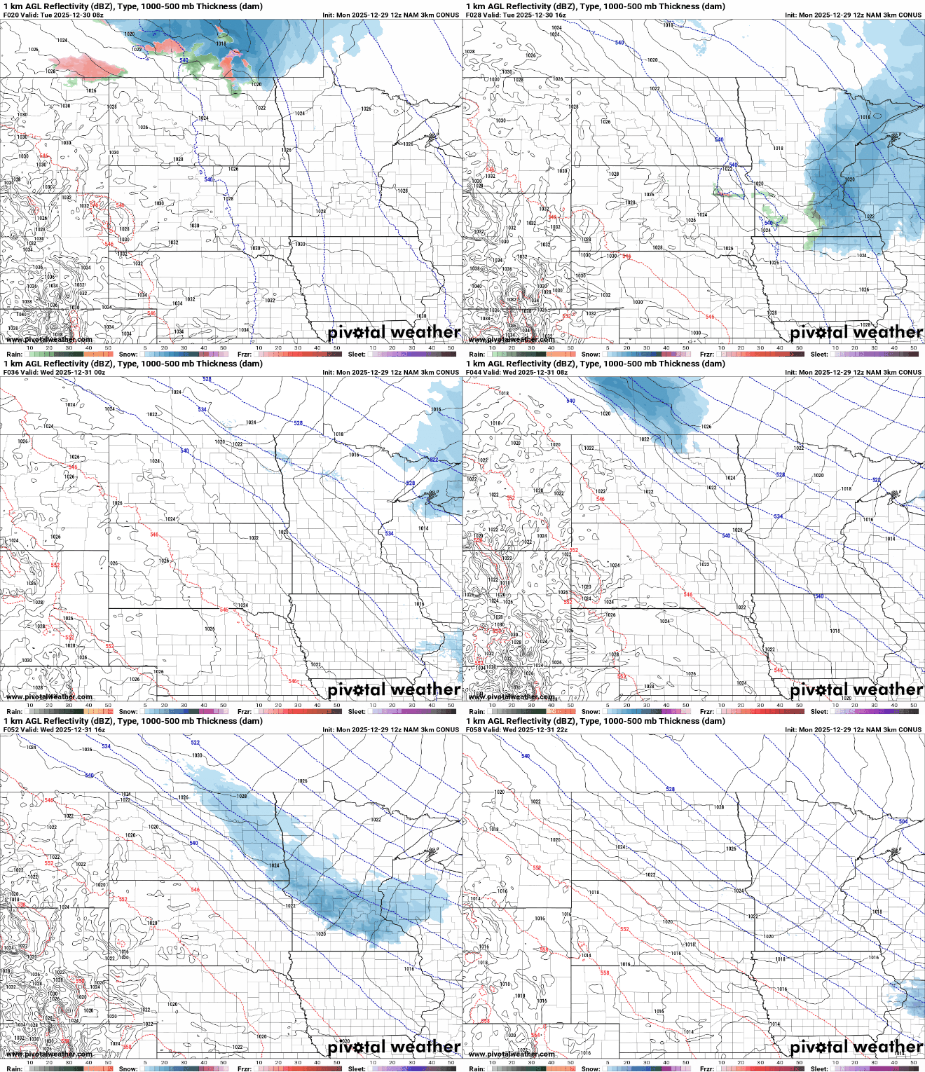
Snowfall Tuesday will be primarily for northeast and portions of east-central Minnesota into western Wisconsin.

Another shot of snow showers Wednesday will be a bit more south and will swipe from northwest through central and southeast Minnesota.

More Arctic air moves in Wednesday and into Thursday and Friday making for a frigid start to the New Year of 2026. If you’re out and about at midnight New Year’s Eve, it’ll be cold with single digits and subzero temperatures.

New Year’s Day Thursday should yield sunshine but cold temperatures. Most will see highs in the single digits with some teens in far southern Minnesota Thursday afternoon.

More seasonable temperatures, mostly in the teens and 20s moves in for the weekend along with a few quiet days of weather.

