
Update: Icy glaze overnight into Tuesday morning
Winter weather advisories cover most of central, southern Minnesota overnight

Go Deeper.
Create an account or log in to save stories.
Like this?
Thanks for liking this story! We have added it to a list of your favorite stories.


Here’s an update as of 4:30 p.m. Monday on our next icing event for Minnesota.
Overall ice accumulations up to one-tenth of an inch are likely across much of southern Minnesota overnight into Tuesday morning.

Some models suggest up to one-quarter inch of ice locally. If that criteria is reached, we could see advisories upgraded to ice storm warnings for parts of Minnesota and especially western Wisconsin overnight.

A weak low-pressure system crossing our region has enough moisture to drop an icy glaze that will coat untreated roads and other surfaces overnight into Tuesday morning.
Turn Up Your Support
MPR News helps you turn down the noise and build shared understanding. Turn up your support for this public resource and keep trusted journalism accessible to all.
The Canadian model seems to have the best handle on precipitation type and coverage overnight into Tuesday. The forecast model loop below between 6 p.m. Monday and 6 p.m. Tuesday shows rain and icy precipitation crossing our region.
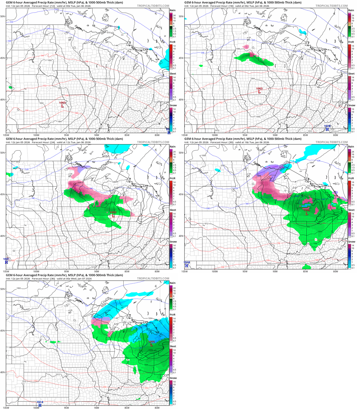
Winter weather advisories cover most of central and southern Minnesota overnight.

Here’s the National Weather Service advisory:
Mille Lacs-Kanabec-Sherburne-Isanti-Chisago-Wright-Hennepin-Anoka- Ramsey-Washington-McLeod-Sibley-Carver-Scott-Dakota-
Including the cities of Blaine, Center City, Monticello, Chanhassen, Victoria, Shakopee, Princeton, Chaska, Cambridge, Mora, Hutchinson, Hastings, Gaylord, Stillwater, St Paul, Minneapolis, and Elk River
1120 AM CST Mon Jan 5 2026
...WINTER WEATHER ADVISORY REMAINS IN EFFECT FROM 9 PM THIS EVENING TO NOON CST TUESDAY...
* WHAT...Freezing rain expected. Total ice accumulations up to one tenth of an inch.
* WHERE...McLeod, Sherburne, Sibley, Wright, Anoka, Carver, Chisago, Dakota, Hennepin, Isanti, Kanabec, Mille Lacs, Ramsey, Scott, and Washington Counties.
* WHEN...From 9 PM this evening to noon CST Tuesday.
* IMPACTS...Difficult travel conditions are possible. The hazardous conditions could impact the Tuesday morning commute.
Temperatures will dip into the 20s overnight into Tuesday morning. That means untreated surfaces will be sporting an icy glaze.

Remember that untreated driveways, sidewalks and parking lots will be slick for walking! Roads deservedly get plenty of attention but many injuries occur from slipping on ice while walking in our Minnesota winters.
Temperatures will warm into the 30s and 40s around Minnesota Wednesday so we’ll thaw out after this latest icy smudge.

In the meantime, be careful out there!

