
Ice, snow system trending north toward Twin Cities late Thursday
Some models show wintry mix reaching Twin Cities region

Go Deeper.
Create an account or log in to save stories.
Like this?
Thanks for liking this story! We have added it to a list of your favorite stories.


Here we go, again?
Forecast model trends late Tuesday show a possible northward shift for our next inbound wintry weather system late Thursday into Friday.
The previous model consensus had the northern edge of accumulating snow staying across southeastern Minnesota south of the Twin Cities.
But the National Oceanic and Atmospheric Administration’s latest 18Z NAM 3 km model run pumps a wintry mix of cold rain and ice initially into the Twin Cities late Thursday afternoon. The model then projects a quick changeover to potentially heavy wet snow Thursday night.
Turn Up Your Support
MPR News helps you turn down the noise and build shared understanding. Turn up your support for this public resource and keep trusted journalism accessible to all.
The forecast model loop below runs from 3 p.m. to 11:59 p.m. on Thursday.
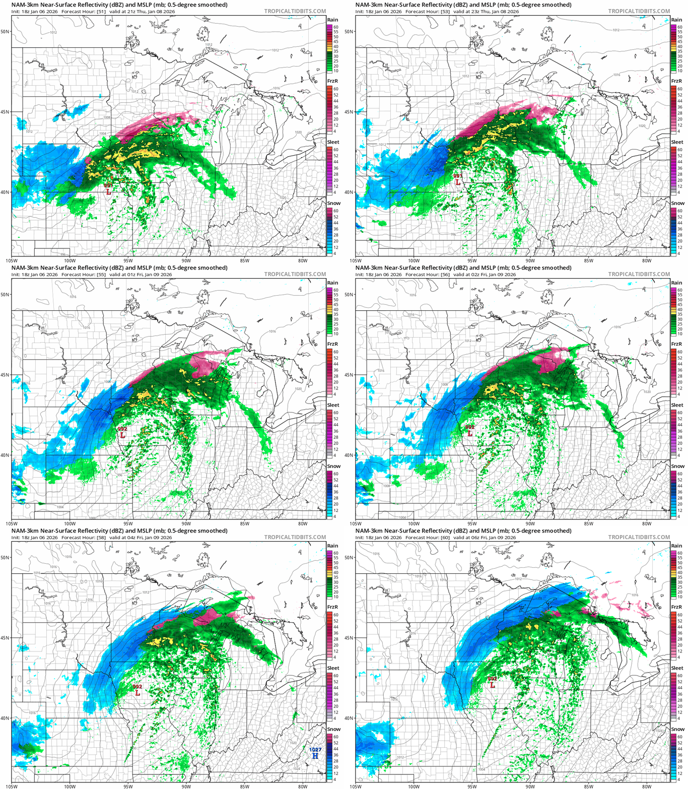
It should be noted that my experience with NAM (North American Mesoscale) models is they are often too far north with storm tracks in winter. So it’s not nearly certain at this point that wintry precipitation will cover the Twin Cities yet.
NOAA’s 18Z Global Forecast System update continues the previous trend of keeping the bulk of precipitation south of the Twin Cities.

The northward trend is worth watching as new model runs come in late Tuesday night and Wednesday.
Stay tuned on this one.
In the meantime, we enjoy a brief thaw Wednesday across most of Minnesota. If we get enough sun, I think we’ll have no trouble soaring into the 40s in the Twin Cities Wednesday afternoon and most of Minnesota will crack the thawing point.


