
Sloppy rain and wet snow system across southern Minnesota late Thursday
Rain and some wet snow mainly south of the Twin Cities area. Accumulations of 1 to 2 inches favor areas south of the Twin Cities.

Go Deeper.
Create an account or log in to save stories.
Like this?
Thanks for liking this story! We have added it to a list of your favorite stories.


We’re watching our next sloppy weather system head for southern Minnesota Thursday. The system looks warm enough for mostly rain. But a transition to wet snow is likely Thursday evening across much of southern Minnesota.
NOAA’s HRRR model still seem to have a good handle on the system. The forecast model loop below runs between 3 p.m. Thursday and 6 a.m. Friday.
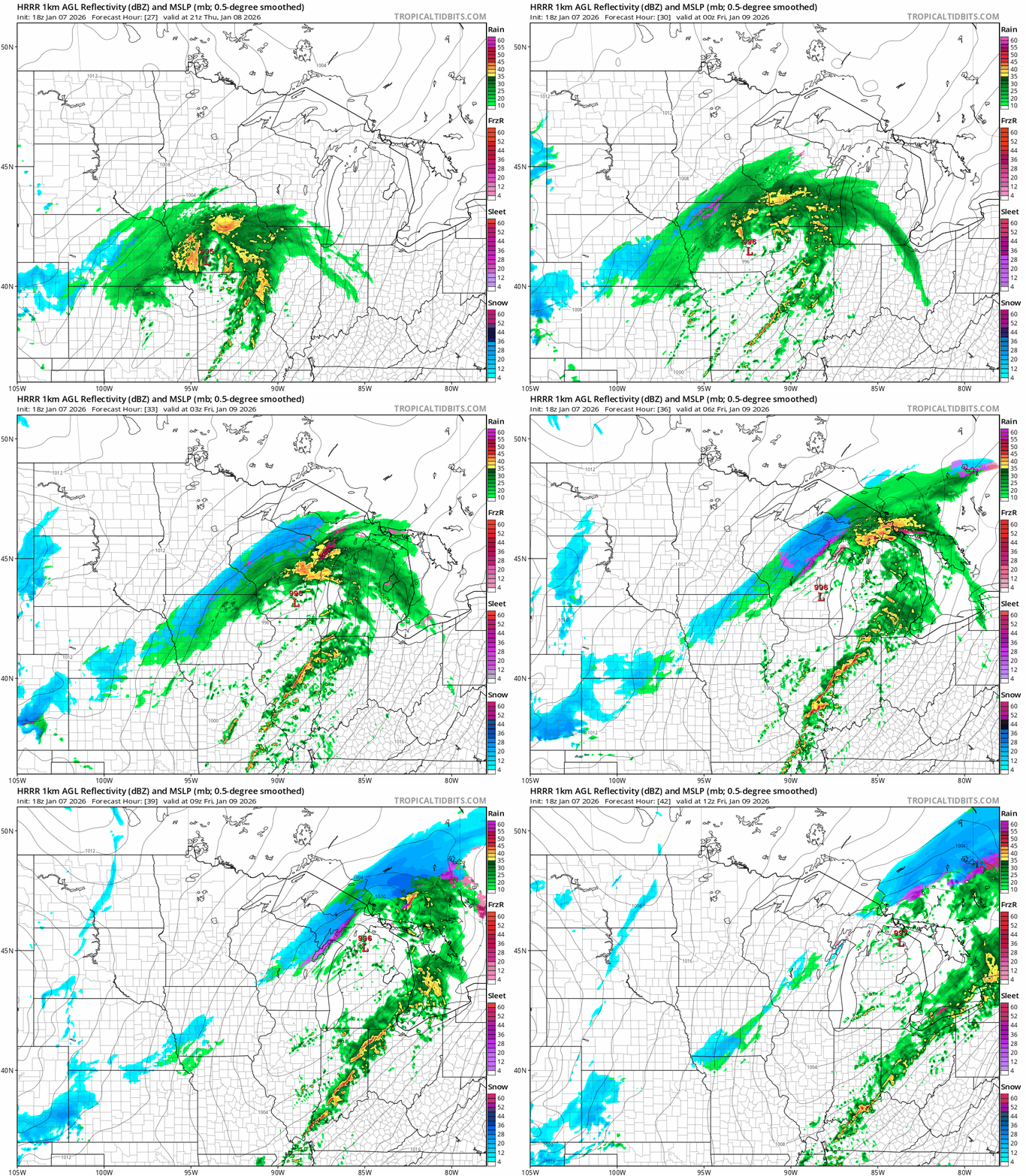
It looks like temperatures will be cold enough for a few hours of wet snow, especially south of the Twin Cities Thursday night. We could see a light slushy coating in parts of the Twin Cities Thursday night (map at top of post).
Highs Thursday will be in the 30s across most of Minnesota.
Turn Up Your Support
MPR News helps you turn down the noise and build shared understanding. Turn up your support for this public resource and keep trusted journalism accessible to all.

This looks like a relatively low impact event overall with roads at or above freezing Thursday evening in southern Minnesota.
Temperatures will fall this weekend with highs in the teens to 20s across most of Minnesota. Light snow Saturday may produce an inch or so in many areas.

Temperatures in the 30s look likely early next week.
Stay tuned.

