
Thaw today! Rain snow mix south late Thursday
Temperatures soaring into the 40s today around most of southern Minnesota. A rain and snow mix arrives late Thursday in the south.

Go Deeper.
Create an account or log in to save stories.
Like this?
Thanks for liking this story! We have added it to a list of your favorite stories.


Behold the January Thaw!
Temperatures have soared under sunshine and a mild Pacific air mass on this Wednesday afternoon. Streets are melty, and the air is pleasantly mild. Temperatures hit 50 degrees in southwest Minnesota Wednesday afternoon.
Minnesota is riding the northern edge of an unusually mild January air mass covering most of the central U.S.

January Thaw climatology
Turn Up Your Support
MPR News helps you turn down the noise and build shared understanding. Turn up your support for this public resource and keep trusted journalism accessible to all.
January thaws occur in about 82 percent of years in the Twin Cities dating back to 1873. 2024 produced the longest January Thaw on record that lasted well into February at 24 days!

Here’s more detail on January Thaws from the Minnesota DNR Climate Group.
A January Thaw is defined as two or more consecutive days with maximum temperatures above 32 degrees F. These thaw episodes are a regular part of Minnesota's climate, bringing a brief respite to a Minnesota winter. January Thaws are most common and often most dramatic in southwestern Minnesota, where the local topography can boost daytime temperatures above freezing with relative ease, and sometimes even above 60 F. Although less extreme, January Thaws also occur most years throughout northern and eastern Minnesota.
In the Twin Cities, January Thaws have occurred 82% of the time historically (back to 1873). For comparison, a "White Christmas" in the Twin Cities (one inch or more of snow cover on Christmas Day) occurs about 72% of the time, meaning we are more likely to have a January Thaw than a White Christmas, and this is true in all but the northern third or so of the state.
With one January Thaw now recorded in 2026, the streak is currently 15 years and counting; the last winter without a January Thaw in the Twin Cities was 2011.
Sloppy rain and snow south late Thursday
It will be a few degrees cooler Thursday but still much milder than our normal high of 24 degrees in the Twin Cities for January 8.

A sloppy rain and snow system will clip southeast Minnesota late Thursday through Thursday night. The Twin Cities looks to ride the northern edge of the system. We could see rain mix with some wet snowflakes especially in the southern Twin Cities through southern Minnesota.
NOAA’s latest 18Z HRRR model keeps most of the precipitation south of the Twin Cities with rain and some sloppy snowflakes Thursday evening.
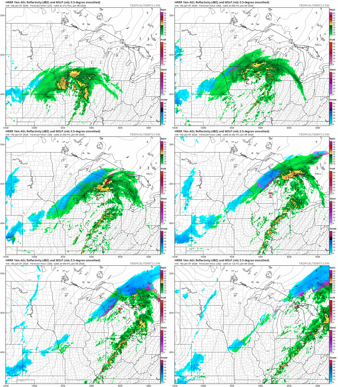
Snowfall accumulations look light with a sloppy inch or so possible across parts of southern Minnesota into Wisconsin.

Temperatures will cool into the 20s next weekend with light snow chances (probably an inch or so) favoring Saturday.
Right now I don’t see any big snow events on the maps for the next week or so.
Stay tuned.

