
Rain changes to sloppy snow Thursday night from the Twin Cities south and east
Temps near or slightly above freezing across southern Minnesota Thursday night

Go Deeper.
Create an account or log in to save stories.
Like this?
Thanks for liking this story! We have added it to a list of your favorite stories.


Our next weather maker is a sloppy one.
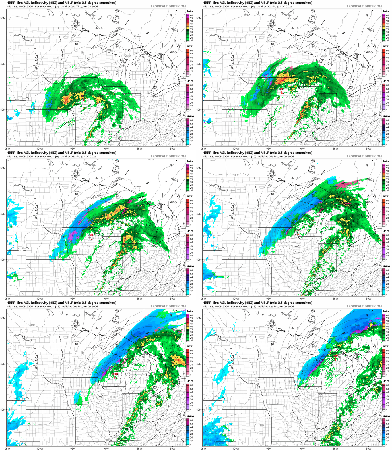
A moderately strong low pressure system pushes rain and wet snow across Iowa, southern Minnesota and western Wisconsin Thursday night. Thursday’s updated forecast models favor the northern edge of the system clipping the Twin Cities as it slides through Thursday night.
That means we’ll likely see rain change to sloppy wet snow Thursday evening from the Twin Cities southward. (See the map above.)
The National Oceanic and Atmospheric Administration’s latest (18Z) High-Resolution Rapid Refresh model shows the trend. The forecast model loop below runs between 3 p.m. Thursday and 6 a.m. Friday.
Turn Up Your Support
MPR News helps you turn down the noise and build shared understanding. Turn up your support for this public resource and keep trusted journalism accessible to all.
Temperature profile
This system has a much warmer temperature profile than our typical January weather system.
Temperatures will hover near or slightly above the freezing mark Thursday evening across southern Minnesota.

That should mean mostly wet roads before snowfall begins to accumulate on grassy and previously snow and ice covered areas.
As temperatures fall below freezing later Thursday night into Friday morning roads may become slick. Watch out for refreeze and some slick spots Friday morning!

Colder weekend
The weekend brings more typical winter temperatures back to Minnesota. Highs Saturday will hover in the 20s south to teens northwest. We’ll also see a few occasional snow showers with light accumulations.

Colder transition next week
Next week starts mild once again. Highs will run in the 30s to low 40s southwest Monday.
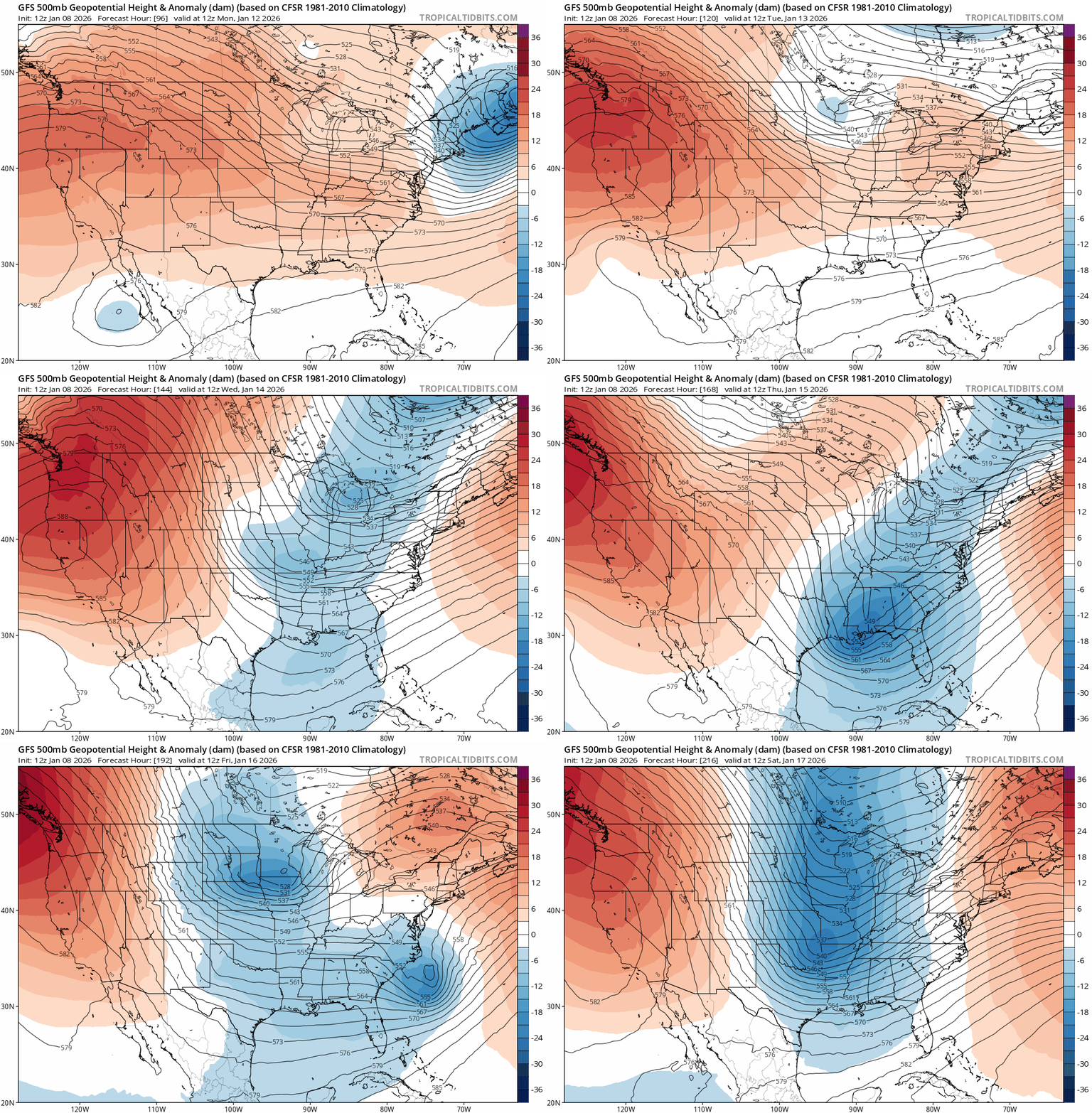
Next week will turn more wintry as the week rolls on. And I’m still watching for the growing, likely shot of more typical mid-January arctic air starting around the weekend of Jan. 17-18.
Mid to late January features the climatologically the coldest weeks of the year in Minnesota so we’re due.
NOAA’s Global Forecast System upper-air forecast shows a northwest flow developing late next week as a chunk of arctic air breaks off from the polar regions and slides down across Minnesota and the Upper Midwest.
NOAA’s outlooks favor below-normal temperatures in the last weeks of January.
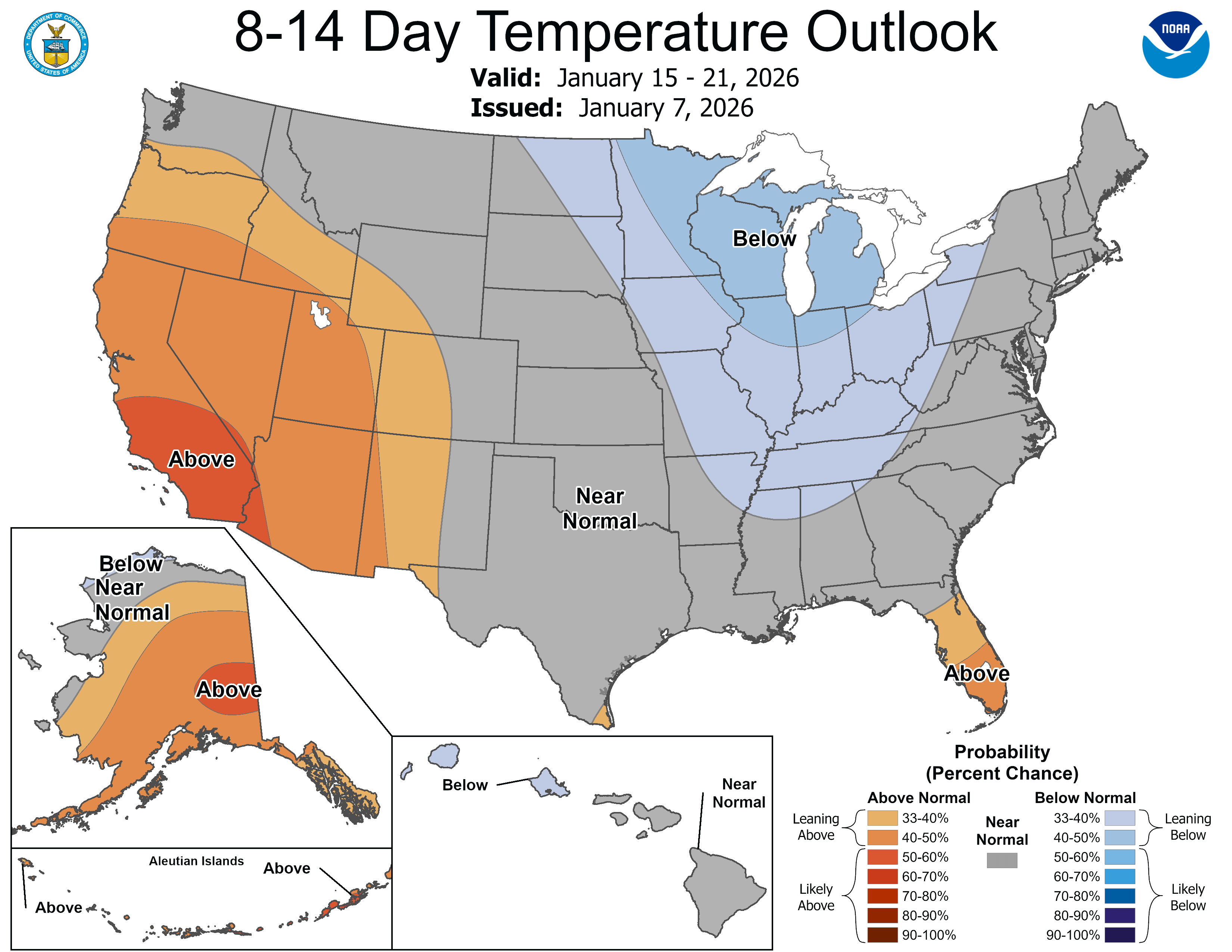
So it looks like more subzero nights are likely in our future in the second half of January.
Stay tuned.

