
Sloppy snow overnight; more typical wintry weekend ahead
Rain changes to wet snow overnight into Friday; seasonally colder this weekend

Go Deeper.
Create an account or log in to save stories.
Like this?
Thanks for liking this story! We have added it to a list of your favorite stories.


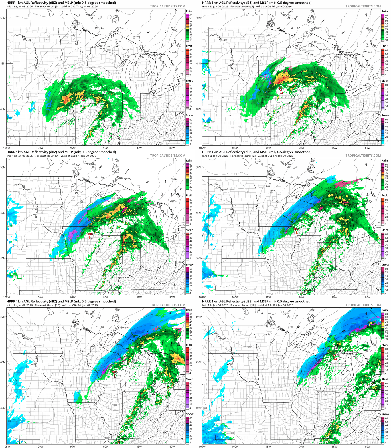
We wake up to a messy morning Friday in much of eastern Minnesota and Wisconsin.
Rain and drizzle changes to wet snow overnight in many areas. Overall accumulations look light, but with temperatures falling below freezing overnight we could have some slick spots again for the Friday morning commute.
A more wintry air mass arrives as we head into the upcoming weekend. Highs Saturday will feel properly wintry with temperatures in the teens northwest and 20s elsewhere.

Saturday’s blustery northwest winds will pack some occasional snow showers and flurries. They may add up to a snowy coating of up to an inch by late Saturday in many areas.
Turn Up Your Support
MPR News helps you turn down the noise and build shared understanding. Turn up your support for this public resource and keep trusted journalism accessible to all.
Sunday will be the sunnier, calmer day of the weekend, but highs will still hover in the 20s.
Changes next week
We get another thaw Monday with highs into the 40s once again in southwestern Minnesota.

Next week turns gradually colder. A possible arctic outbreak arrives the weekend of Jan. 17-18.
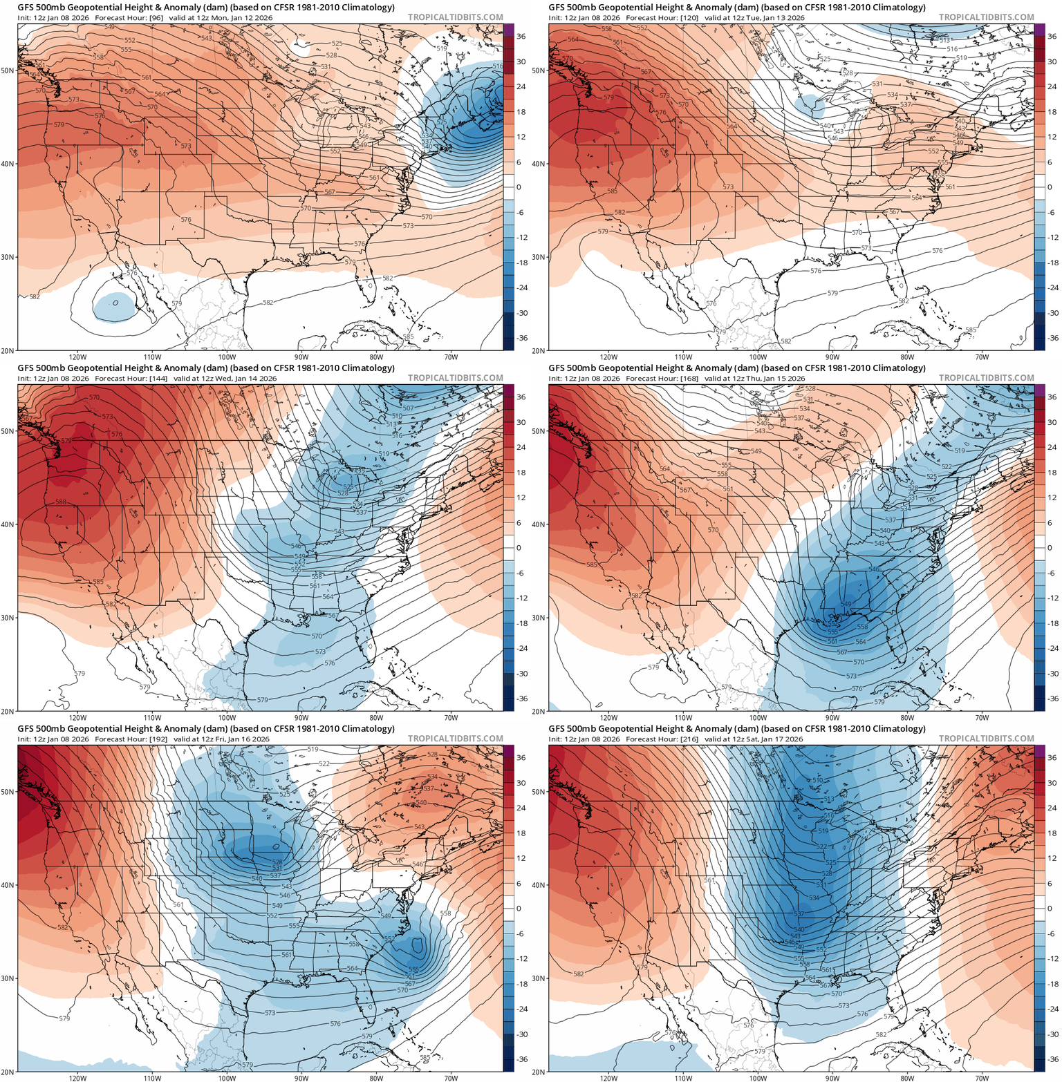
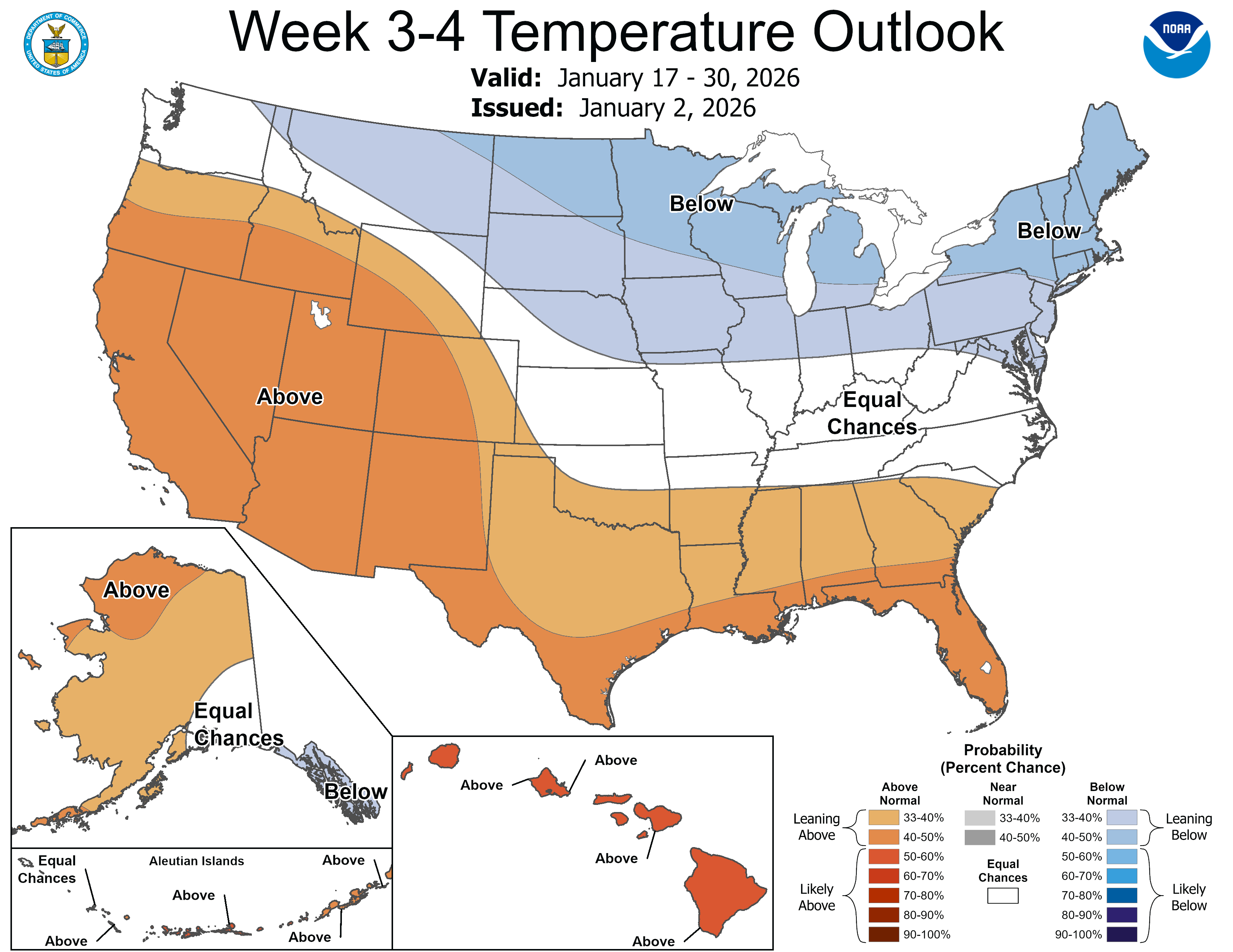
More subzero lows appear to be on the way in the second half of January.
La Niña fades by spring?
It’s interesting to note that NOAA’s forecast models suggest a rapid transition from our current La Niña (cold water) phase of the tropical Pacific Ocean to an El Niño-Southern Oscillation neutral phase by spring and a possible a flip to El Niño (warm water) phase next summer.

What this means for Minnesota for the rest of our winter is unclear. Typically, La Niña favors colder snowier winters in Minnesota, often peaking during the second half of winter.
Our weather regime does look to flip to a colder pattern late next week. Colder-than-normal temperatures are likely for the second half of January.
If the current La Niña fades by spring, it could mean less forcing in the Upper Midwest for colder air as we move through February.
February looks like a wild card for temperatures and snowfall at this point.
December was 3.1 degrees colder than normal. So far, January is running about 5 degrees warmer than normal in much of Minnesota. It remains to be seen if we’ll finish warmer or colder than normal this winter.
If El Niño ramps up into next winter it’s likely to be milder than normal. It’s getting harder and harder to cobble together a colder-than-normal winter in the era of climate change in Minnesota.
Stay tuned.

