
Arctic cold and snow return to Minnesota
A mild start to January gives way to much colder temperatures in the next week. Occasional snow arrives Thursday into Sunday.
Go Deeper.
Create an account or log in to save stories.
Like this?
Thanks for liking this story! We have added it to a list of your favorite stories.


It’s been a balmy January so far by Minnesota standards.
So far this month temperatures are running five to 10 degrees warmer than normal across Minnesota with the highest anomalies in southwest Minnesota.

Temperatures nudged 50 degrees in southwest Minnesota again Tuesday afternoon with widespread 40s in the south.

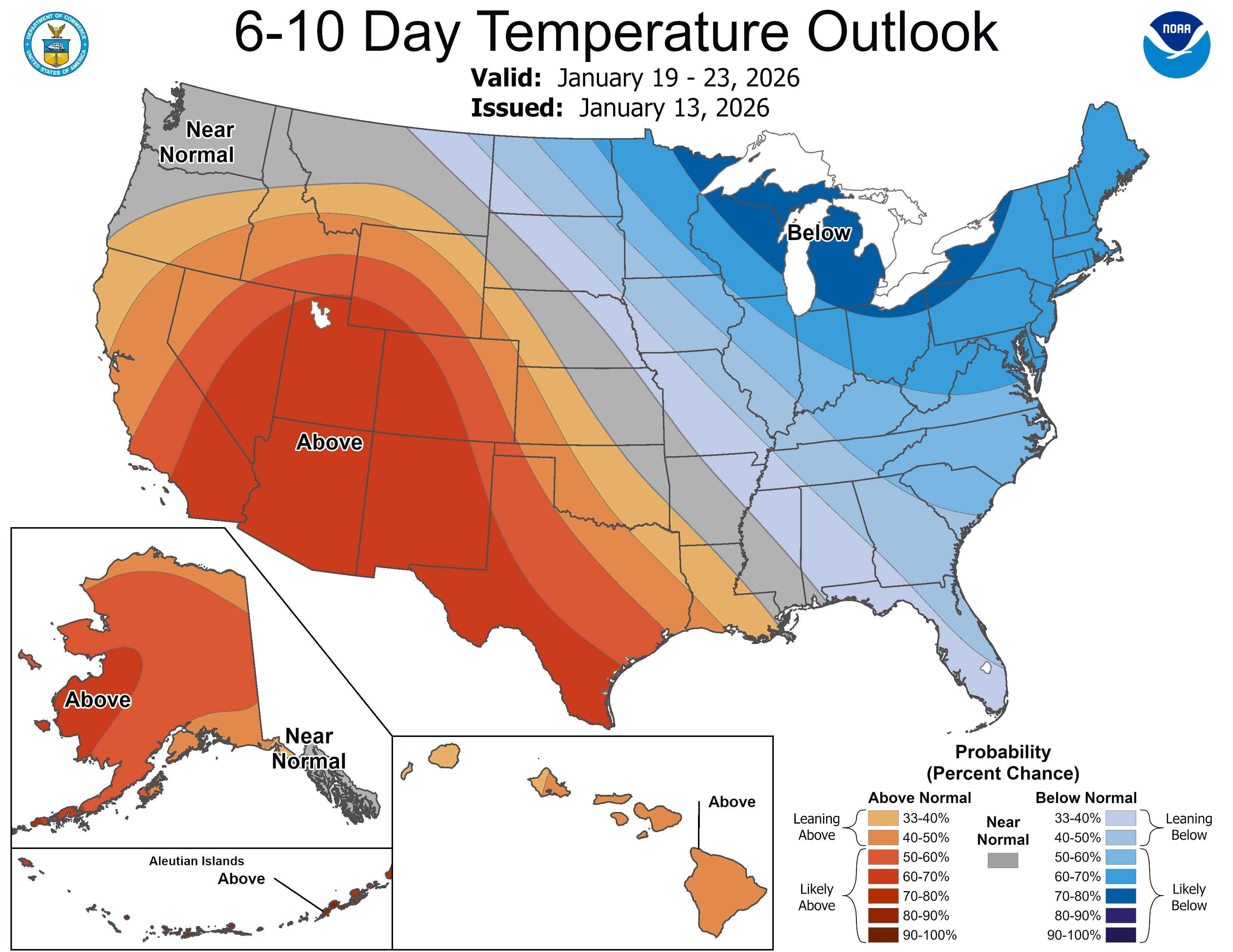
But big changes are afoot in the upper air pattern across North American as we move toward the upcoming weekend.
Turn Up Your Support
MPR News helps you turn down the noise and build shared understanding. Turn up your support for this public resource and keep trusted journalism accessible to all.
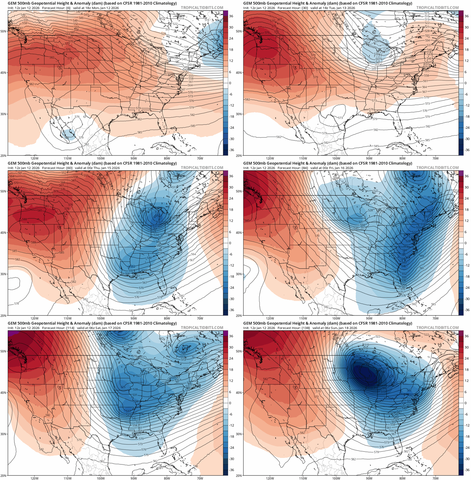
A cold front blowing through Minnesota will drop temperatures into subzero territory Wednesday morning in northwest Minnesota.

The Twin Cities wakes up to temperatures in the teens Wednesday. Highs will struggle to make the low 20s under sunny skies Wednesday afternoon with blustery Northwest winds gusting to 30 mph at times.

Snow returns
A series of Clippers will sail south into Minnesota between Thursday and Sunday. It won’t snow all the time, but occasional waves of snow and intermittent snow showers and flurries will be around between Thursday and Sunday.
The Canadian model seems to capture the essence of roving bands of snow showers. The forecast model loop below runs between 6 a.m. Thursday and midnight Monday. (Sunday night)
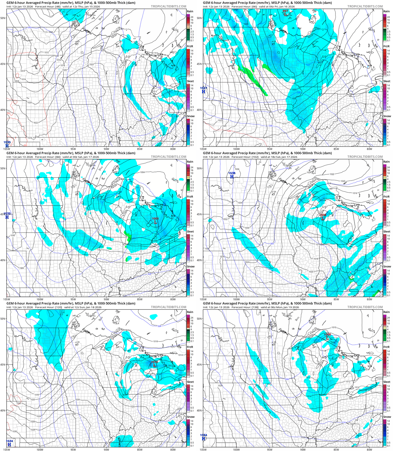
Overall snowfall accumulations look light at any given time, but will add up over the course of a few days. Forecast models vary widely as usual this early and snowfall potential forecast will change as we move ahead this week.
Here’s an early look at snowfall accumulations form NOAA’s digital forecast database with the first waves of snow into Friday morning.

And this European model output seems like a good place to start for totals snowfall accumulations through Sunday. Snow will likely be drier than this 10:1 output, but the overall coverage looks reasonable. The best chance for 6 inch snowfall totals favors northeast Minnesota.

So the best actionable weather advice at this point is to expect occasional bouts of snow between Thursday and Sunday with much colder air on the way. Roads will be slick at times. Plan for that scenario into the upcoming weekend.
Arctic weekend ahead
Highs will be in the 20s south to teens north through Friday.
But this weekend advancing Arctic air mass favors subzero temperatures into early next week. Temperatures by Sunday morning will be below zero in the Twin Cities and well below zero in the north.

Right now the coldest morning appears to be next Tuesday. The most likely bottom looks to favors low temperatures in the -30s north to between -10 and -20 around the Twin Cities and suburbs. This European model is the most aggressive with Arctic cold next Tuesday morning.

So the bottom line is a much more wintry weather pattern arrives Wednesday and lasts into next week. Perfect timing for what is typically the coldest two weeks of the year on average in Minnesota.
Stay warm and safe out there.

