
Winter reality check: Snow and subzero cold ahead for Minnesota
Occasional snow Thursday into the weekend; subzero temps this weekend

Go Deeper.
Create an account or log in to save stories.
Like this?
Thanks for liking this story! We have added it to a list of your favorite stories.


January has been kind to Minnesota so far. Temperatures are running 9 degrees warmer than normal through Jan. 13 in the Twin Cities!
So far this month, we’ve received just eight-tenths of an inch of snow at Minneapolis-St. Paul International Airport. That’s way behind the monthly average of 5 inches to date.
We’re about to make up for lost weather time this month.
The first cold front has already swept through Minnesota Wednesday on gusty northwest winds. Temperatures are running a good 20 degrees colder than Tuesday around the state.
Turn Up Your Support
MPR News helps you turn down the noise and build shared understanding. Turn up your support for this public resource and keep trusted journalism accessible to all.
Lows overnight will dip into the teens south and single digits north by early Thursday morning.
Highs Thursday afternoon will recover into the teens and 20s northeast to 30s south and west.

Snow returns Thursday into the weekend
A series of clippers sails south into Minnesota starting Thursday into the upcoming weekend.
This won’t be one big storm and it won’t snow all the time. But occasional waves of mostly light snow and flurries will sweep through Minnesota at times Thursday into Sunday.
The first clipper begins overnight into Thursday morning in the north. Snow will spread south into the Twin Cities most likely between about 9 a.m. and noon Thursday.
The National Oceanic and Atmospheric Administration’s NAM 3 km model shows the first clipper putting out patches of snow between 6 a.m. Thursday and 6 p.m. Friday.
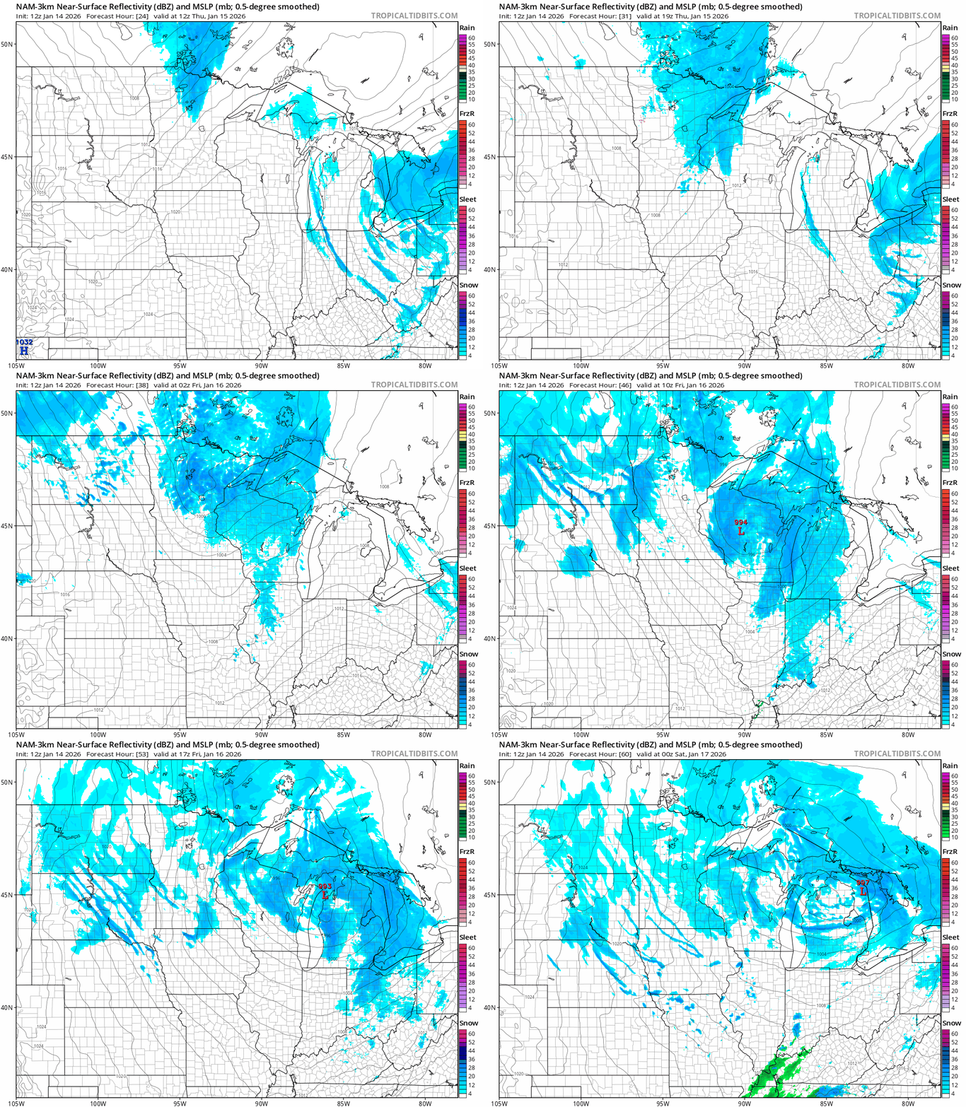
Overall snowfall accumulations will be heaviest in northeastern Minnesota (see the map at the top of the post). Snowfall totals between 1 and 3 inches look likely around the Twin Cities by Saturday morning. Lighter totals favor western Minnesota.

We may get a break in snowfall as the arctic air arrives Saturday, but forecast models suggest another clipper could bring additional snow Sunday.
Arctic weekend ahead
The first real wave of arctic air arrives this weekend. Right now, this first wave looks likely to produce single digit subzero lows in the south with teens below in the north.
Highs this weekend will stall mostly in the single digits in the south with subzero temperatures Saturday in the north.
The arctic flow continues into next week. The European Centre for Medium-Range Weather Forecasts model is still cranking out subzero temperatures in southern Minnesota Monday morning.

We could rack up several subzero morning across most of Minnesota in the next two weeks. The overall pattern keeps arctic air in place into late January.
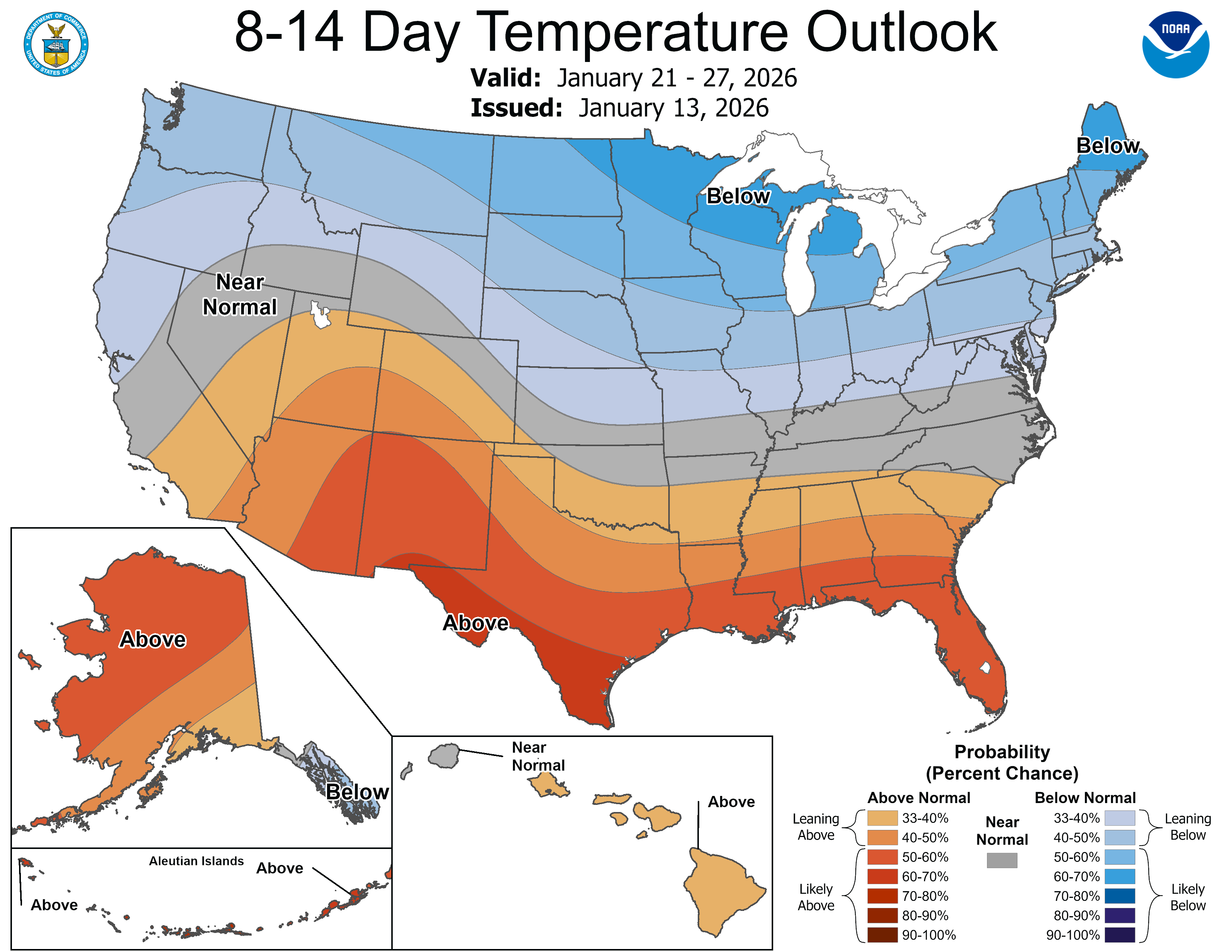
We started the month 9 degrees warmer than normal but it looks like we may end up closer to an average January temperature given the persistent cold ahead in the last two weeks of the month.
Stay tuned.

