
Yes it's cold; but the coldest air of winter arrives late this week
Temperatures may approach -20 degrees in the Twin Cities with -40 possible up north Saturday.

Go Deeper.
Create an account or log in to save stories.
Like this?
Thanks for liking this story! We have added it to a list of your favorite stories.


The climate and weather are in sync this winter across Minnesota. This is typically the coldest period of winter climatologically speaking. And the weather maps appear ready to deliver the coldest air mass of the winter season by late this week.
First we have already endured the second coldest morning of the year so far across most of Minnesota Monday. The Twin Cities bottomed out at -8 degrees Monday morning. The coldest morning do far this winter at MSP Airport is -11 degrees on December 14.
Here are some select minimum temperatures from Monday morning around Minnesota.
MSP Airport, Rochester -8 degrees
Fargo-Moorhead, Brainerd -10 degrees
St. Cloud -11 degrees
Duluth -14 degrees
Embarrass -15 degrees
Thief River Falls -16 degrees
International Falls, Hallock -20 degrees
It looks like we’ll plunge below these numbers late this week.
Turn Up Your Support
MPR News helps you turn down the noise and build shared understanding. Turn up your support for this public resource and keep trusted journalism accessible to all.
First we “enjoy” a slightly less cold Tuesday and Wednesday ahead. Highs Tuesday will crack the teens (above zero) in southern Minnesota.

Wednesday brings the mildest day this week with highs making the 20s in the south.

Snow Tuesday night and Wednesday
A couple Clippers will ride through Minnesota ahead of advancing Arctic air Tuesday night and Wednesday. Many of us may see 2 waves of light snow. I like the looks of how NOAA’s NAM 3 km model handles the systems this week. The forecast model loop below runs between noon Tuesday and 6 p.m. Wednesday.
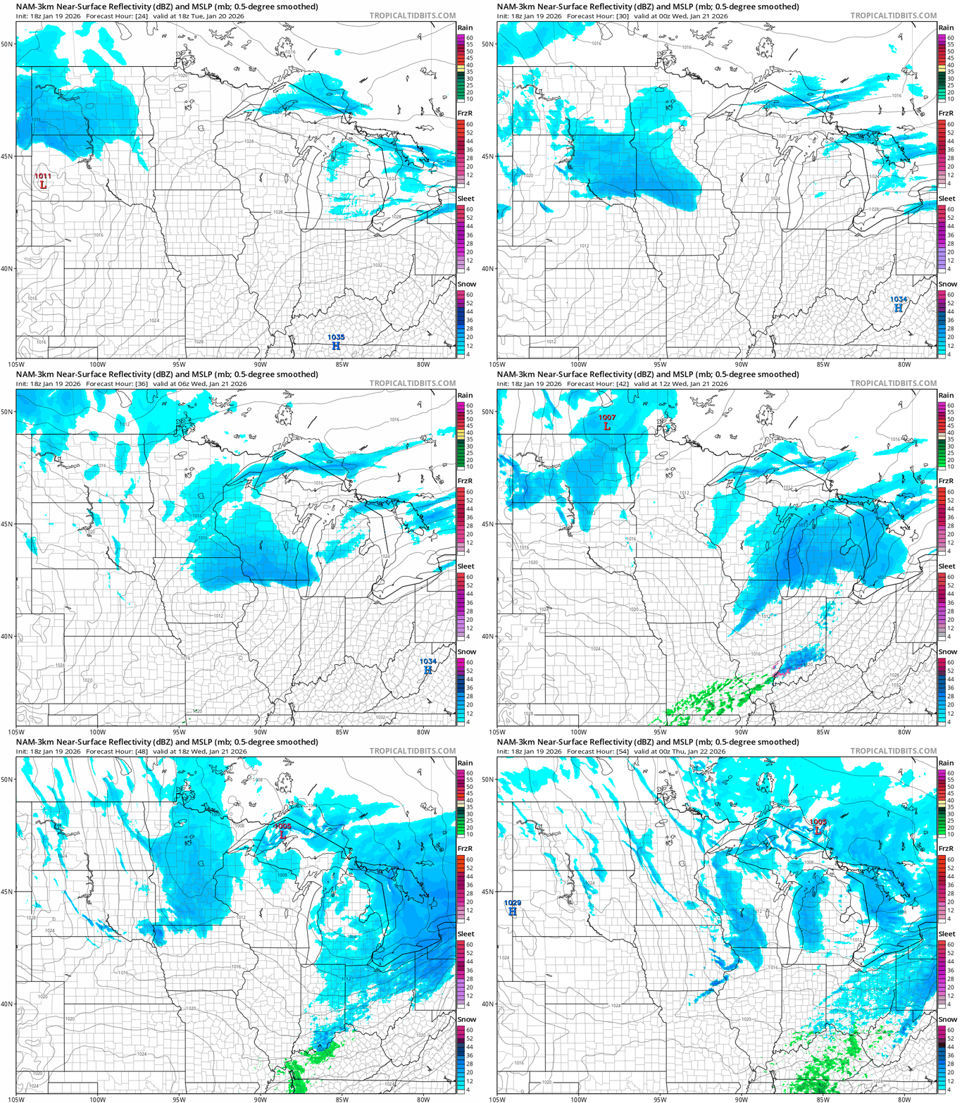
Overall snowfall totals looks heaviest across southern Minnesota this week with less snow in the north. NOAA’s digital forecast output seems reasonable as a place to start for snowfall accumulations.

Coldest air of winter ahead late this week
It still looks like the main chunk of the Polar Vortex will break off and dive south into Minnesota this upcoming weekend.
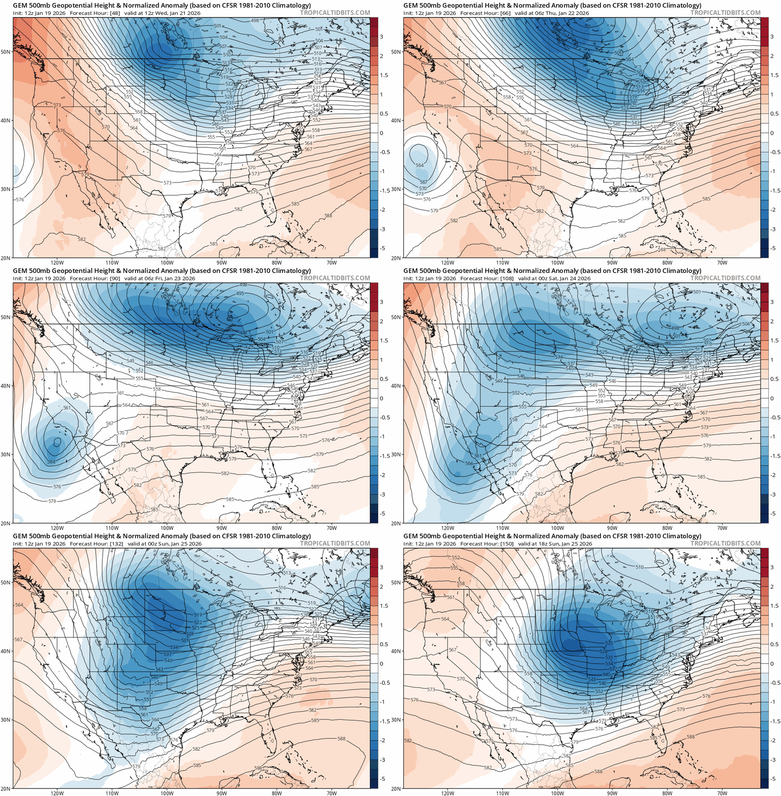
Forecast models are cranking out some ridiculously cold temperatures Friday and Saturday mornings. The European and other models crank out -20s for the Twin Cities Friday and Saturday mornings with temperatures near -40 degrees in the far north!
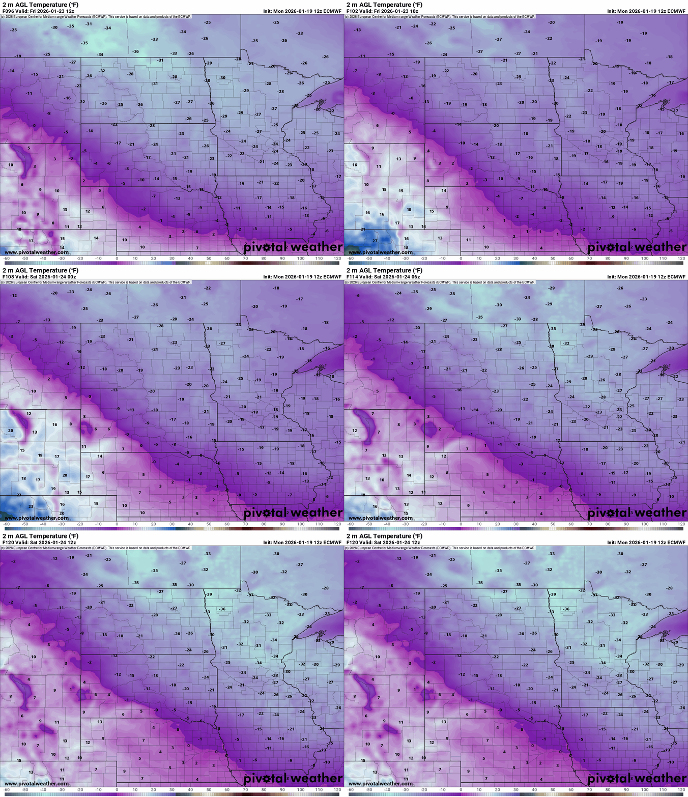
This is downright dangerous to be outside for any length of time.
Record low temperatures for the Twin Cities are -34 degrees Friday and -33 degrees Saturday. I don't think we’ll get that cold but we could reach the annual benchmark of -20 degrees in the Twin Cities Friday or Saturday morning.
Stay tuned!

