
One more arctic embrace: Cold weather advisory up north into Friday morning
Friday wind chills of minus 35 up north, minus 15 in the Twin Cities

Go Deeper.
Create an account or log in to save stories.
Like this?
Thanks for liking this story! We have added it to a list of your favorite stories.


Who’s ready for one more arctic embrace?
The last in our recent series of arctic cold fronts eases south through Minnesota into Friday. Temperatures will plunge to minus 25 degrees across the far north Friday morning. In the south we’ll bottom out again in the single digits below zero.

Toss in the wind chill Friday morning and it will feel like minus 15 degrees in the south and minus 35 degrees in the north. (See the unattractive map at the top of this post.)
A cold weather advisory covers most of the northern half of Minnesota into Friday morning.
Turn Up Your Support
MPR News helps you turn down the noise and build shared understanding. Turn up your support for this public resource and keep trusted journalism accessible to all.
Including the cities of Grand Rapids, Pine River, Hill City, Pine City, Hibbing, Grand Marais, Brainerd, Ely, Bigfork, Isabella, Duluth, Aitkin, Silver Bay, Two Harbors, International Falls, Walker, and Hinckley
1250 PM CST Thu Jan 29 2026
...COLD WEATHER ADVISORY IN EFFECT FROM 9 PM THIS EVENING TO 11 AM CST FRIDAY...
* WHAT...Very cold wind chills as low as 35 degrees below zero expected.
* WHERE...Crow Wing, Aitkin, Pine, Koochiching, Cass, Itasca, Carlton, St. Louis, Cook and Lake Counties.
This includes the Tribal Lands of the Grand Portage Reservation, the Fond du Lac Band, the Mille Lacs Band, Hinckley, Lena Lake, Big Sandy Lake and, East Lake areas and the Bois Forte Band, Nett Lake, Deer Creek and, Lake Vermilion areas. Other locations including Voyageurs National Park. The entire Boundary Waters is also included.
* WHEN...From 9 PM this evening to 11 AM CST Friday.
* IMPACTS...The dangerously cold wind chills as low as 35 degrees below zero could cause frostbite on exposed skin in as little as 10 minutes.
I have a hunch the coldest days of winter are now mercifully behind us. Yes, we’ll see more subzero lows in February and maybe even the first week of March. But the odds of nipping minus 20 degrees again in the Twin Cities are dropping by the day.
Daylight and sun intensity are rapidly increasing now. Frigid air masses than pour south from the Arctic Circle now modify a bit with more solar radiation coming down.
Friday morning will be our 17th subzero day this season in the Twin Cities. I still think we’ll approach our seasonal average of 22 days below zero before spring finally arrives.
Gradually milder weekend
We still awaken Saturday morning to subzero temperatures across Minnesota, but highs Saturday afternoon in the teens above zero will feel remarkably good under sunshine.
By Sunday, bank thermometers in southwestern Minnesota will be flashing in the 30s — maybe even as close to the Twin Cities as Waconia on the far southwestern side of the Twin Cities.

Light snow Sunday
A weak clipper sails through Minnesota with some light snow Sunday. On the map below, the Canadian model shows the light snow wave crossing Minnesota between midnight and 6 p.m. Sunday.
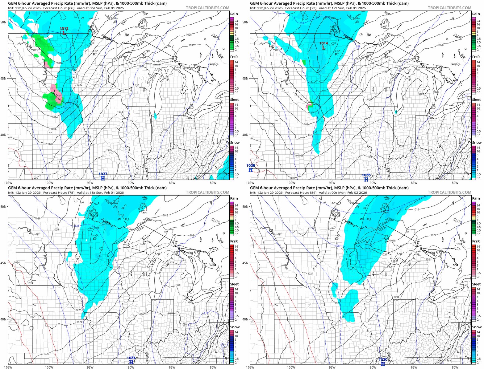
Snowfall totals Sunday looks light overall but it may be enough to slick up roads. Many of us will see an inch of snow with the best chance for a couple inches in the north.

Highs early next week will be mostly in the 20s, but there are still signs of a possible thaw later next week.
Stay tuned.

