
Closer to normal February temps now; signs of a thaw Thursday and next week?
Forecast models continue to vary on the magnitude of a possible thaw next week.
Go Deeper.
Create an account or log in to save stories.
Like this?
Thanks for liking this story! We have added it to a list of your favorite stories.


Winter has finally settled into a more normal temperature pattern for most of this week.
Most days in the first half of January ran 10 to 20 degrees warmer than normal. Then we whiplashed with most of the days in the second half of January in the range of 10 to as much as 30 degrees colder than normal, including bottoming out at -21 degrees in the Twin Cities on Jan. 23!

So far, February temperatures are hanging relatively closer to 30-year normals. The normal high and low for Tuesday in the Twin Cities are 25 and 9 degrees. As of this post, we’ve managed to reach 22 degrees at MSP Airport on Monday afternoon.

Temperatures Tuesday will run a few degrees cooler with highs mostly in the teens across Minnesota. By Wednesday, we’ll be very close to seasonal norms once again with highs mainly in the 20s south with a few teens north.
Turn Up Your Support
MPR News helps you turn down the noise and build shared understanding. Turn up your support for this public resource and keep trusted journalism accessible to all.

Thursday thaw
Forecast models continue to show a brief thaw Thursday before another cold front Friday into Saturday. Highs Thursday could touch 40 in the Twin Cities with 40s in southwest Minnesota.

Much cooler temperatures blow in once again by Saturday, with highs in the seasonal 20s.

Right now, I don't see any real snows on the maps this week.
Bigger thaw next week?
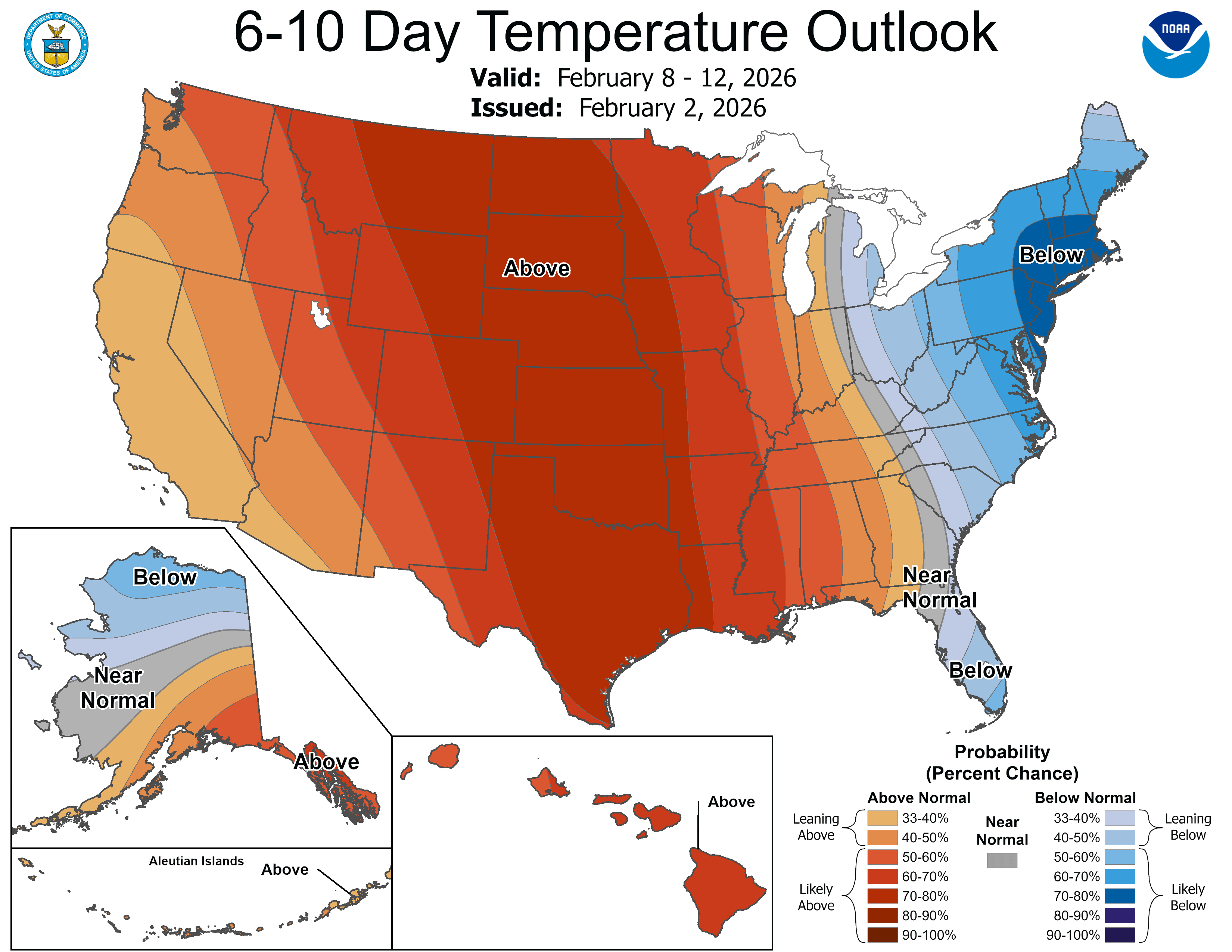
Signs of milder air are on the weather maps next week. A Pacific flow will push milder air into Minnesota next week.
Highs in the 30s and 40s look likely at least early next week in the south.

It should be noted that some forecast models, like the European, have been too aggressive with milder air the past couple of weeks.
For example, the European output from Jan. 25 cranked out highs at MSP Airport of 34 degrees for Tuesday, Feb. 3. The forecast is for upper teens Tuesday at MSP. Also, on Jan. 25, the European model output showed a high of 43 degrees for Saturday, Feb. 7. The current model output suggest highs in the 20s Saturday.
It appears European model forecasts issued the past couple of weeks have been about 15 degrees too warm for early February.
Monday’s (12Z) European model run is cranking out temperatures into the 40s for the Twin Cities and southern Minnesota by Friday, Feb. 13.

Let’s see how it turns out.
Stay tuned.

