
Thursday thaw previews a bigger thaw next week
Highs in the 40s Thursday afternoon in SW Minnesota
Go Deeper.
Create an account or log in to save stories.
Like this?
Thanks for liking this story! We have added it to a list of your favorite stories.


Ready for some milder breezes Minnesota? Thursday brings a one-day thaw to most of our state.
Highs will reach the 40s in the snow cover-free parts of southwestern Minnesota. If we can get some sunny breaks around midday, we could tickle 40 degrees in the Twin Cities area. Otherwise we’ll have to settle for 30s.

But this thaw is a brief visitor. A cold front with gusty northwest winds blows through Friday. A glancing blow of arctic style air will graze Minnesota Friday night into Saturday.
Temperatures will fall from the 30s to the 20s Friday, and highs Saturday will be in the 20s for most of Minnesota.
Turn Up Your Support
MPR News helps you turn down the noise and build shared understanding. Turn up your support for this public resource and keep trusted journalism accessible to all.

Bigger thaw next week
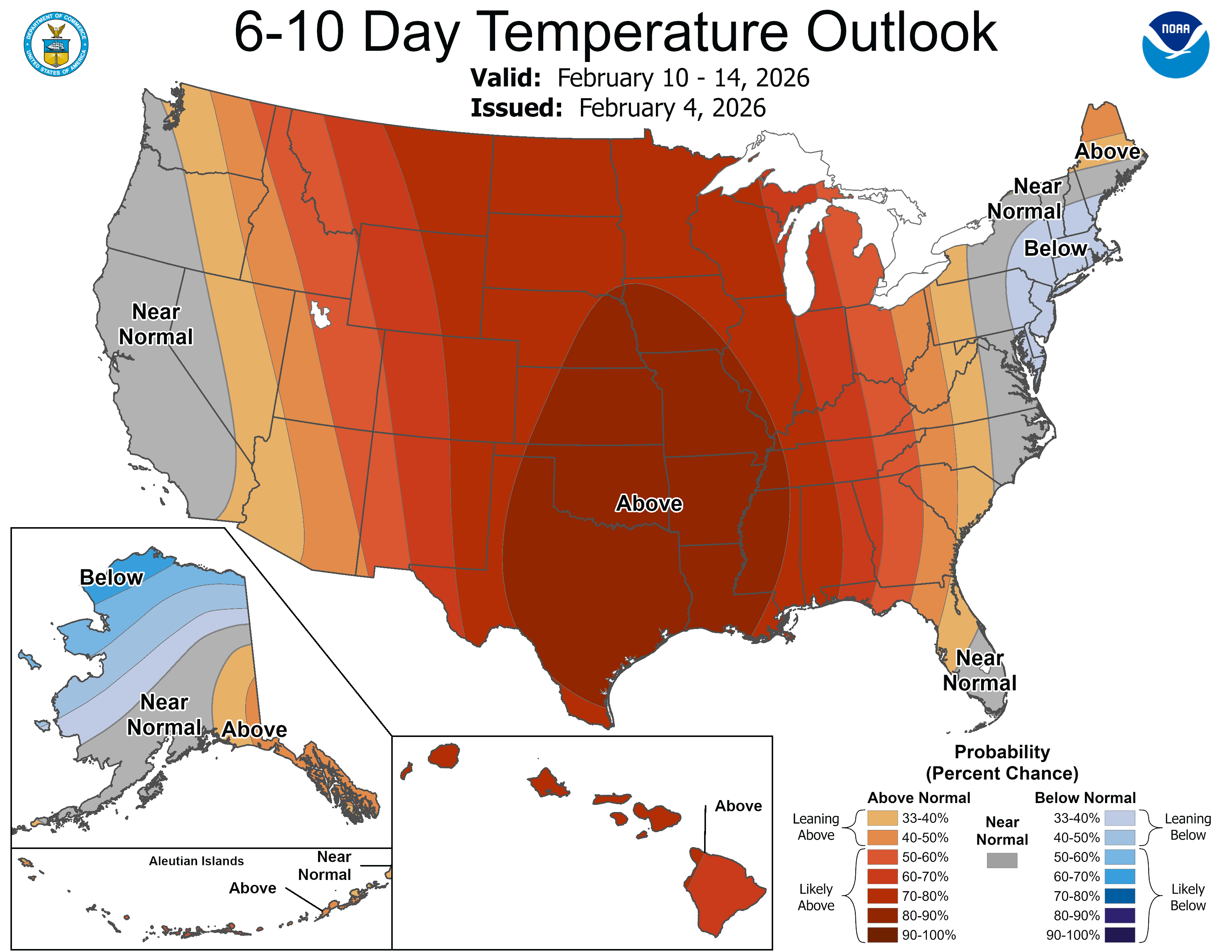
Another bath of milder Pacific air washes into Minnesota early next week. It looks like we will have another thaw Monday and Tuesday. This one brings even milder air. Highs by Monday could push into the 50s in southwest Minnesota!
The Twin Cities looks likely to have no trouble pushing into the 40s Monday and possibly Tuesday.

Highs may cool into the 30s later next week but temperatures will still run several degrees warmer than normal.
Right now, I still don't see any big snow systems in sight. Far northeastern Minnesota still has 1 to 2 feet of snow on the ground to play in.

Stay tuned.

