
Freeze-thaw this week; bigger thaw next week
Milder-than-normal temps this week around Minnesota
Go Deeper.
Create an account or log in to save stories.
Like this?
Thanks for liking this story! We have added it to a list of your favorite stories.


It’s a balmy start to February, the last month of meteorological winter in Minnesota.
Temperatures are running 3.7 degrees warmer than normal so far this month in the Twin Cities. This week will feature more freeze-and-thaw cycles with daytime highs above freezing the rest in southern Minnesota.

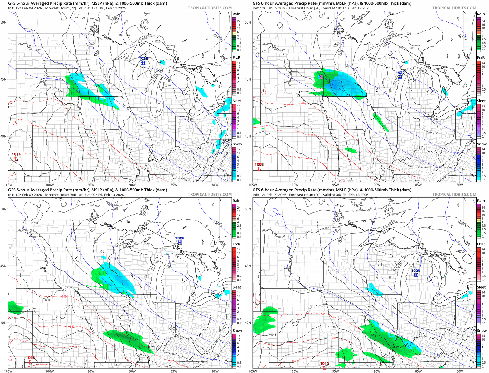
There is a chance for a little (light) rain or snow mix on Thursday. The National Oceanic and Atmospheric Administration’s Global Forecast System hints at a weaker system sliding through. Check out the map below.
Bigger thaw next week
The weather maps for North America continue to favor what we meteorologists call a zonal (west to east) Pacific flow across our region into next week.
A trough in the west will deliver colder air and storms there, while a milder ridge builds in the east and includes Minnesota on the western edge.
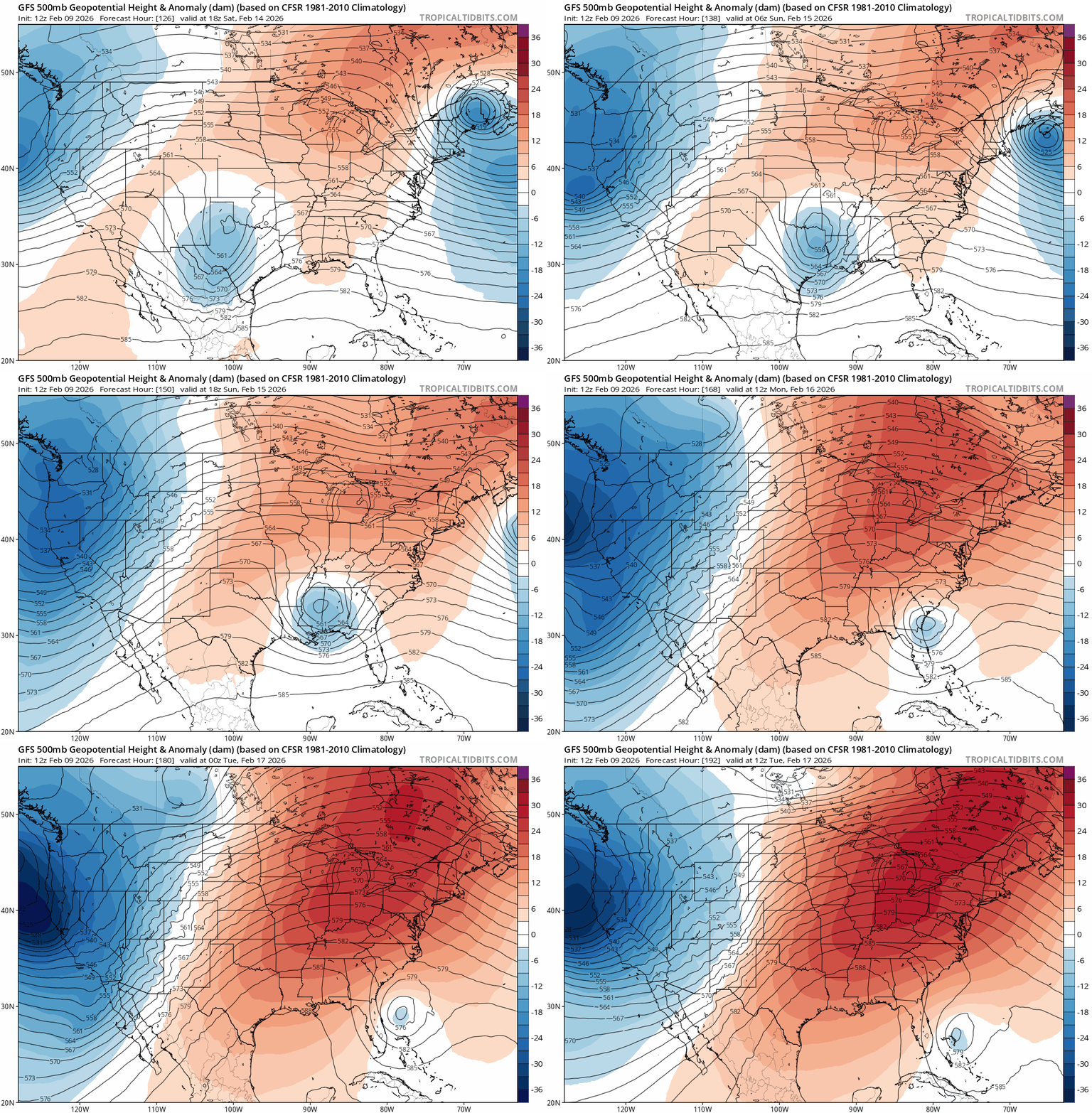
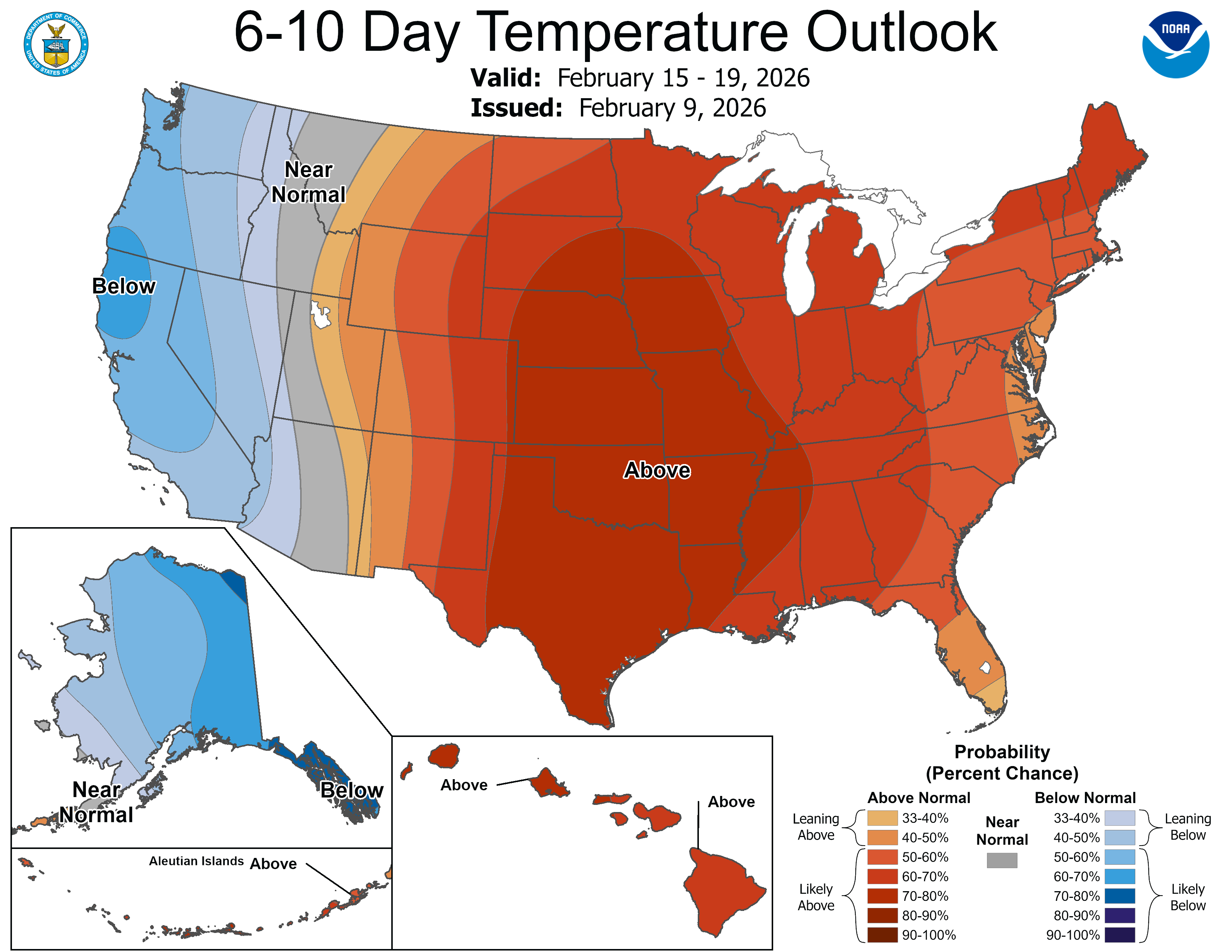
That pattern will pump even milder air early next week. Models suggest highs in the 40s are likely in the south with, some 50s possible close to the Twin Cities next week.

Turn Up Your Support
MPR News helps you turn down the noise and build shared understanding. Turn up your support for this public resource and keep trusted journalism accessible to all.

