
Record warmth now, rain-snow system likely next week
Twin Cities tied record high 51 degrees Friday; Valentine's Day could set a record

Go Deeper.
Create an account or log in to save stories.
Like this?
Thanks for liking this story! We have added it to a list of your favorite stories.


February is already running about 7 degrees warmer than normal in the Twin Cities as we approach the middle of the month. It will trend even warmer the next three days.
Minneapolis-St. Paul International Airport hit 51 degrees Friday afternoon, tying the longstanding high temperature record set in 1890!
On Saturday, Valentine’s Day, we’ll challenge the Twin Cities record high for Feb. 14 — 50 degrees, set in 1892.

With little snow cover and higher mid-February sun, we should bump 50 degrees Saturday around the Twin Cities with temperatures closer to 60 in southwestern Minnesota.
Turn Up Your Support
MPR News helps you turn down the noise and build shared understanding. Turn up your support for this public resource and keep trusted journalism accessible to all.
Our unseasonable warmth continues Sunday and Monday. It will feel more like early April.

The normal high for the Twin Cities on April 1 is 50 degrees. No foolin’.
Rain and snow next week
Friday’s forecast models continued the trend of pushing a messy low-pressure system through Minnesota next Tuesday into Wednesday.
The still-way-too-early-to-be-precise forecast storm tracks currently favor rain changing to snow in the Twin Cities and southern Minnesota with heavier snow potential across central into northern Minnesota.
Here’s the National Oceanic and Atmospheric Administration’s Global Forecast System model between 6 p.m. next Tuesday and 6 p.m. Wednesday:
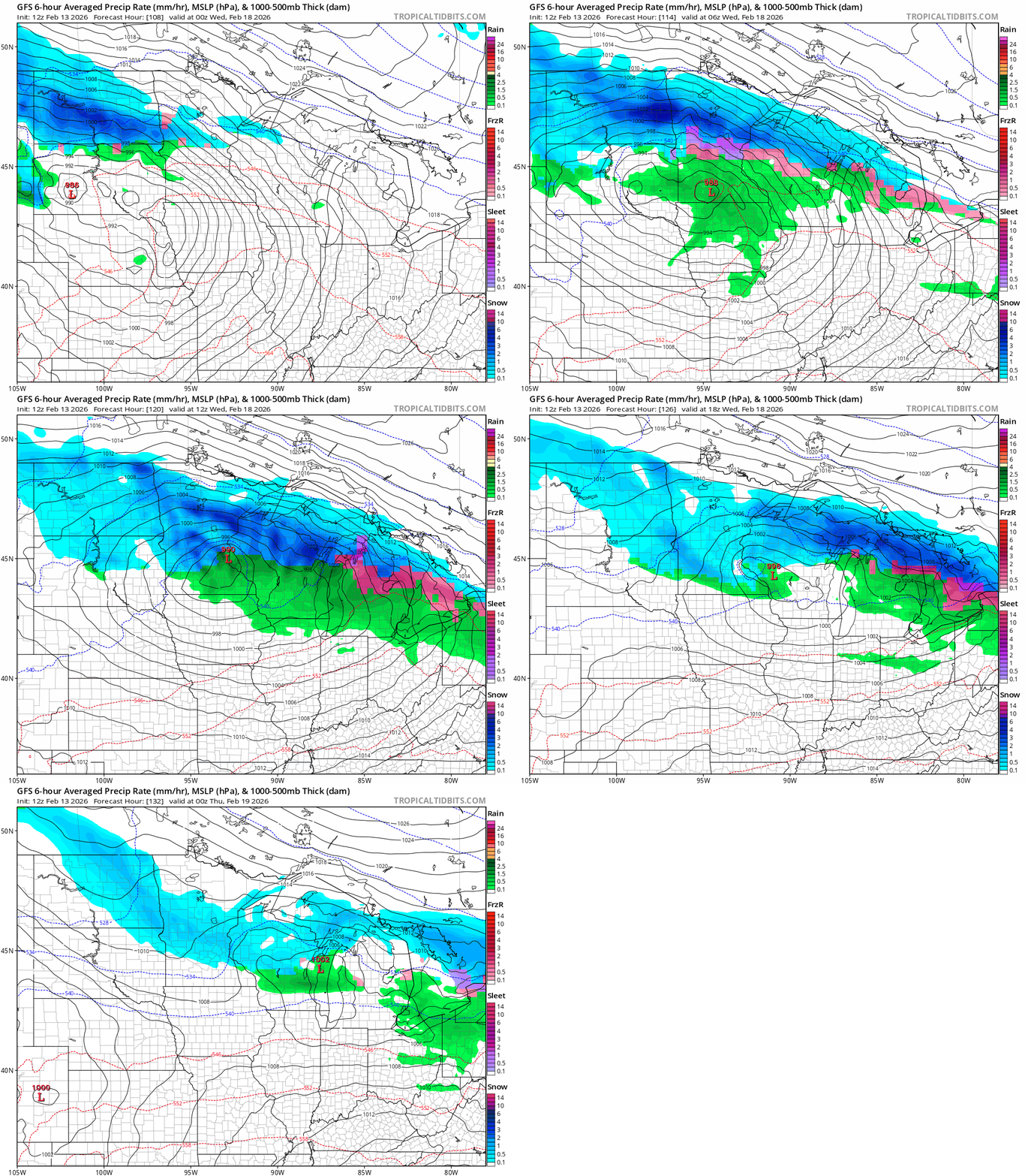
If the storm track end up farther south, we will get more snow around the Twin Cities.
This will be a fun one to watch next week. There are hints of a possible second sloppy snow system next week along about Friday.
Temperatures look cooler but still warmer than normal later next week and potentially into early March.
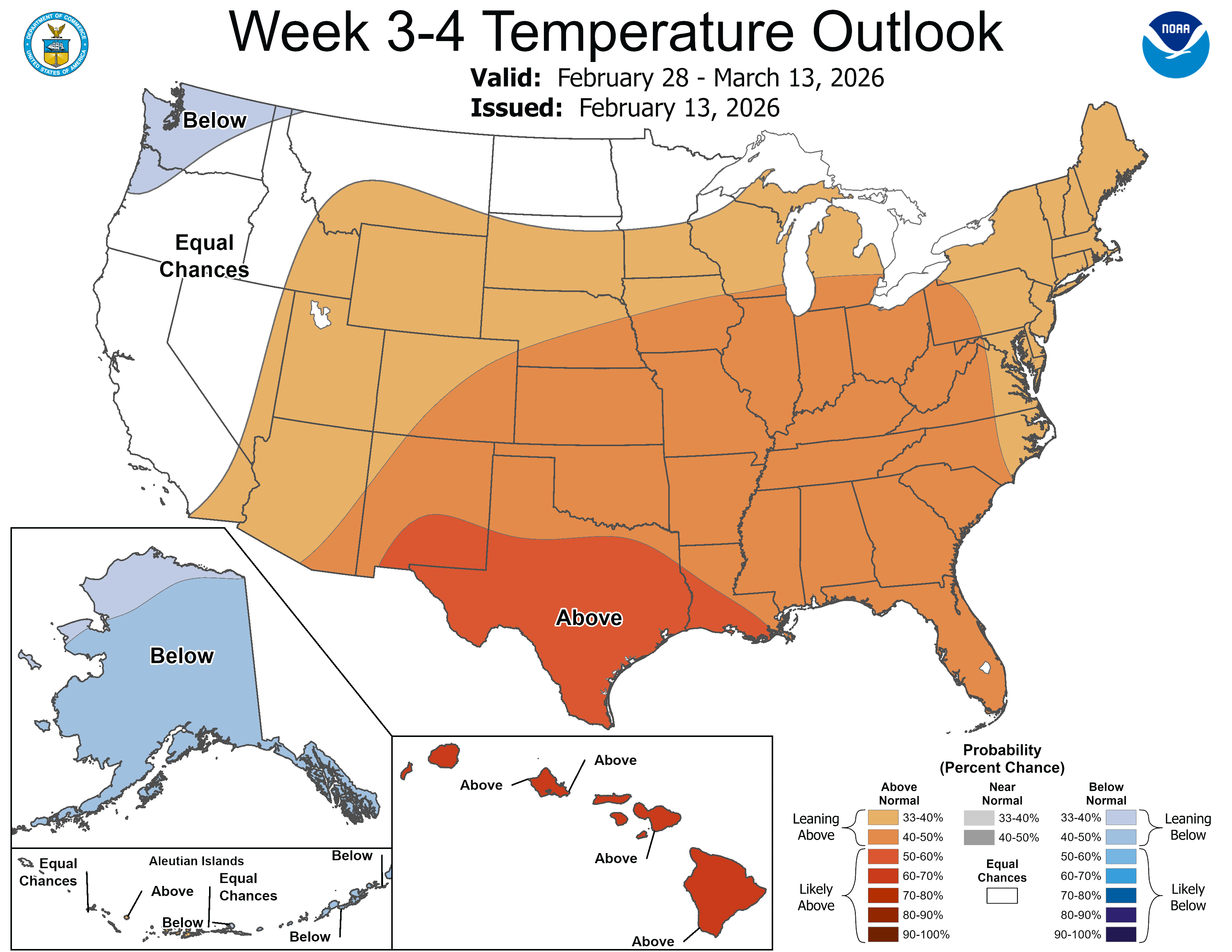
Might we see an early spring this year? It’s possible, but we could both be warmer than normal in spring, and still get pasted by a late March or April snow.
Happy Valentine’s Day, Minnesota!

