
2 to 3 feet of snow on North Shore; significant accumulations in the Twin Cities
Blizzard warnings continue for North Shore into Thursday. Snow gradually winds down into Thursday morning.

Go Deeper.
Create an account or log in to save stories.
Like this?
Thanks for liking this story! We have added it to a list of your favorite stories.


The most ferocious blizzard I can remember in years is still raking the North Shore overnight into Thursday morning.
The combination of a potent winter storm with plenty of moisture, fierce upslope winds rising along higher terrain and lake-enhanced snowfall has dumped 2 to 3 feet along portions of the North Shore.

Hovland, a few miles east of Grand Marais, reports picking up 8 inches of snow in just 3 hours Wednesday afternoon. That’s an incredible snowfall rate of nearly 3 inches per hour, pushing the physical limits of the atmosphere for snowfall rates.
Here are some updated snowfall totals as of late Wednesday. It is still snowing, so final storm snowfall totals will still go higher in many areas. (A few totals are still from earlier Wednesday.)
Turn Up Your Support
MPR News helps you turn down the noise and build shared understanding. Turn up your support for this public resource and keep trusted journalism accessible to all.
Hovland [Cook Co, MN] Cocorahs reports Snow of 34.00 Inch at 4:00 PM CST — Cocorahs station MN-CK-7 Hovland 0.1 NE. 8 inches over last 3 hours.
3 WSW Lutsen [Cook Co, MN] Cocorahs reports Snow of 24.50 Inch at 4:00 PM CST — Cocorahs station MN-CK-3 Tofte 4.9 NE. 3.5 inches over past 3 hours.
7 NNW Two Harbors [Lake Co, MN] CO-OP Observer reports Snow of 18.00 Inch at 1:10 PM CST — Storm total snowfall so far. 5.2 inches since this morning report.
3 E Grand Marais [Cook Co, MN] Trained Spotter reports Snow of 15.60 Inch at 1:45 PM CST — Total snow. 2.0 inches since last report.
9 ESE Sawbill Lake [Cook Co, MN] Cocorahs reports Snow of 13.00 Inch at 12:35 PM CST —
While most of northern Minnesota picked up plowable snow, the totals are not as high as North Shore communities.
Blackduck [Beltrami Co, MN] Public reports Snow of 6.00 Inch at 1:58 PM CST
1 WNW Grand Forks [Grand Forks Co, ND] Official NWS Obs reports Snow of 6.30 Inch at 12:00 PM CST — Event total so far.
4 S Warren [Polk Co, MN] Public reports Snow of 5.50 Inch at 6:35 AM CST
9 SSW Bemidji [Hubbard Co, MN] Local Official reports Snow of 6.00 Inch at 8:26 AM CST — 4" with some pockets of 5-6".
Twin Cities snow
The Twin Cities picked up significant snow, affecting the afternoon rush hour Wednesday.
A persistent band of heavier snow centered around the southern Twin Cities has dropped 2 to 4 inches as of early Wednesday evening in the southern Twin Cities.
Forecast models how this persistent feature gradually winding down overnight.
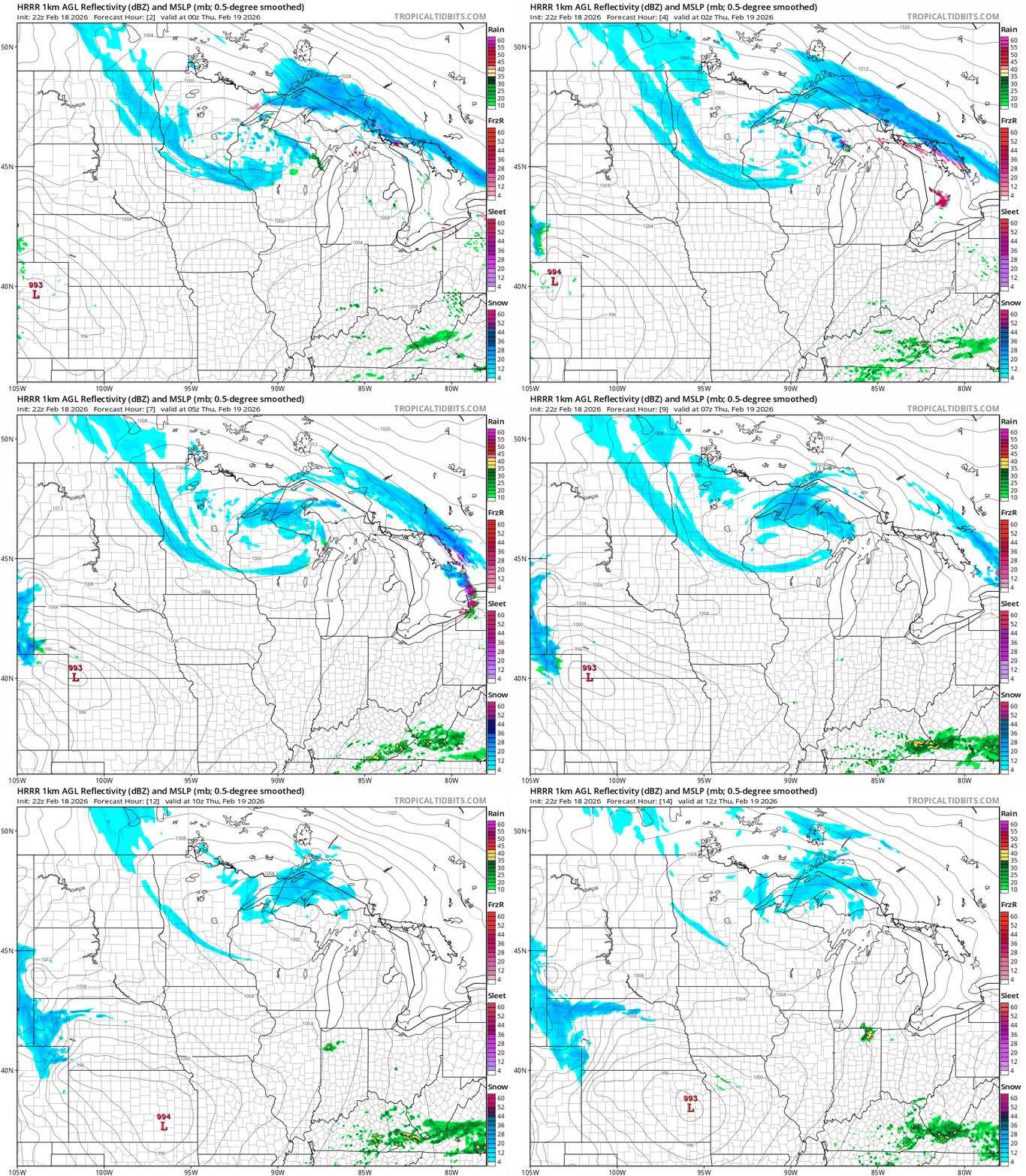
Our weather turns quieter Thursday. The next storm system on Friday appears aimed at Wisconsin with the western edge grazing the eastern parts of Minnesota.
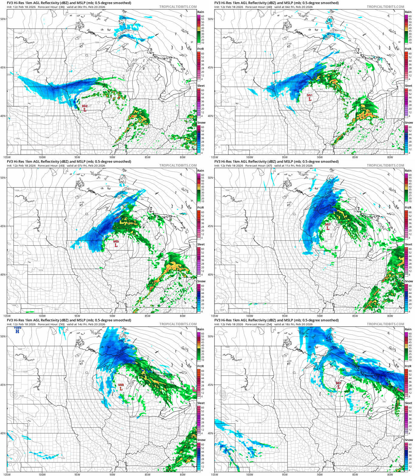
Let’s see if the storm track on this on zigs or zags in Thursday’s forecast model runs.
Stay tuned.

