
North Woods clipper dumps snow into Tuesday
Heavy snowfall at Arrowhead's tip; Twin Cities may see light wintry mix Tuesday morning

Go Deeper.
Create an account or log in to save stories.
Like this?
Thanks for liking this story! We have added it to a list of your favorite stories.


Minnesota’s next clipper is focusing the heaviest snow in the northeast.
The National Oceanic and Atmospheric Administration’s FV3 model seems to have a pretty good handle on the system as it tracks through northern Minnesota overnight into Tuesday.
On the map below, note the heaviest snow in the north Tuesday morning. The Twin Cities gets clipped by the passing front with a possible wintry mix of ice and a little snow Tuesday morning.
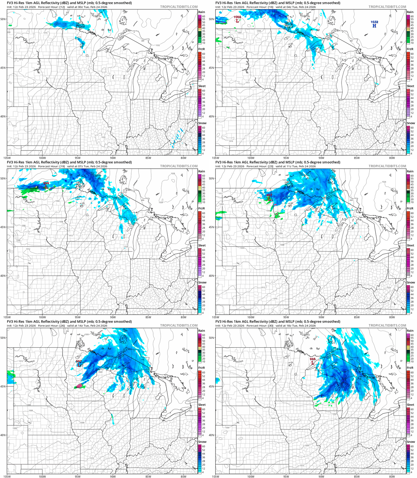
The heaviest snows of 4 to 9 inches are likely along the tip of the Arrowhead along higher terrain. Also note minor accumulations as we move farther south across Minnesota from a second system Wednesday night into Thursday.
Turn Up Your Support
MPR News helps you turn down the noise and build shared understanding. Turn up your support for this public resource and keep trusted journalism accessible to all.

Roller coaster temperatures this week
A series of warm and cold fronts will sweep through Minnesota this week. Temperatures Tuesday afternoon will rise above freezing in the south.

But the next cold front will plunge arctic air into Minnesota under sunny skies once again Wednesday.

Thursday brings another warmup, and Friday looks like a full-blown thaw across Minnesota. We could see 50s in the far south and mid-40s into the Twin Cities by Friday afternoon.

It’s typical to see wild temperature swings as we had toward March as air masses sweep freely across Minnesota. The weekend into early next week looks cold again with highs in the 20s south. But there are sign of another thaw late the first week of March.
Buckle up for weather whiplash in the coming days and weeks.

