
All aboard: Roller coaster temperatures thaw out Thursday
40s to 50s in southern Minnesota Thursday and Friday; even milder air possible late next week
Go Deeper.
Create an account or log in to save stories.
Like this?
Thanks for liking this story! We have added it to a list of your favorite stories.


All aboard the Minnesota weather roller coaster express. We’re about to see some wild temperature swings across Minnesota over the next week.
This time of year is known for rapidly changing air masses. There’s little more than a barbed wire fence between Minnesota and the Arctic Circle. The same goes for the Gulf of Mexico.
Air masses sweep across Minnesota with no resistance from the blocking effects of mountains or moderating effects of oceans.

This time of year features battles between still-frigid arctic air masses to the north and budding springlike air to the south. You can see the wintry air mass Wednesday. But look to the south.
Turn Up Your Support
MPR News helps you turn down the noise and build shared understanding. Turn up your support for this public resource and keep trusted journalism accessible to all.

Southerly winds will pump much milder air in Thursday and Friday. Highs Thursday will reach the thawing point across most of Minnesota with 40s in the Twin Cities to around 50 degrees in the far south.

Friday looks even warmer. Highs could approach 60 degrees along the Iowa border with 40s pushing well into central Minnesota.

Ups and downs, strikes and gutters — to paraphrase the Dude.
Wintry weekend ahead
Our winds turn north once again as we had into the weekend. Highs this weekend will plunge back into the teens north to 20s south.

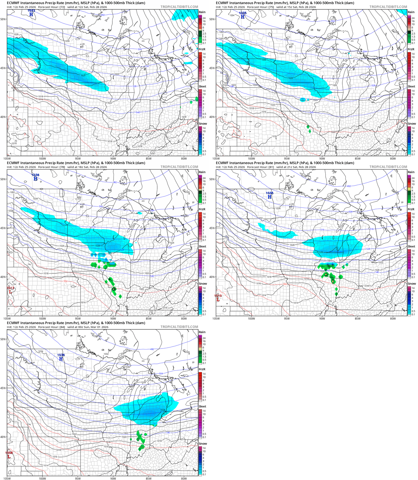
A few models suggest a minor clipper Saturday that could bring a swath of snow to southern Minnesota. Most suggest heavier snow will favor the Interstate 90 corridor in the far south. But the northern edge could clip the Twin Cities.
Here’s the European Centre for Medium-Range Weather Forecasts model output for Saturday:
Mild start to March
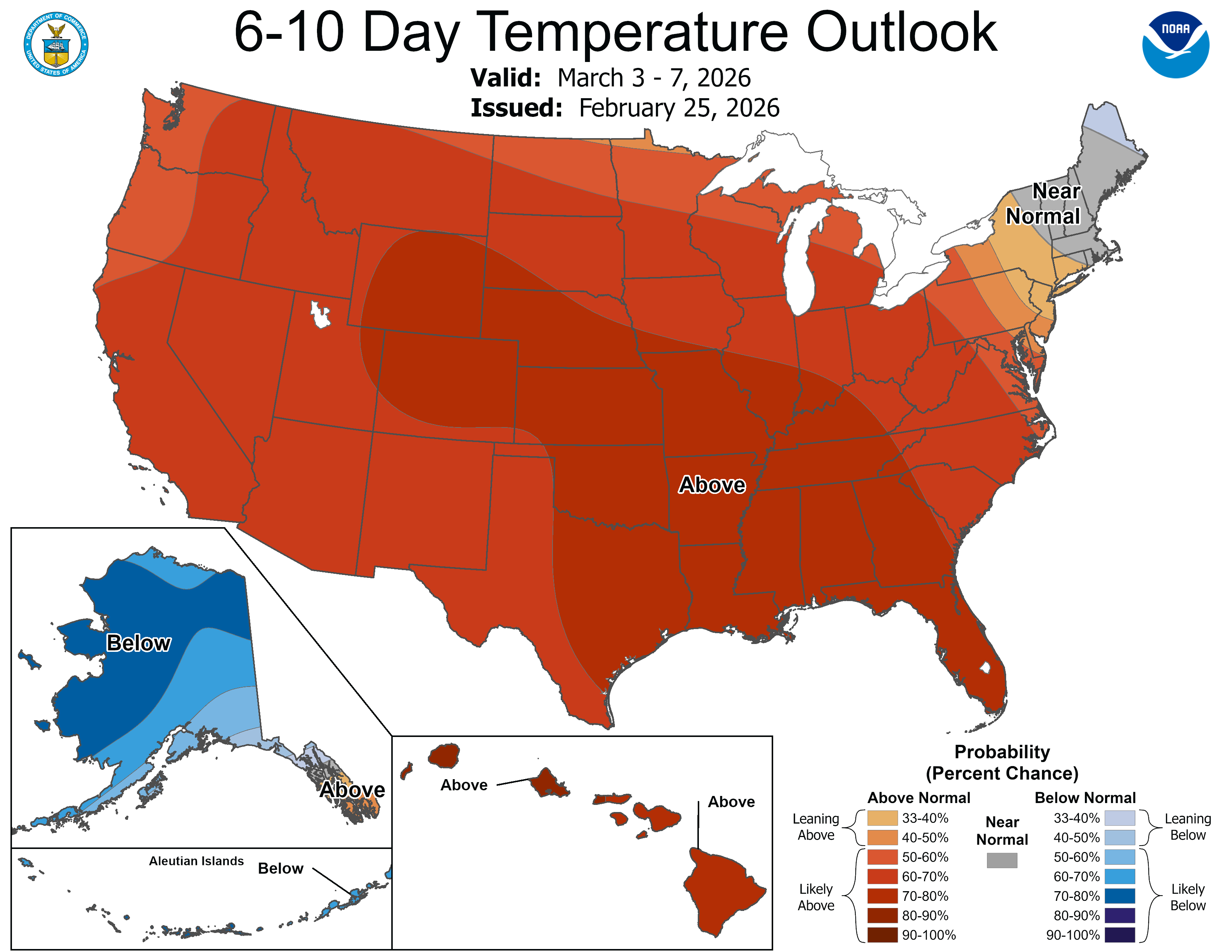
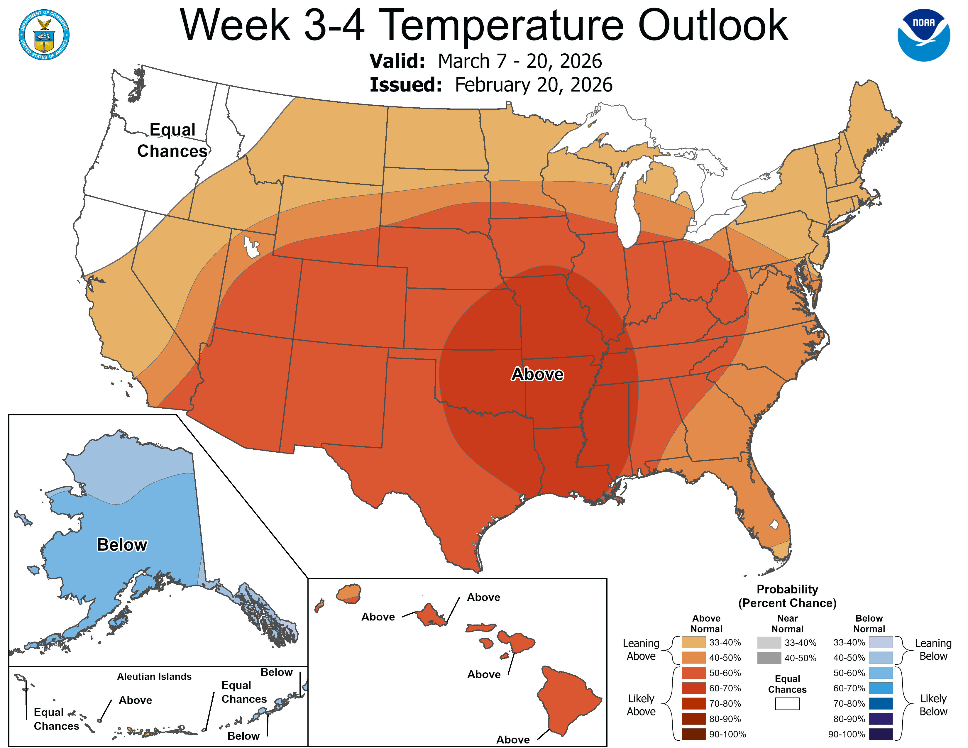
Next week we start chilly, but signs of another thaw are emerging for later next week. A couple models suggest 50s may reach the Twin Cities later next week with 60s in the southwest again. And the outlooks deeper into March favor warmer than normal temperatures.
Enjoy the ride.

