
Mostly melty through Friday, then another wintry weekend
40s and 50s across southern Minnesota Friday; cold front sweeps through Friday night

Go Deeper.
Create an account or log in to save stories.
Like this?
Thanks for liking this story! We have added it to a list of your favorite stories.


It’s a mostly melty end to the week across central and southern Minnesota. Pacific breezes boosted temperatures into the 40s and even 50s in the south Thursday afternoon.

We enjoy a repeat performance Friday before the next cold front sweeps south by Friday night.
Highs Friday will reach the 50s again in the south with 40s into central Minnesota Friday ahead of the front. See the map at top of the post.
Weekend cold front
Our two-day thaw won’t last into the upcoming weekend. Another wintry front sweeps south by Friday night. Highs this weekend will hover in the 20s south and teens north.
Turn Up Your Support
MPR News helps you turn down the noise and build shared understanding. Turn up your support for this public resource and keep trusted journalism accessible to all.

Saturday clipper south
A fairly weak clipper looks to bring mostly light snow to southern Minnesota Saturday. Most forecast models keep most of the snow south of the Twin Cities, but we can’t rule out a light dusting if the northern edge of the system clips the Twin Cities.
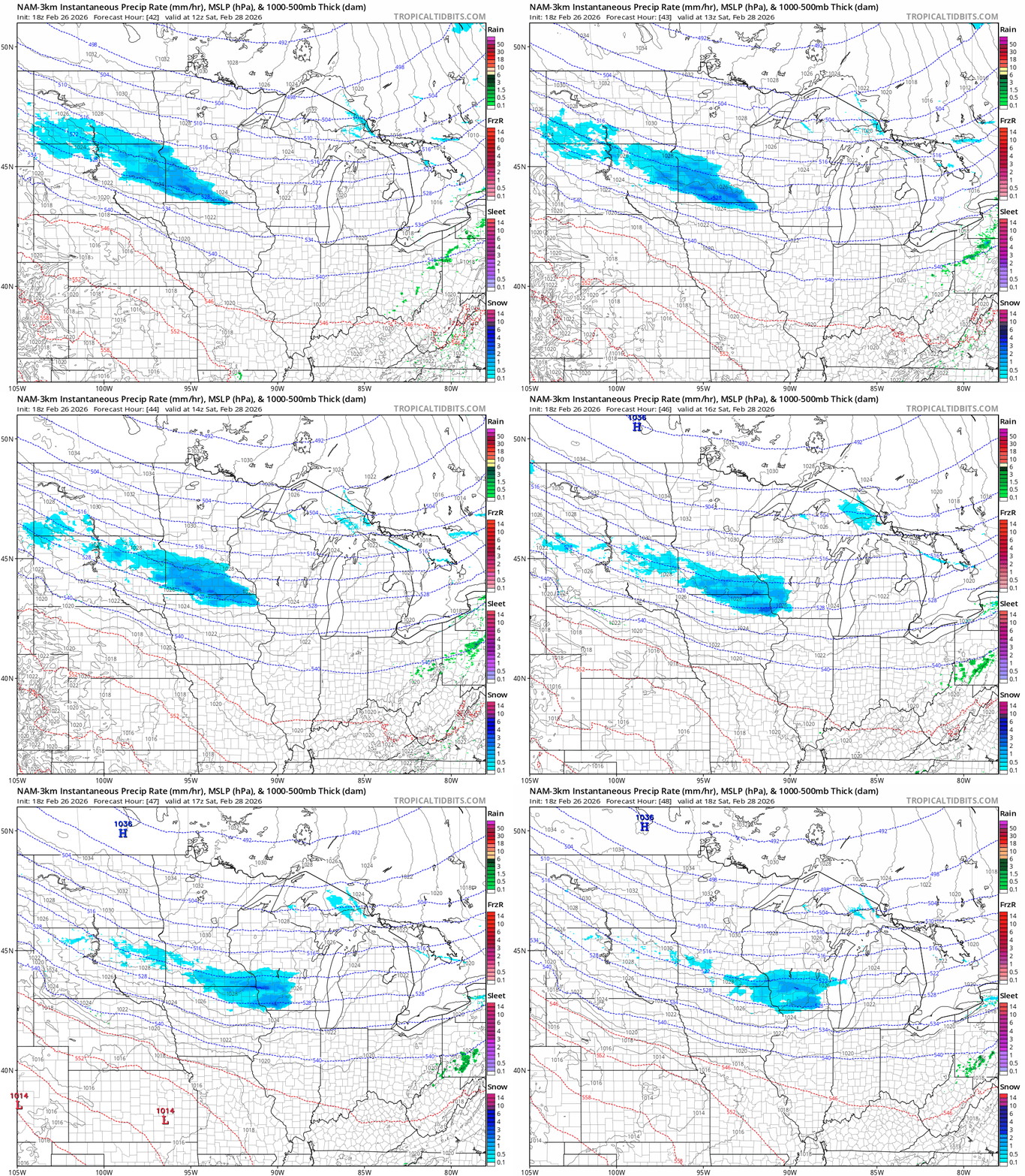
There are signs of another thaw later next week as more Pacific air pushes our way.
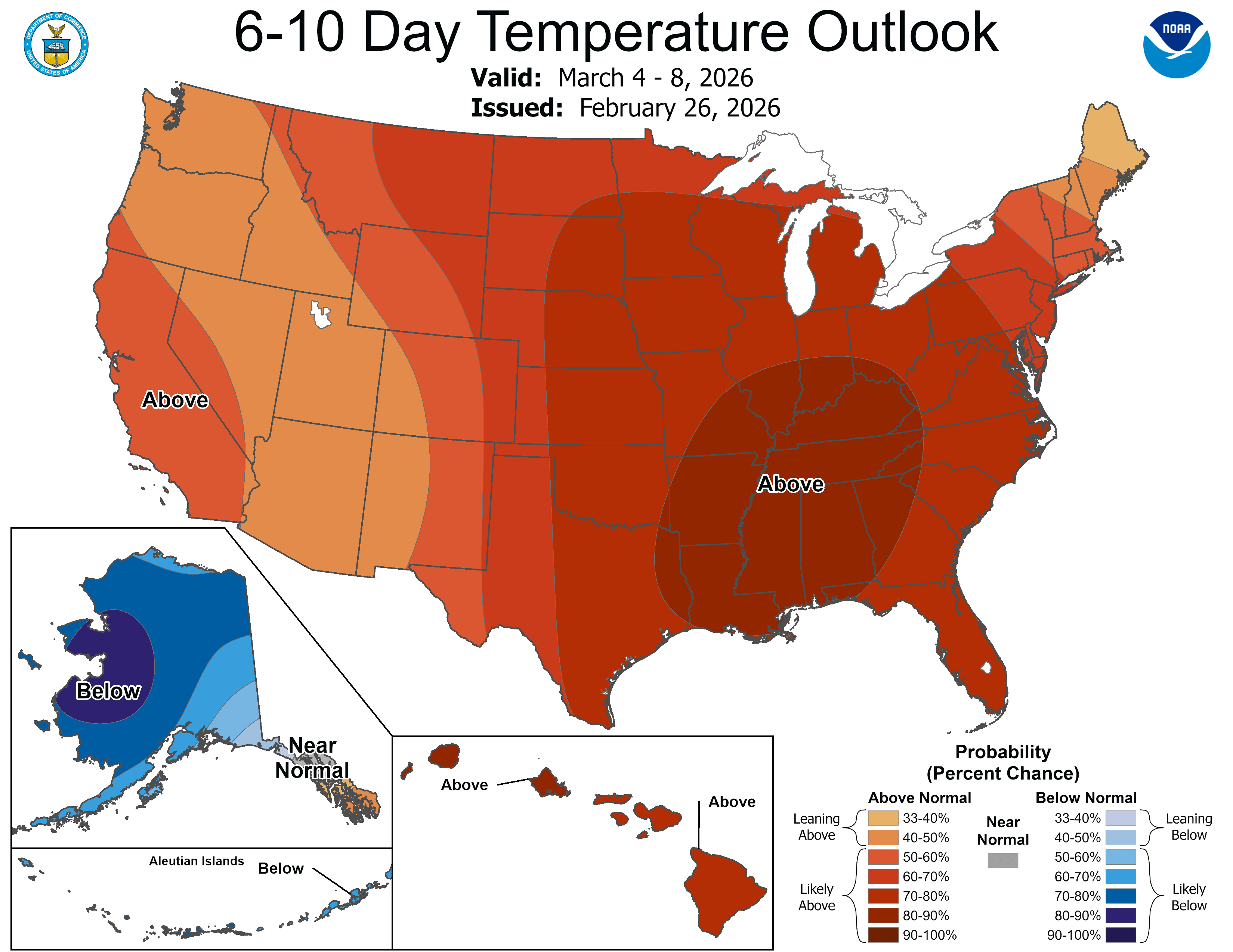
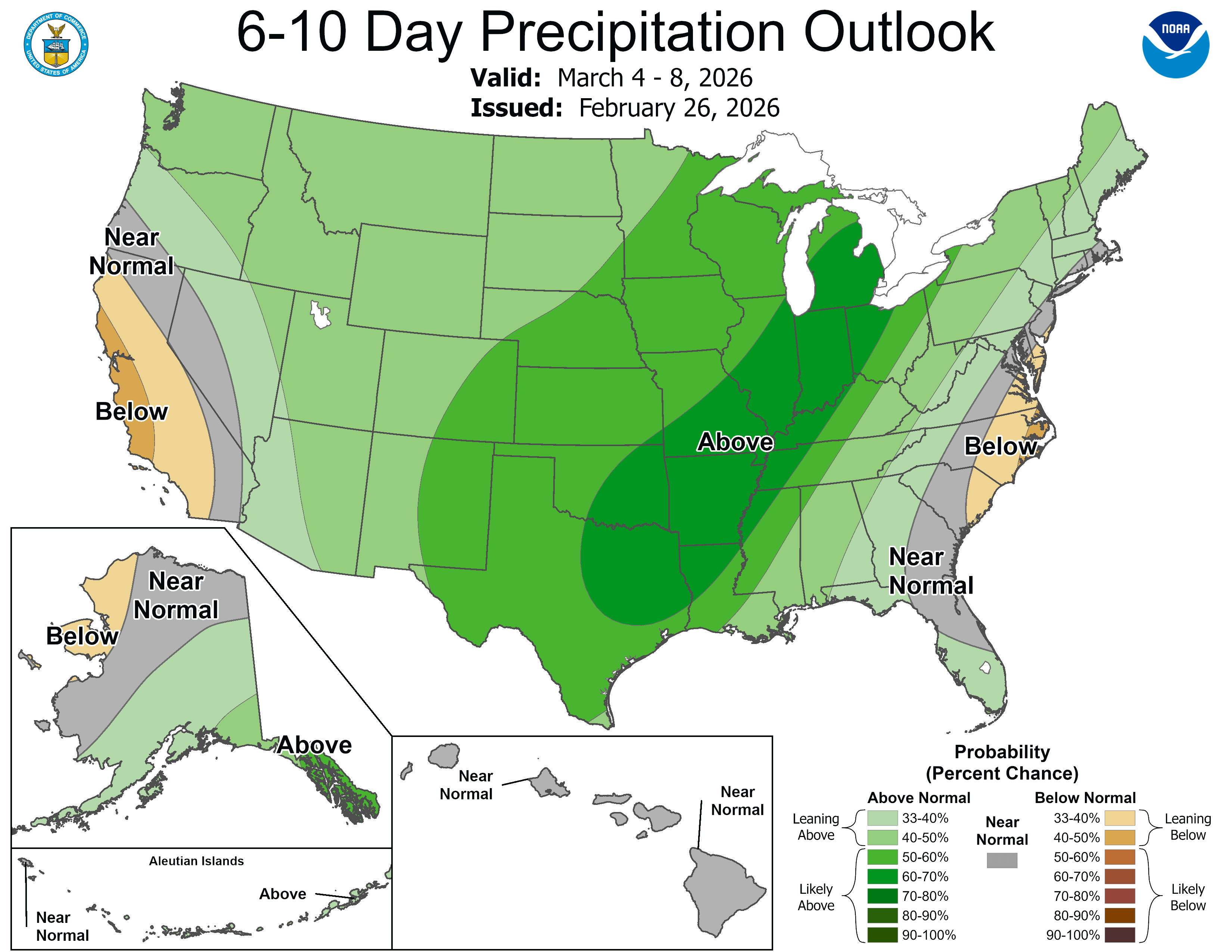
A few model show possible rain in the south last next week with an icy mix farther north.
Stay tuned.

