
Snowy Saturday ahead: Plowable snow likely for Twin Cities as clipper tracks farther north
Updated forecast models suggest several inches could fall Saturday

Go Deeper.
Create an account or log in to save stories.
Like this?
Thanks for liking this story! We have added it to a list of your favorite stories.


Get ready for a snowy Saturday, Twin Cities.
Friday’s morning and midday forecast model runs show a northward shift in the storm track for our inbound Saturday clipper.
Most forecast models now bring accumulating snow into the Twin Cities Saturday morning with several inches likely between the Interstate 94 corridor and the Minnesota River axis.
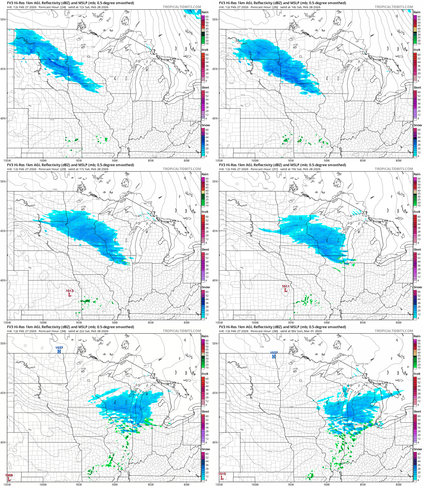
On the map below, the National Oceanic and Atmospheric Administration’s FV3 model is one of many that push a band of vigorous snow with a potential rapid snowfall onset across Minnesota and into the greater Twin Cities area Saturday morning.
Turn Up Your Support
MPR News helps you turn down the noise and build shared understanding. Turn up your support for this public resource and keep trusted journalism accessible to all.
The snow continues most of the day before fading from west to east by late Saturday afternoon.
Snowfall totals
Friday’s forecast models also favor a more productive system. Intensity changes are common as models grasp details of the inbound system within 24 hours of the event.
Many models now lay out several inches of plowable snow Saturday between the I-94 corridor and the Minnesota River Valley through the Rochester area. This looks like a plowable event for most of south-central Minnesota.
Widespread snowfall between 2 and 5 inches appears likely, with a narrower zone of 6 inches-plus locally possible.
Given the current forecast model storm tracks, the heaviest snow is likely just south and west of the Twin Cities into west-central Minnesota. Less snow is likely on the northeast side of the Twin Cities.
NOAA’s FV3 model lays out the heaviest snowfall south and west of the Twin Cities:

NOAA’s North American Mesoscale 3 km model brings a heavier snowfall band with at least 3 inches into the greater Twin Cities area by late Saturday.

And NOAA’s latest High-Resolution Rapid Refresh model is the aggressor, cranking out some 6-inch snowfall potential for parts of the Twin Cities with even heavier snowfall to the west.

NOAA’s National Blend of Models snowfall output appears to be still playing catch up with snowfall totals on this one.

Expect snow to begin in western Minnesota before dawn Saturday and spread east into the Twin Cities probably between 6 a.m. and 8 a.m. Saturday.
Snowfall will be heavy at times, especially Saturday morning. So we still have about 15 hours to adapt plans for Saturday. Roads will be slick with temperatures in the 20s in the south.

Plan accordingly for a snowy Saturday!

