
Messy wintry system: Winter weather advisories Friday for most of Minnesota
Rain south; snow, ice possible west and north of Twin Cities

Go Deeper.
Create an account or log in to save stories.
Like this?
Thanks for liking this story! We have added it to a list of your favorite stories.


Here comes our next Minnesota weather mess.
A low-pressure storm pushes mixed precipitation into Minnesota Friday. Depending on where you are, it could be rain with a side of thunder or snow with a coating of ice.
Let’s break down the inclement weather ahead over the next 36 hours.
The system
A moderately strong, late winter-early spring low-pressure system tracks from near Omaha, Neb., through Iowa toward the Twin Cities to Lake Superior Friday into Saturday.
Turn Up Your Support
MPR News helps you turn down the noise and build shared understanding. Turn up your support for this public resource and keep trusted journalism accessible to all.
On the map below, the National Oceanic and Atmospheric Administration’s Thursday midday (18Z) High-Resolution Rapid Refresh model run shows rain developing across southern Minnesota overnight with snow and mixed icy precipitation in the west and north later Friday.
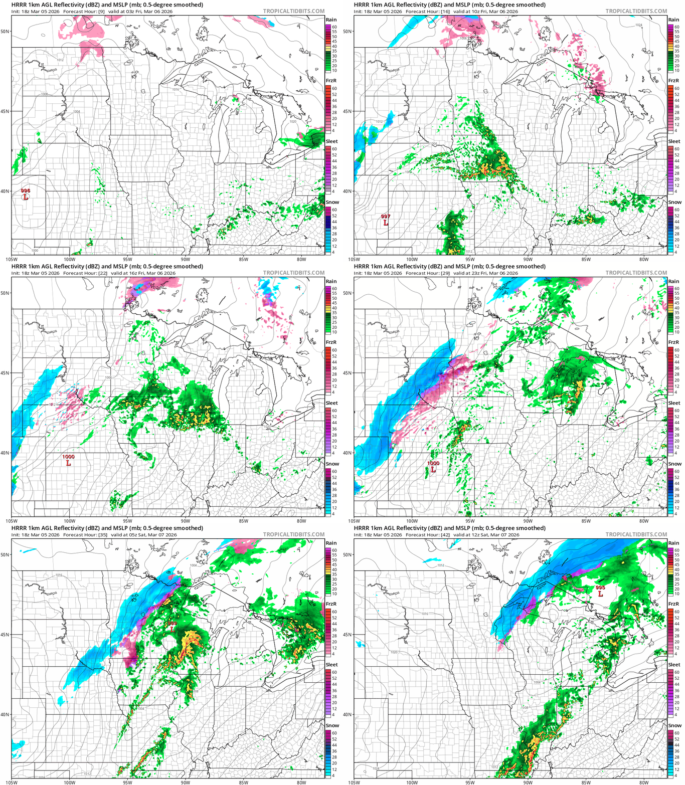
In the south, it will be warm enough for rain Friday. We may even have a few thunderstorms, especially south of the Twin Cities. NOAA’s Storm Prediction Center lays out a large severe weather risk zone from Iowa to Texas Friday:

A marginal severe risk mainly for large hail extends into southeastern Minnesota Friday.
Farther north and west, it will be cold enough for mixed wintry precipitation.

Rain will change to snow and some ice with sleet and some glaze possible. Winter weather advisories cover most areas west and north of the Twin Cities Friday into Saturday morning.
The Twin Cities is likely to catch a little coating of snow by early Saturday morning. It should be noted that forecast models have missed a more southward snow trend with the past two weather systems, so we’ll need to watch for the potential of a little more snow around the Twin Cities.
Winter weather advisories are up for most of Minnesota just west and north of the Twin Cities area. Here’s the National Weather Service bulletin:
Including the cities of St Cloud, Little Falls, Redwood Falls, Mora, St Peter, Willmar, St James, Elk River, Monticello, Hutchinson, Long Prairie, New Ulm, Princeton, Fairmont, Sauk Rapids, Litchfield, Olivia, and Gaylord
258 PM CST Thu Mar 5 2026
...WINTER WEATHER ADVISORY IN EFFECT FROM 3 PM FRIDAY TO 9 AM CST SATURDAY...
* WHAT...Mixed precipitation expected. Total snow accumulations up to two inches and ice accumulations around one tenth of an inch.
* WHERE...Portions of central, east central, south central, and southwest Minnesota. * WHEN...From 3 PM Friday to 9 AM CST Saturday.
* IMPACTS...Roads, and especially bridges and overpasses, will likely become slick and hazardous. Plan on slippery road conditions. The hazardous conditions will impact the Friday evening commute.
Here’s the early snow read from the Twin Cities National Weather Service office:

Warmer by Sunday
Highs will hover in the 30s and 40s Saturday.
Another wave of milder air rides into Minnesota Sunday. We should have 60s across the southern half of Minnesota Sunday afternoon.

The are signs of colder air again by the middle of next week.
Stay tuned.

