
Wintry weather returns: Active snow chances through Sunday
Three possible rain and snow events through Sunday for Minnesota

Go Deeper.
Create an account or log in to save stories.
Like this?
Thanks for liking this story! We have added it to a list of your favorite stories.


Some of us may be done with winter. But winter is not done with us yet.
Yes, March is technically meteorological spring here. I always say March is more winter than spring in Minnesota. My former WCCO-TV colleague, news legend Dave Moore, used to say, “Make no big decisions in March, in Minnesota.”
Dave usually said it best.
A more active wintry weather pattern has arrived here in Minnesota through Sunday. Three separate weather systems bring rain and snow to our region. Let’s break down the timing and impacts of the weather systems ahead for our region.
Turn Up Your Support
MPR News helps you turn down the noise and build shared understanding. Turn up your support for this public resource and keep trusted journalism accessible to all.
System No. 1: Tuesday night into Wednesday morning
The first system rides through central Minnesota and northwestern Wisconsin Tuesday night into Wednesday morning. A rain-to-snow precipitation zone will cross central Minnesota, including the Twin Cities, Tuesday night into Wednesday morning.
The National Oceanic and Atmospheric Administration’s NAM 3 km model seems to have a good handle on snowfall timing and coverage. The forecast model loop below runs between 6 p.m. Tuesday and 6 a.m. Wednesday.
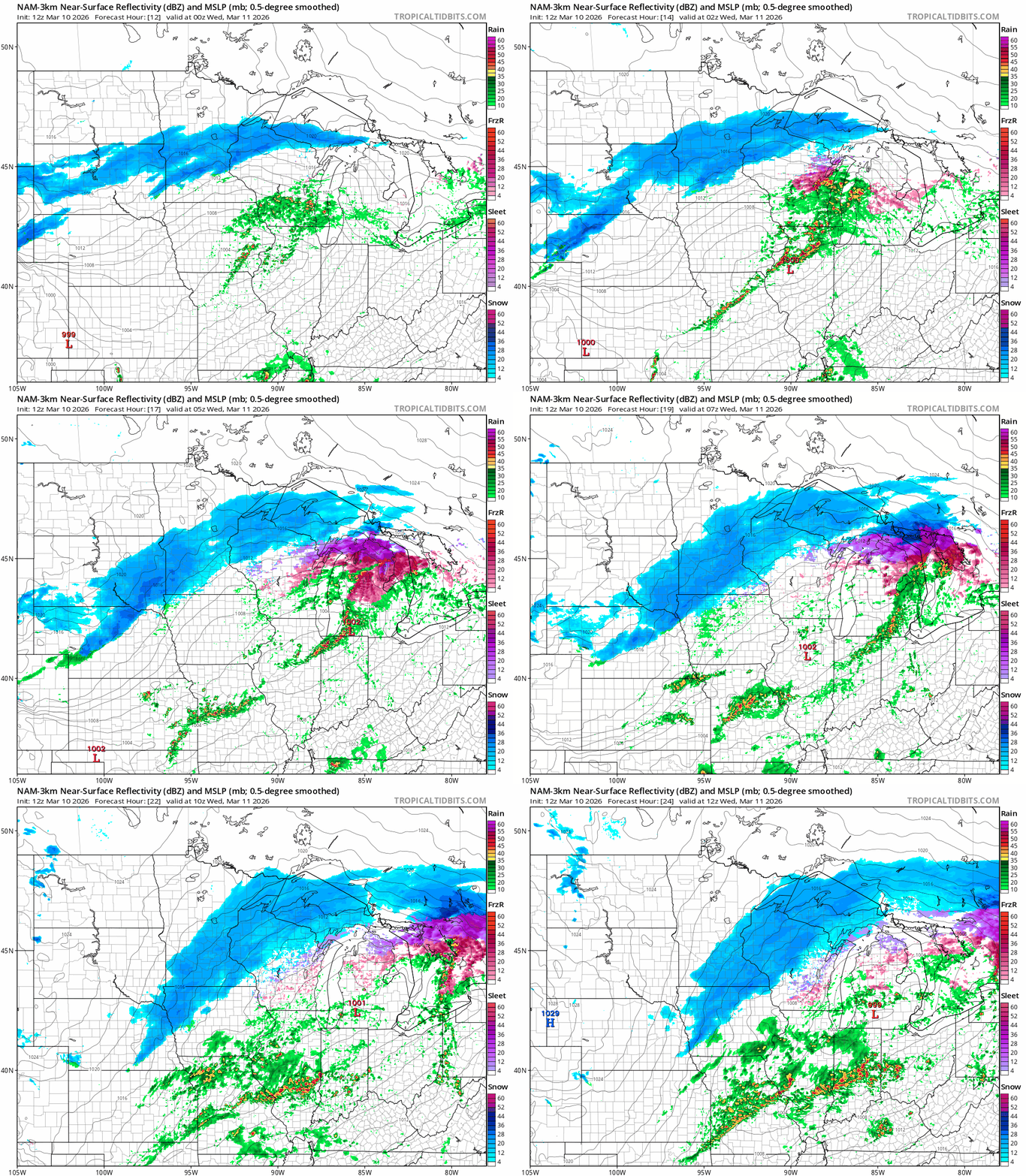
The heaviest snowfall with this first system will fall in northwestern Wisconsin through Michigan’s Upper Peninsula. But a mix of forecast models suggest the Twin Cities could pick up anywhere from a light snowy coating to 2 inches or so in the far northeastern Twin Cities.

Temperatures will be in the upper 20s Wednesday morning so morning rush hours could be slick.
System No. 2: Thursday
The second system arrives in Minnesota Thursday.
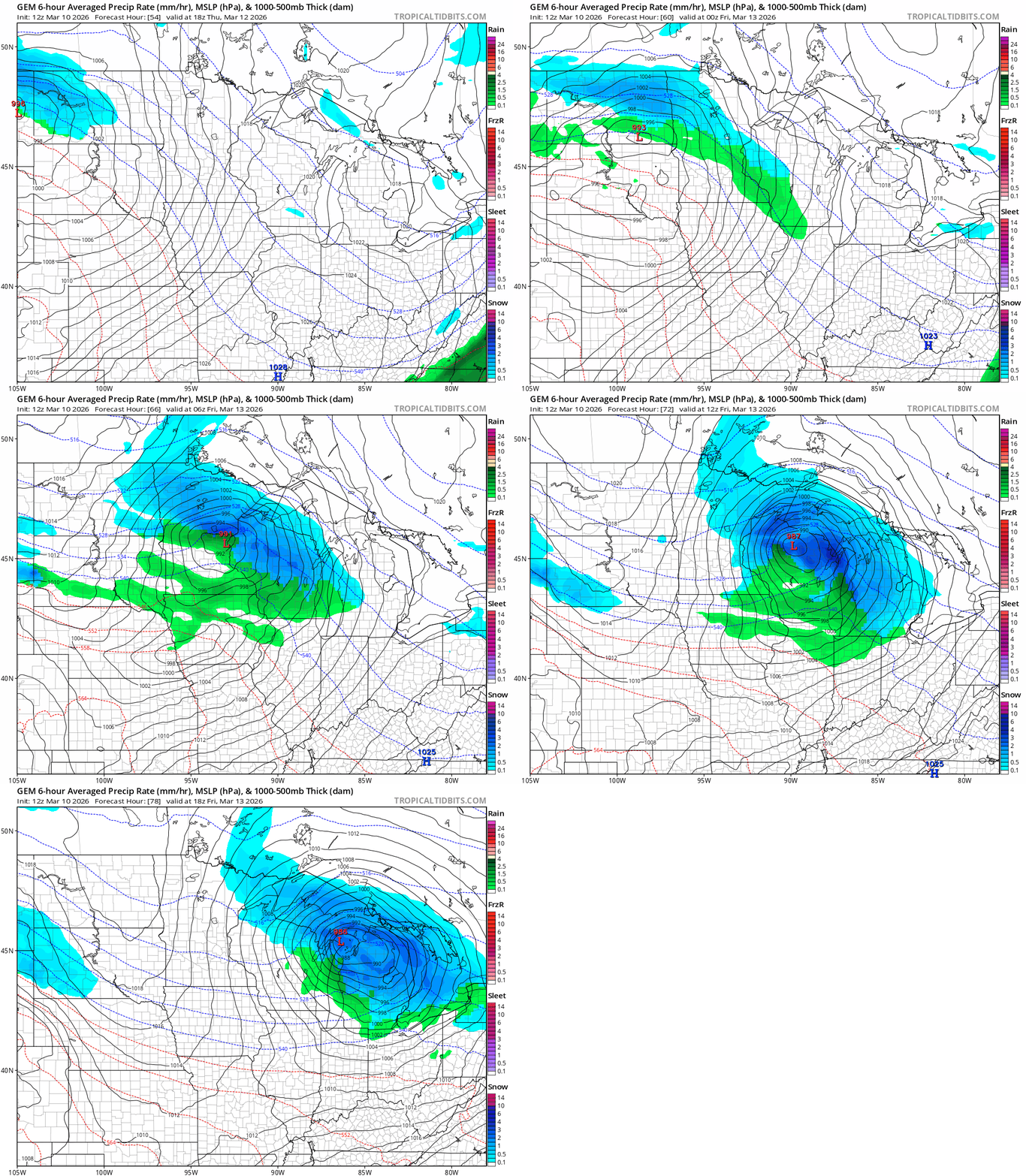
A moderately strong low-pressure storm favors snow in the north with mostly rain in the Twin Cities and south. If the currently favored storm track verifies it could produce several inches of snow in the north with mostly rain in the south Thursday.
On the map below, the Canadian model shows the likely storm track and precipitation types between noon Thursday and noon Friday.
System No. 3: Late Saturday and Sunday
The biggest storm on the maps appears ready to slam into Minnesota late Saturday through Sunday. This system appears to have all the earmarks of a heavy wet snow producer somewhere in Minnesota.
The storm track is still very uncertain this far out, but the potential for heavy snow in parts of Minnesota is there. Here’s Monday morning’s (12Z) European Centre for Medium-Range Weather Forecasts model output between noon Saturday and 6 p.m. Sunday:
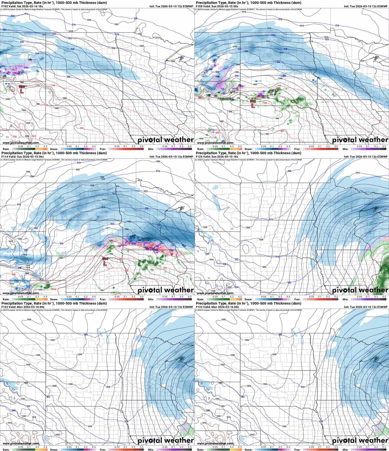
This system appears strong enough to dump several inches of plowable snow across much of Minnesota.
So stay tuned as we watch forecast model trends for a potentially significant snow event this upcoming weekend.

