
Clipper drops light snow Tuesday night; 60s south by Saturday
Snowy dusting across Minnesota into early Wednesday; much milder temps ahead

Go Deeper.
Create an account or log in to save stories.
Like this?
Thanks for liking this story! We have added it to a list of your favorite stories.


It’s another snowy dusting for much of Minnesota Tuesday night into the wee hours of Wednesday.
On the map below, the National Oceanic and Atmospheric Administration’s NAM 3 km model shows the snow band sliding across eastern Minnesota into Wisconsin between 7 p.m. Tuesday and 7 a.m. Wednesday.
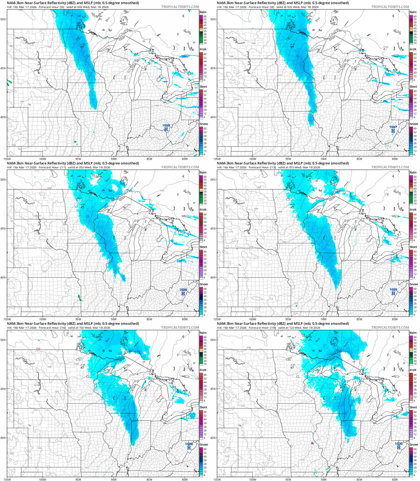
A warmer layer of air pushing in aloft may produce a little freezing drizzle as the system passes through. Temperatures will rise overnight into the 20s south as milder Pacific air begins to seep into Minnesota.
Milder days ahead
Our weather pattern changes for the milder the rest of this week across Minnesota. Look for a mix of sunshine and a few cloudy intervals through the upcoming weekend.
Turn Up Your Support
MPR News helps you turn down the noise and build shared understanding. Turn up your support for this public resource and keep trusted journalism accessible to all.
We’ll be melting snow in the afternoons, so foggy mornings are likely as extra moisture condenses in the atmosphere overnight from snow melt. Highs will like ease into the 40s across much of Minnesota Wednesday and Thursday.

How warm we get each afternoon will depend on how quickly the fog patches burn off each day. More sun equals warmer afternoons this week. By Friday, I think we’ll have melted enough snow to see temperatures soar into the 50s in many areas and even 60s in the southwest.

Saturday: Warmest day in 4 months?
Our milder Pacific flow peaks Saturday across the Upper Midwest. If we can burn off the fog early Saturday, temperatures will soar especially across southern Minnesota.
It all depends on sunshine, but if we get sun early and often Saturday models are pushing temperature to 70 degrees in the southwestern part of Minnesota. On the map below, check out the 80s across Nebraska in the upstream air mass!

I expect lots of bare ground with just a few snow plow piles left by the weekend.
Stay tuned.

