
Springy Wednesday ahead; rain, some snow especially north Thursday
Temperature roller coaster this week across Minnesota

Go Deeper.
Create an account or log in to save stories.
Like this?
Thanks for liking this story! We have added it to a list of your favorite stories.


Get ready for another free ride on the famed Minnesota weather roller coaster. This one starts with a springy Wednesday ahead.
Milder air eases into Minnesota Wednesday under mainly sunny skies. Temperatures will soar with our now stronger late March sun intensity. Highs will reach the 70s in the south, possibly as far north as the Twin Cities. Check out the map at the top of the post.
But our latest taste of spring is a one-day preview. Cooler temperatures and rain with some snow chance north arrive Thursday.
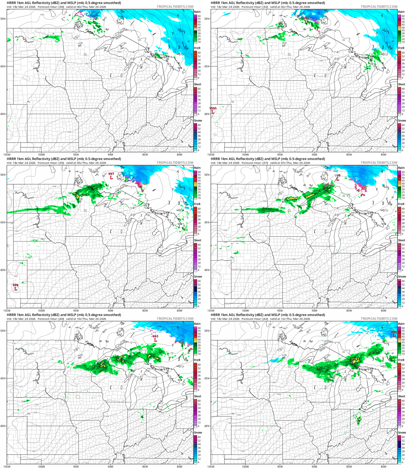
The National Oceanic and Atmospheric Administration’s High-Resolution Rapid Refresh model shows the likely rain zone mainly north of the Twin Cities between midnight and 7 a.m. Thursday:
Turn Up Your Support
MPR News helps you turn down the noise and build shared understanding. Turn up your support for this public resource and keep trusted journalism accessible to all.
High temperatures Thursday will be notably cooler than our springy Wednesday.

Friday brings sunnier skies with cooler temperatures to the region.

Nice last weekend in March
The last weekend in March looks ready to go out like a lamb. We’ll enjoy plenty of sunshine. Highs will run in the 40s north to 50s south Saturday. Sunday will be the milder day this weekend as 60s return to the south.

We’re almost out of the snowy Minnesota woods this season, but remember April brings a couple inches of snow on average. Sometimes less. Sometimes a whole lot more.
Stay tuned.

