
Balmy Wednesday transitions to colder showers Thursday
A couple of chilly days before another weekend warmup

Go Deeper.
Create an account or log in to save stories.
Like this?
Thanks for liking this story! We have added it to a list of your favorite stories.


Did you get outside Wednesday?
Temperatures felt more May than March across most of Minnesota Wednesday. We rode the upper end of that record-heat dome that’s been cooking the West with record summerlike heat the past several days.
Our 72-degree temperature at Minneapolis-St. Paul International Airport so far Wednesday is an astounding 26 degrees warmer than the normal high of 46 degrees for March 25.
Thursday cold front
Our spring fling is a one-day event this time, though. Notice those shades of blue in the far north on the map above? That’s the colder air that will pour south into Minnesota Thursday and Friday.
Turn Up Your Support
MPR News helps you turn down the noise and build shared understanding. Turn up your support for this public resource and keep trusted journalism accessible to all.
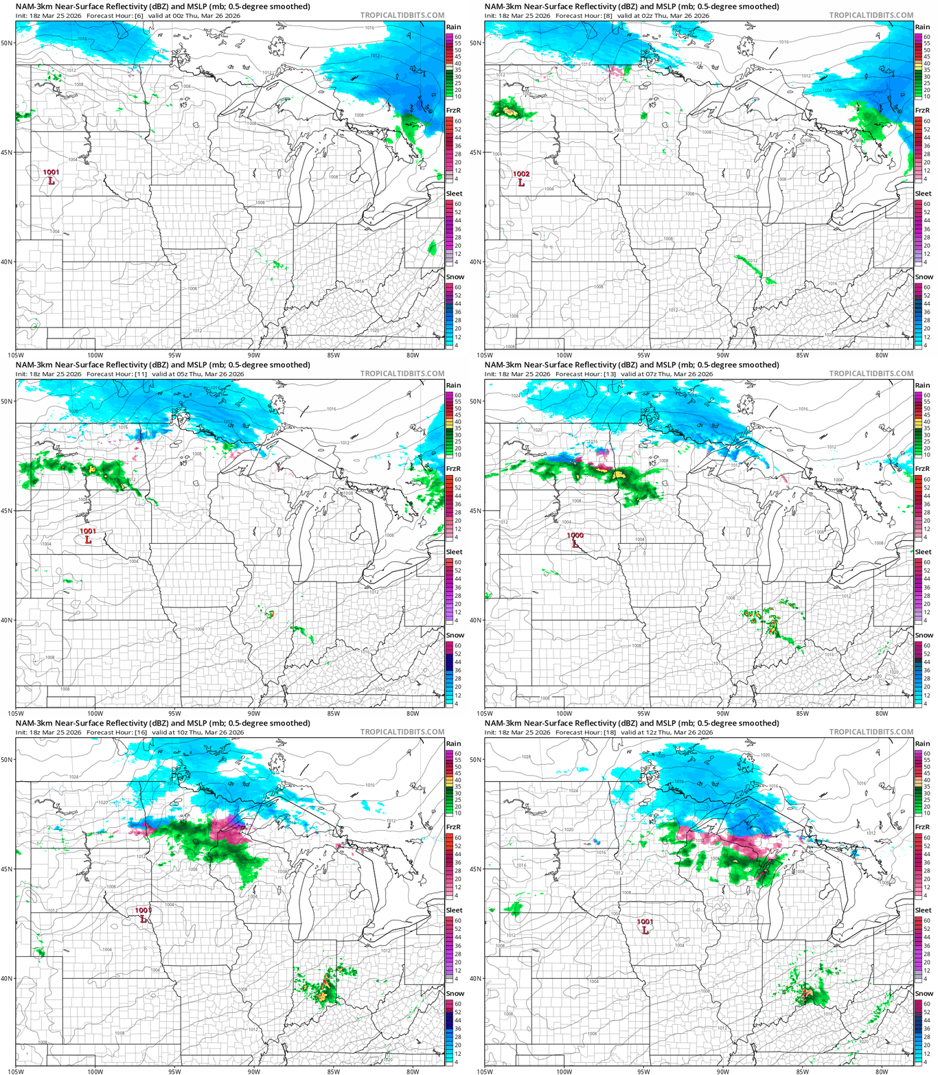
The cold front brings a band of rain showers with a few possible snowflakes in the north overnight into Thursday. We could see a few rain showers dip as far south as the Twin Cities early Thursday.
The National Oceanic and Atmospheric Administration’s NAM 3 km model shows the trend between 7 p.m. Wednesday and 7 a.m. Thursday:
Highs Thursday will be noticeably colder than Wednesday’s warmth. Jackets are back.

Friday will be the coldest day for the next week — and maybe for the rest of spring. Highs in the 30s to low 40s south will remind us it’s still March for a few more days.

The weekend looks sunny and milder once again. Highs in the 40s north and 50s south Saturday will warm into the 60s south by Sunday.


