
Next sloppy system brings rain to Twin Cities, winter storm warnings north
Several inches for northern Minnesota Friday, Saturday; warm enough for rain in the south

Go Deeper.
Create an account or log in to save stories.
Like this?
Thanks for liking this story! We have added it to a list of your favorite stories.


We got off lucky with storm No. 1 Thursday across most of Minnesota. Temperatures dipped at the freezing mark for a couple of hours around the Twin Cities and a light coating of glaze was recorded in many areas.
Warm pavement helped keep roads mostly wet, and road treatments work well at these temperatures.
But farther east into Wisconsin, widespread ice and tree damage occurred from Menomonie eastward into central Wisconsin.
Our next system arrives Friday and Saturday. It looks warm enough for rain in the Twin Cities and southern Minnesota, but snow will fall once again across the north.
Turn Up Your Support
MPR News helps you turn down the noise and build shared understanding. Turn up your support for this public resource and keep trusted journalism accessible to all.
The National Oceanic and Atmospheric Administration’s NAM 3 km model shows the evolution of the system between 7 a.m. Friday and 7 p.m. Saturday:
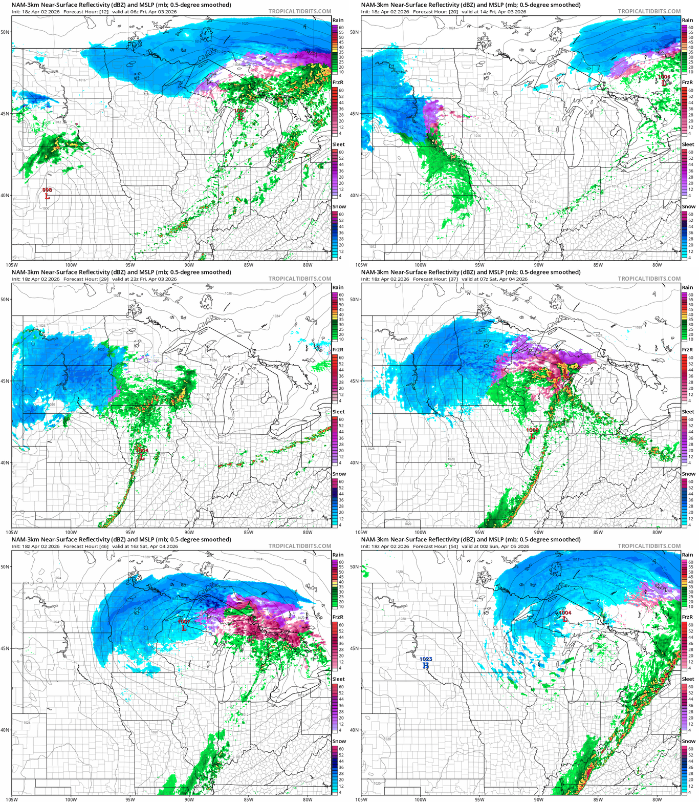
Snowfall trends still favor heavier snow in the northern parts of Minnesota through Saturday. Winter storm warnings are up for most of northwestern Minnesota and will likely expand eastward again by Friday.

Here’s the National Weather Service guidance:
Including the cities of Detroit Lakes, Two Inlets, Lake Itasca, New York Mills, Fergus Falls, and Mahnomen
1252 PM CDT Thu Apr 2 2026
...WINTER WEATHER ADVISORY REMAINS IN EFFECT UNTIL 7 PM CDT THIS EVENING... ...WINTER STORM WARNING IN EFFECT FROM 4 PM FRIDAY TO 1 AM CDT SUNDAY...
* WHAT...For the Winter Weather Advisory, snow. Additional snow accumulations up to one inch. For the Winter Storm Warning, heavy snow expected. Total snow accumulations between 6 and 12 inches.
* WHERE...Portions of northwest and west central Minnesota.
* WHEN...For the Winter Weather Advisory, until 7 PM CDT this evening. For the Winter Storm Warning, from 4 PM Friday to 1 AM CDT Sunday.
* IMPACTS...Travel could be very difficult. The hazardous conditions could impact the Thursday evening and Friday morning commutes.
Travel by Easter Sunday looks much better. Highs will reach the 40s under sunnier skies across most of Minnesota Sunday afternoon.

It does look like we’ll warm up by the middle of next week. Highs in the 60s south return by Wednesday.

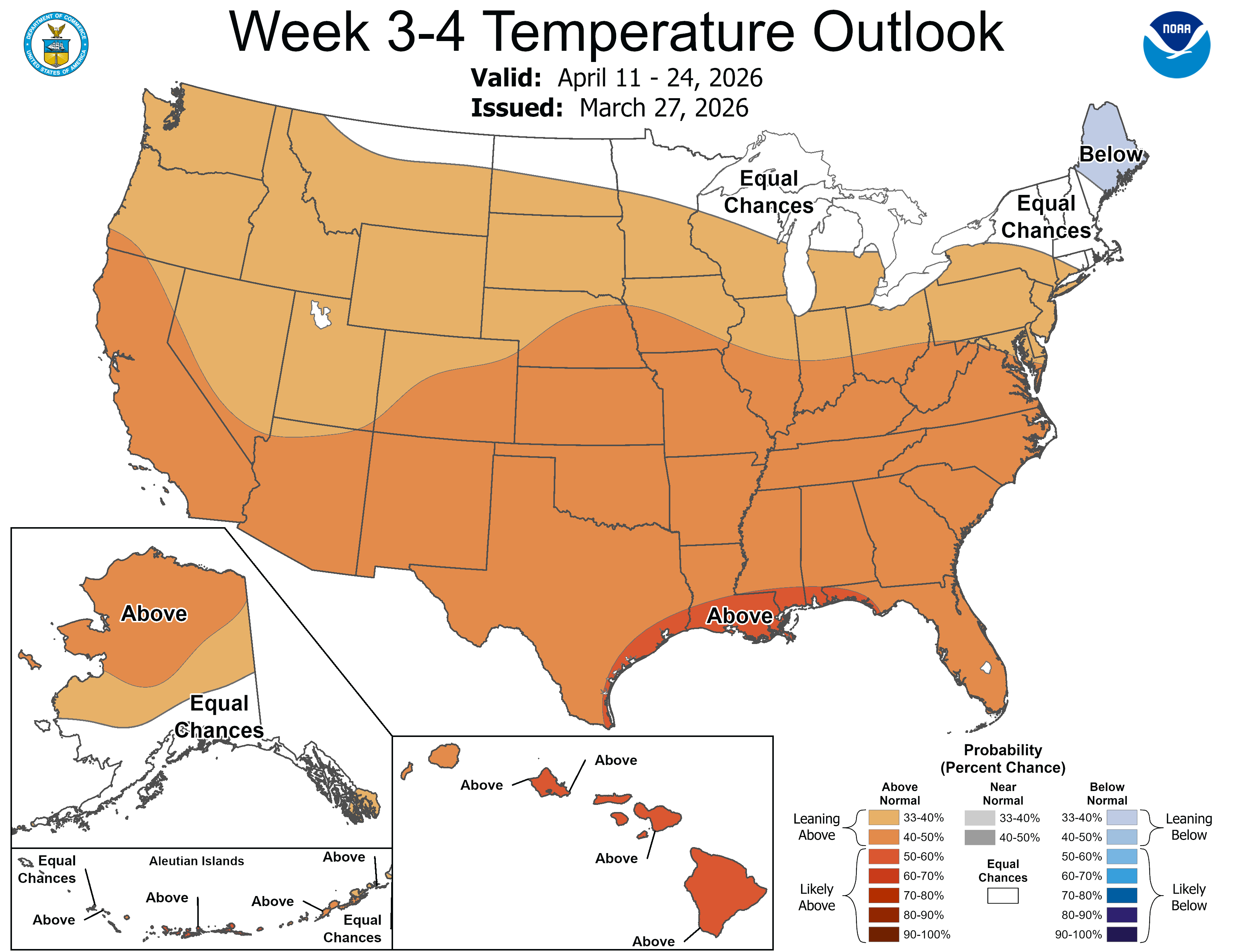
Spring looks like it will bloom with milder temperatures in the next couple weeks.
Hang in there!

