
Minnesota's reluctant spring brings milder temperatures ahead
Expect 60s Saturday, 70s Sunday across Minnesota's southern half

Go Deeper.
Create an account or log in to save stories.
Like this?
Thanks for liking this story! We have added it to a list of your favorite stories.


It’s baby steps into spring this year.
March was mild in southern Minnesota with temperatures running 5.8 degrees warmer than normal in the Twin Cities. Temperatures ran closer to normal in the north during March. Here’s the temperature departure map for March 2026.

But April has flipped the script with temperatures running 5.2 degrees below normal so far for the first week.
Wednesday briefly brings milder air to the south once again. A warm front-cold front combo will push temperatures into the low 60s south, before another cold front sweeps thought around midday Wednesday.
Turn Up Your Support
MPR News helps you turn down the noise and build shared understanding. Turn up your support for this public resource and keep trusted journalism accessible to all.

Wednesday’s system will produce some snow in the north, with a few rain showers south. Here’s the National Oceanic and Atmospheric Administration’s NAM 3 km model:
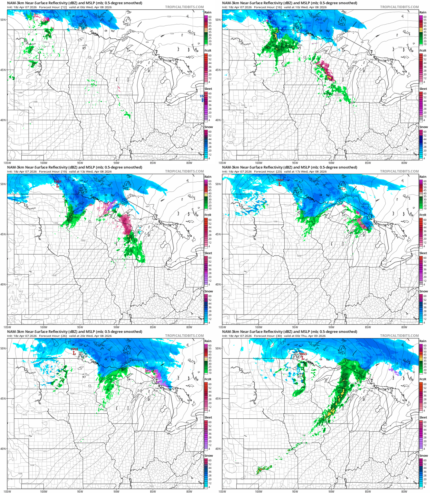
Overall snowfall totals look light in the north, but it will still look more winter than spring on April 8 in the north.

Thursday and Friday bring cooler and quieter weather with highs mainly in the 40s north and 50s south.
Springlike weekend ahead
The upcoming weekend looks springy across Minnesota. Saturday brings highs back into the lower 60s south. Sunday and Monday will be even warmer. Highs should make the 70s in the south. It will finally feel like spring out there.

We’ll be dodging a few showers this weekend. Right now the bulk of showers and a few possible thunderstorms appear to favor the hours between later Saturday afternoon through Saturday night into early Sunday.
If current forecast model timing pans out, the sunnier and drier hours of the weekend could be early Saturday and late Sunday.
Stay tuned as we tweak possible rain and thunder timing this weekend.

