
Cooler again through Friday; 70s possible Sunday afternoon
Another spring temperature roller coaster ride ahead for Minnesota

Go Deeper.
Create an account or log in to save stories.
Like this?
Thanks for liking this story! We have added it to a list of your favorite stories.


We’re catching another ride on the Minnesota weather roller coaster.
It was a 2-for-1 special on fronts Wednesday for Minnesota. The warm front pushed temperatures up into the low 60s in the Twin Cities around midday — for almost an hour.

Then the cold front slammed cooler air right back in from the northwest.

The milder air never made it to northern Minnesota. Snow squalls dropped visibility and coated areas with an April layer of snow.
Turn Up Your Support
MPR News helps you turn down the noise and build shared understanding. Turn up your support for this public resource and keep trusted journalism accessible to all.
Here’s the view Wednesday afternoon from Whiteside Park in Ely:

Temperatures head lower by Thursday morning with 30s south and some 20s north.

Thursday brings some clouds and the colder weather linger into Friday. Friday looks like a sunny and cool but nice day across Minnesota with light winds.

Springlike weekend ahead
The weekend brings typical spring weather to Minnesota. That means some milder temperatures by Sunday afternoon, but also some April showers and possibly thunderstorms.
The National Oceanic and Atmospheric Administration’s Global Forecast System model is similar to those that show the best chances for heavier rain and thunder Saturday night into Sunday morning. Check out the map below.
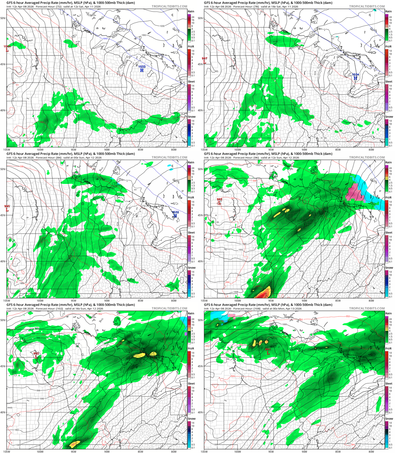
If the system tracks as modeled, there’s a chance southern Minnesota will break into a warmer air mass Sunday afternoon.
That would push highs into the 70s in the south Sunday.
Stay tuned.

