
True spring ahead: Warmer days and a severe weather risk emerging
Weather maps take a springy, stormy turn over the next week

Go Deeper.
Create an account or log in to save stories.
Like this?
Thanks for liking this story! We have added it to a list of your favorite stories.


True spring has spring on the forecast maps. Our weather pattern takes a clear turn toward more springlike weather over the next week.
Yes, we could still get colder days and snow is not out of the question around Minnesota into May. But I see many more days in the 60s, 70s, and even 80s ahead in the next couple of weeks.
There’s also a growing risk for a few strong to possibly severe storms in the coming days.
Let’s breakdown the week ahead.
Turn Up Your Support
MPR News helps you turn down the noise and build shared understanding. Turn up your support for this public resource and keep trusted journalism accessible to all.

Sunday warm front
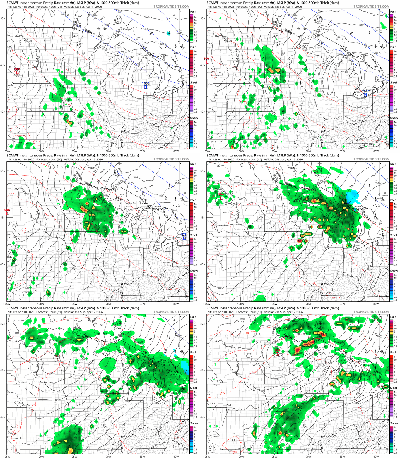
The weekend starts cool but clear into early Saturday. Most of Saturday morning will be dry, but a few scattered showers may push into Minnesota from the south by Saturday afternoon.
The most favored time for scattered downpours and a few thunderstorms still looks like Saturday evening into Sunday morning.
Then much of central and southern Minnesota works into the warm sector of the system behind a powerful warm front by Sunday afternoon. The European Centre for Medium-Range Weather Forecasts model shows the trends between 7 a.m. Saturday and 7 p.m. Sunday:
The National Oceanic and Atmospheric Administration’s Storm Prediction Center has a marginal (low) risk for a severe cell Sunday.
Sunday afternoon’s inbound air mass and stronger April sunshine look capable of boosting temperatures into the lower 80s in southern Minnesota Sunday afternoon!

If we hit 80 degrees Sunday at Minneapolis-St. Paul International Airport it will be the warmest day in six months since we hit 91 degrees on Oct. 4.
We topped out at 79 degrees on March 21 at MSP this year. The average date for the first 80 degree temperature of the year in the Twin Cities is around May 3. So we’re way ahead of schedule if we get there Sunday.
Severe risk Monday?
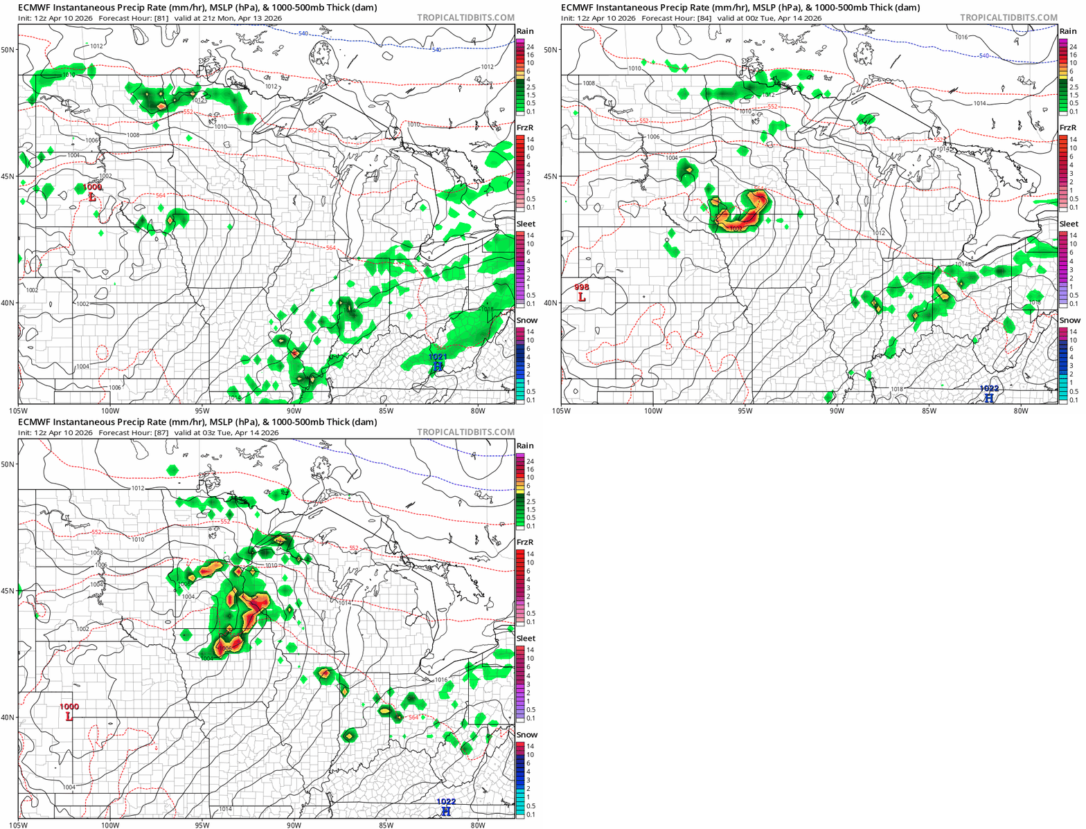
Our June preview continues Monday. Highs again will run in the 70s to low 80s in the south Monday.

Dew points in the 60s in southeastern Minnesota will provide fuel for the next wave to spawn some strong thunderstorms Monday afternoon and evening.
The European model is cranking out some potentially nasty red blobs Monday in southern Minnesota.
NOAA’s Storm Prediction Center has already laid out the risk zone for a potential severe weather outbreak through the central U.S. Monday:

Here’s a closer look at southern Minnesota.

Tuesday may bring another wave of storms in the south.
So pick your good weather spots this weekend, like Sunday afternoon. And get ready for some strange vibrant colors on the Doppler as we move through the next several days.
Stay tuned.

