
Severe risk Friday: Morning to midday storms possible in Twin Cities, eastern Minnesota
Highest severe weather risk zone Friday in SE Minnesota and Wisconsin

Go Deeper.
Create an account or log in to save stories.
Like this?
Thanks for liking this story! We have added it to a list of your favorite stories.


Heads up for what could be the early bird storm special Friday.
A fast-moving cold front may spark strong to severe storms earlier than usual Friday across eastern Minnesota and Wisconsin.
The National Oceanic and Atmospheric Administration’s Storm Prediction Center paints a marginal (low) severe weather risk for the Twin Cities but higher slight (level 2 of 5) and enhanced (level 3 of 5) risk zones to the east. (See the map at the top of the post)
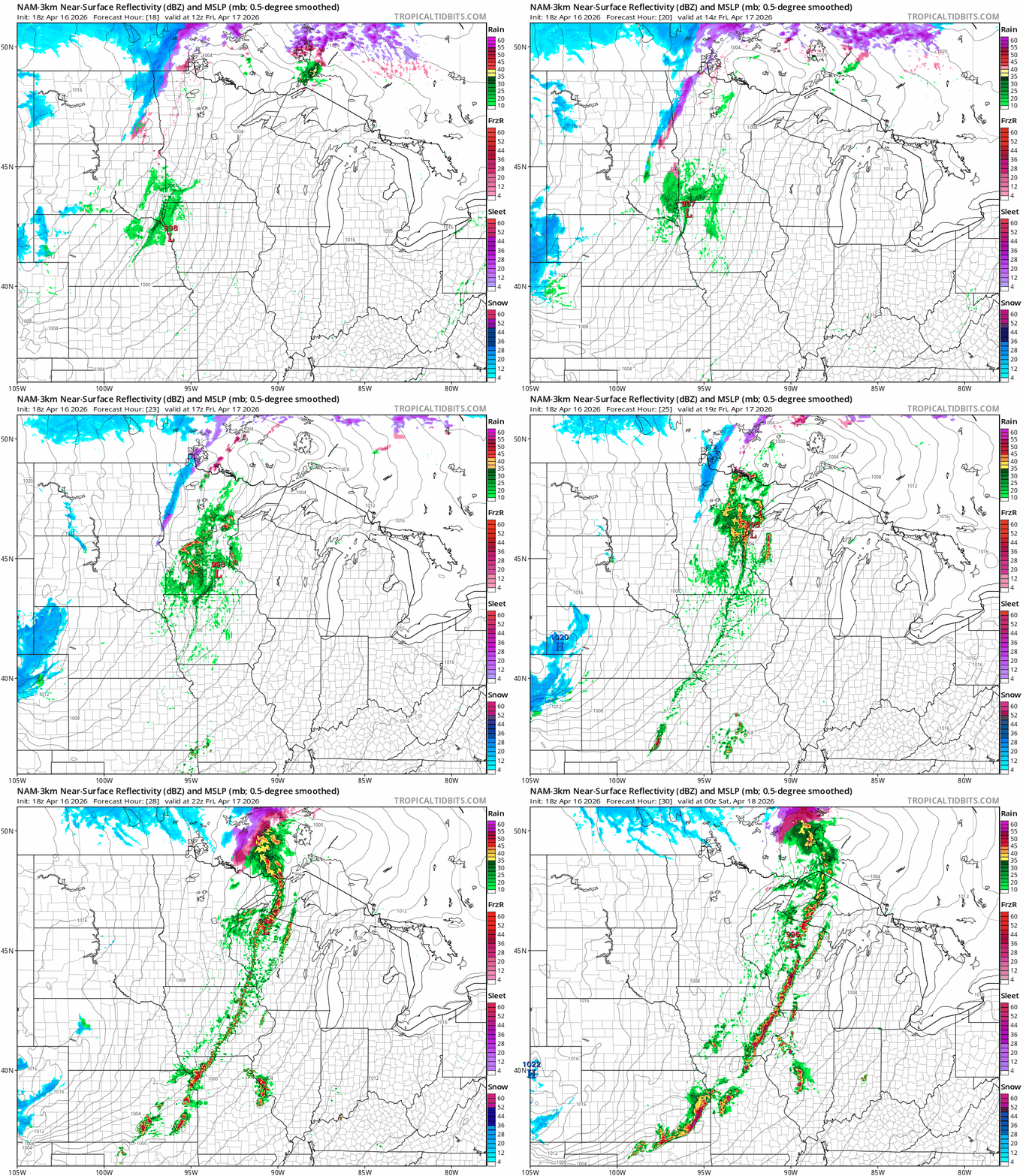
Forecast models vary as usual a bit on timing the front. Some limit storm development until the front passes the Twin Cities to the east. But several models fire storms west of or over the Twin Cities and eastern Minnesota Friday morning and sweep them east into southeastern Minnesota and Wisconsin through the midday and afternoon hours.
Turn Up Your Support
MPR News helps you turn down the noise and build shared understanding. Turn up your support for this public resource and keep trusted journalism accessible to all.
Here’s NOAA’s NAM 3 km model solution between 7 a.m. and 7 p.m. Friday:
Hazards with any storms that do reach severe levels include large hail and damaging winds. A few tornadoes cannot be ruled out Friday as the front sweeps eastward.

Temperatures ahead of the front will reach the 70s before quickly crashing back into the 50s. It will be chilly all day in the west with 30s once again in the far west.

The weekend will be chilly with highs in the 40s and 50s, but warmer air funnels in next week. Highs should reach the 70s again by next Tuesday and last most of next week.

Stay tuned.

