
Taste of July Wednesday; severe risk returns Thursday
Highs in the 80s Wednesday give way to scattered strong storms Thursday

Go Deeper.
Create an account or log in to save stories.
Like this?
Thanks for liking this story! We have added it to a list of your favorite stories.


It doesn’t get any better than this, Minnesota.
Our picture perfect spring air mass Tuesday brought highs in the 70s to much of Minnesota with some 80s again in the southwest.

That summery air mass to the southwest blows deeper into Minnesota Wednesday. Temperatures will feel more like July Wednesday afternoon around these parts.
But early season warmth in April usually comes with grass fire danger. There’s still a lot of dry grass from last season out there. The spring green up has not happened yet around much of Minnesota. Fire weather watches and red flag warnings cover most of Minnesota Wednesday.
Turn Up Your Support
MPR News helps you turn down the noise and build shared understanding. Turn up your support for this public resource and keep trusted journalism accessible to all.
Douglas-Todd-Morrison-Mille Lacs-Stearns-Benton-Sherburne-Wright- Carver-Scott-Le Sueur-Rice-Waseca-Steele-Freeborn-
1212 PM CDT Tue Apr 21 2026
...FIRE WEATHER WATCH IN EFFECT FROM WEDNESDAY AFTERNOON THROUGH WEDNESDAY EVENING...
The National Weather Service in the Twin Cities has issued a Fire Weather Watch.
* AFFECTED AREA...Portions of central, east central, south central, and west central Minnesota.
* TIMING...From Wednesday afternoon through Wednesday evening. * WINDS...South winds 15 to 20 mph with gusts up to 30 mph.
* RELATIVE HUMIDITY...Around 25 percent.
* IMPACTS...Any fires that develop will spread rapidly. Outdoor burning is not recommended.
Thursday severe risk
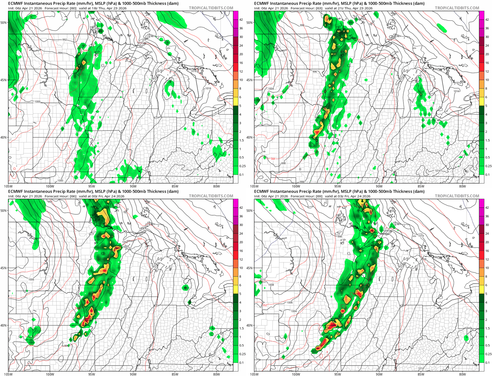
By Thursday, our southerly air flow will pump additional moisture in the Minnesota. Dew points in the 60s will fuel scattered storms ahead of an advancing cold front.
The European Centre for Medium-Range Weather Forecasts model seems to have a good handle on storms forming in western Minnesota and moving into eastern Minnesota Thursday afternoon and evening.
The forecast model loop below runs between 1 p.m. and 10 p.m. Thursday.
The National Oceanic and Atmospheric Administration’s Storm Prediction Center lays out a slight risk (level 2 of 5) for severe storms packing high winds and hail Thursday from southwestern Minnesota all the way to Oklahoma. A lower marginal risk (1 of 5) zone covers most of the rest of Minnesota.

Here’s a closer look at the risk zone for southern Minnesota and the Twin Cities area.

So be ready for possible severe weather watches and warnings Thursday.
The weekend looks dry but much cooler again with highs in the 40s and 50s.
One of these weeks we’ll get the timing right for our current weather to arrive on a weekend.
Stay tuned.

