
Summery Wednesday; severe risk ahead Thursday
Scattered severe storms possible Thursday afternoon across Minnesota.

Go Deeper.
Create an account or log in to save stories.
Like this?
Thanks for liking this story! We have added it to a list of your favorite stories.


Are you enjoying our July preview?
Temperatures soared well into the 80s across much of southern and western Minnesota Wednesday.

Now we watch as the next cold front carves through Minnesota Thursday. A band of higher dew points in the 60s will provide enough moisture ahead of the front to fuel scattered rain and thunder cells Thursday. The European model shows development along the frontal zone midday through the evening hours. The forecast model loop below runs between 1 p.m. and 10 p.m. Thursday.
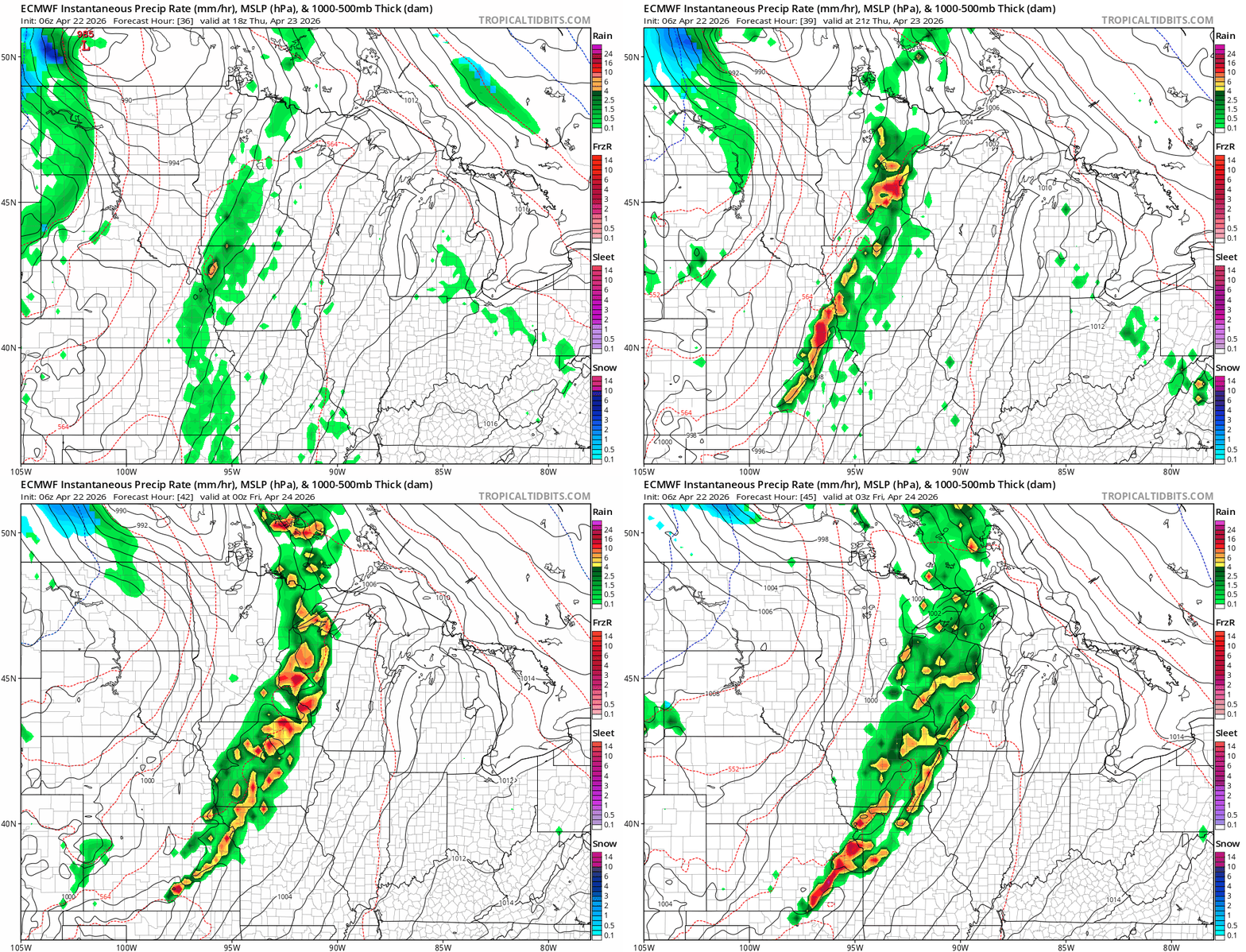
It doesn’t look like this severe weather event is as potent as last Friday. But scattered severe storms with high winds and large hail are quite possible.
NOAA’s Storm Prediction Center paints the larger risk zone from Minnesota southward Thursday.

Day 2 Convective Outlook NWS Storm Prediction Center Norman OK
1222 PM CDT Wed Apr 22 2026 Valid 231200Z - 241200Z
...THERE IS A SLIGHT RISK OF SEVERE THUNDERSTORMS FROM SOUTHERN KANSAS INTO SOUTHERN MINNESOTA...
...SUMMARY... Severe thunderstorms will be possible from southern Kansas into southern Minnesota on Thursday. Large hail to very large hail, damaging winds, and a few tornadoes are possible.
...Synopsis...
By early to mid afternoon, convergence along the pre-frontal trough/dryline coupled with increasing height falls/forcing for ascent are expected to support widely scattered thunderstorms from portions of central and southern MN through eastern NE and western IA, into at least northeast KS. While the strongest mid/upper-level wind fields are expected to remain to the immediate west of the initiating boundary, a corridor of 40-45 kt effective bulk shear will overlie the western fringe of the warm sector, supporting organized multicells and supercells as the initial storm mode with an attendant threat for large to very large hail and a few tornadoes. Subsequent upscale growth into a broken band of storms is expected Thursday evening into Thursday night across portions of eastern MN into western WI, western and central IA, southeast NE, northeast KS, and northwest MO. Damaging wind potential will increase with that mode change, with a continued risk for a few tornadoes.
You can see the slight risk zone at the top of this post has been nudged into the Twin Cities area and points south Thursday.
Keep an eye out for possible severe weather watches and warnings Thursday afternoon and evening!
Turn Up Your Support
MPR News helps you turn down the noise and build shared understanding. Turn up your support for this public resource and keep trusted journalism accessible to all.

