
Super soaker: Multi-inch rainfall Monday; sunnier days ahead this week
About an inch fell across the Twin Cities with 2 to 4 inches falling to the west

Go Deeper.
Create an account or log in to save stories.
Like this?
Thanks for liking this story! We have added it to a list of your favorite stories.


It’s an April super soaker across Minnesota to start the last week in April.
A slowly moving, low-pressure storm dumped soaking to heavy rainfall around most of our state. Doppler radar is seeing an estimated wide zone of 2 to 4 inches of rainfall west of the Twin Cities area through central Minnesota.
Many locations around the Twin Cities have seen an inch of rain. Areas in the western and northern Twin Cities have soaked up more than 1.5 inches in many areas.
The good news on a rainy Monday? The rain in southwestern Minnesota and in parts of the north are falling on drought areas, so this will help ease some of that drought going forward.
Turn Up Your Support
MPR News helps you turn down the noise and build shared understanding. Turn up your support for this public resource and keep trusted journalism accessible to all.

Silver linings, people.
Sunnier days ahead
Our weather takes a sunnier turn the next few days. Temperatures will remain on the cool side for late April.

The normal high for April 28 in the Twin Cities is 62 degrees.
We warm gradually through the upcoming weekend. Look for plenty of sun and milder temperatures.

This spring in Minnesota is taking its time to unfold. Temperatures have run a few degrees either side of normal for April.
The longer range outlook for May continues to favor even odds for temperatures above and below normal through May.
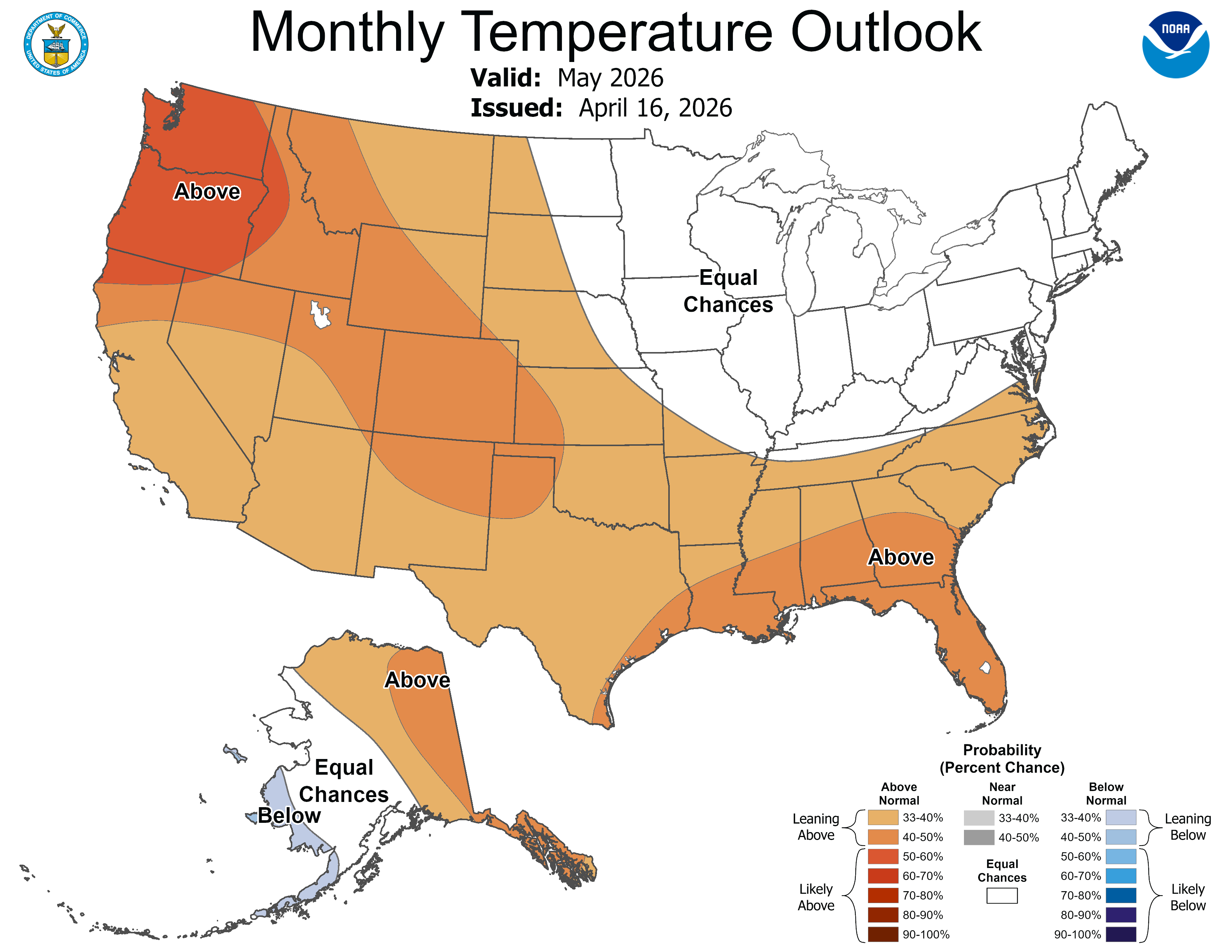
Many years we seem to whiplash from snow to instant 80s in April. Could we have a good old-fashioned gradual spring season in Minnesota this year?
Stay tuned.

