
Reluctant spring 2026: Sunny and cool with frosty mornings for much of Minnesota
Late April frosts may persist into May across Minnesota

Go Deeper.
Create an account or log in to save stories.
Like this?
Thanks for liking this story! We have added it to a list of your favorite stories.


Ah, spring.
It’s a reluctant season at this latitude. A warn day here and there that makes you feel like spring is here to stay. Then another cold front reminds us that it’s still April and we live in Minnesota.
We’ll enjoy plenty of sunshine this week with cooler-than-normal temperatures. Highs will stay in the 50s south through Friday with 40s north.

The weekend brings milder temperatures in the 60s, which will feel nice.
Turn Up Your Support
MPR News helps you turn down the noise and build shared understanding. Turn up your support for this public resource and keep trusted journalism accessible to all.

Little rain is likely for the next week or so.
Frosty mornings
Look for widespread frost these final April mornings into early May. Lows will dip into the 20s north. Lows in the 30s will include southern Minnesota. We may hold just above freezing in the Twin Cities inner core, but the suburbs will likely see frost the next few mornings.

The 30-year average (1991-2020) date of the last 32-degree temperature of spring at Minneapolis-St. Paul International Airport is April 23.
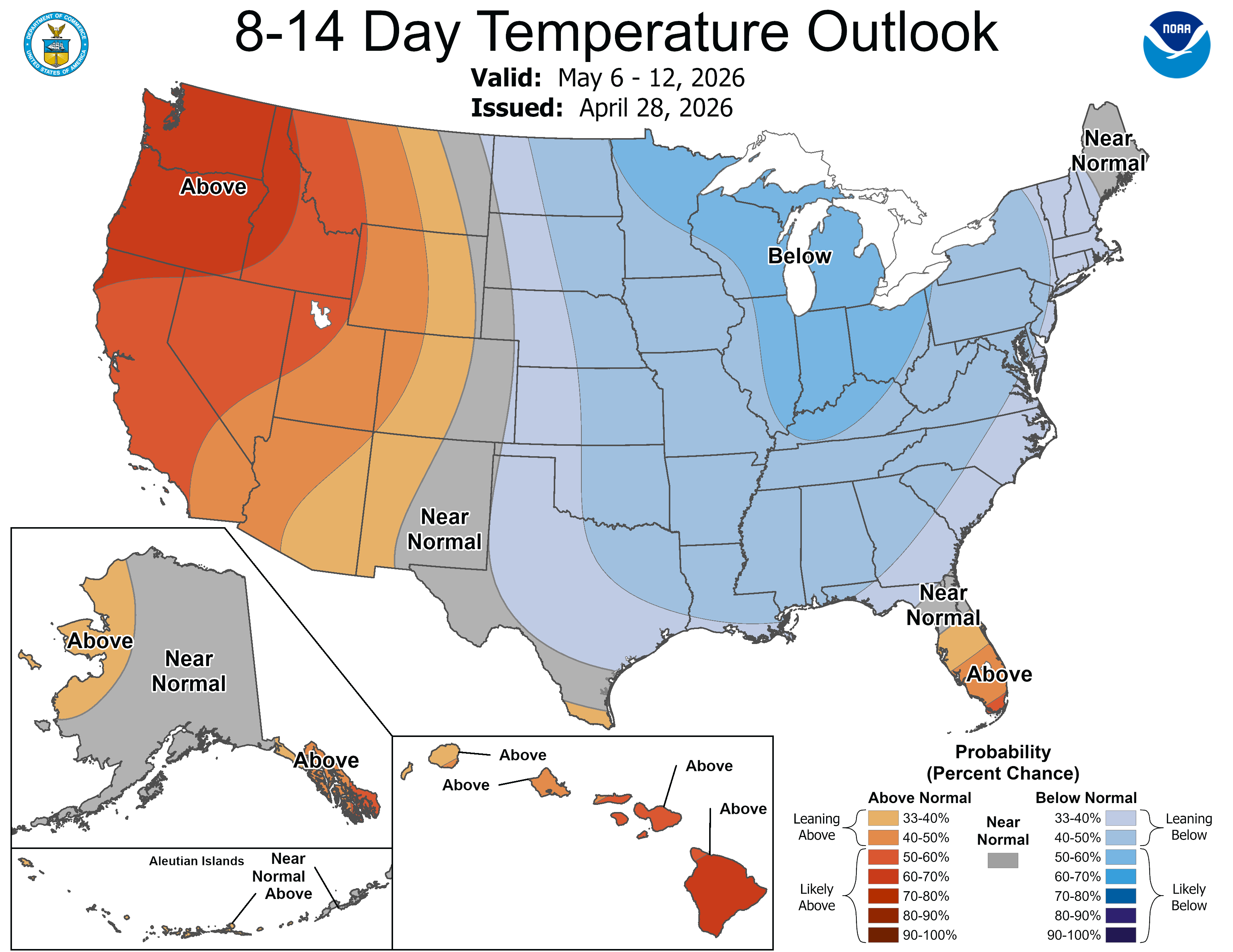
The National Oceanic and Atmospheric Administration’s outlooks still favor cooler-than-normal temperatures overall into May.
Hang in there a little longer, gardeners.

