Relentless winter of 2013-14 rolls on
Go Deeper.
Create an account or log in to save stories.
Like this?
Thanks for liking this story! We have added it to a list of your favorite stories.


Winter mojo
Minnesota is earning back our cold weather reputation this winter. The past decade has delivered an unusually high number of mild winters. Golf in January? It has happened in recent years. Not this winter.

Our vigorous winter of 2013-14 rolls on. Temperatures may ease a bit as we move into February, but right now I don't see a huge pattern change just yet. In the short term, get ready for more Alberta Clippers and "ground blizzards."

Blizzard in progress
Turn Up Your Support
MPR News helps you turn down the noise and build shared understanding. Turn up your support for this public resource and keep trusted journalism accessible to all.
Blizzard warnings continue for southwest Minnesota into Thursday. Another full blown "ground blizzard" has already whipped fluffy snowflakes airborne, and dropped visibility to zero in many southwest Minnesota locations.
Here are some of the blizzard reports from Twin Cities office of the National Weather Service.

Sub-zero Thursday
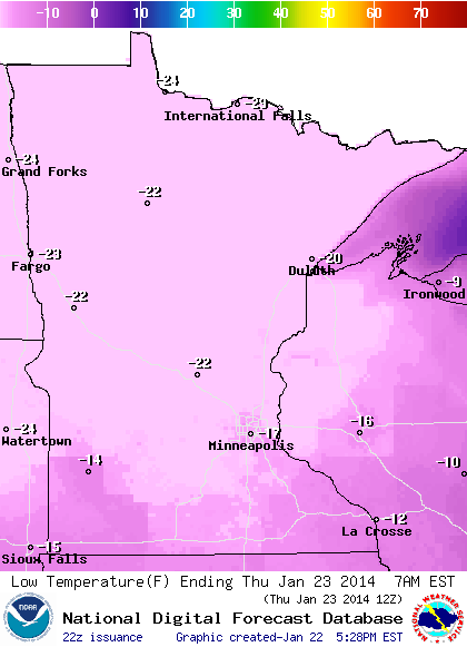
Thursday dawns brittle again. Temps will bottom out around -15 in the Twin Cities metro area, and may touch -30 up north.
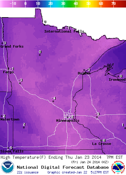
Highs struggle to reach zero statewide Thursday afternoon.
Next clipper Friday
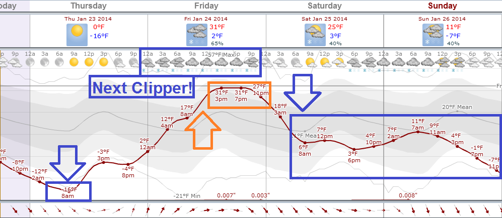
Temperatures begin to recover Thursday night and "soar" to near 30 degrees Friday. Of course, we know when it warms up rapidly in winter in Minnesota, it usually snows.
Our next clipper could deliver several more inches Friday and Friday evening. Temperatures plunge again Saturday behind the next arctic front. Here' a look at temperature and snowfall trends through the weekend, via the National Oceanic and Atmospheric Administration's Global Forecast System model.
Stay tuned, and stay warm!