Nearly two weeks after the start of two of the most devastating wildfires to hit the Los Angeles area, Southern California is under an extreme fire risk warning again.
Most schools across Minnesota are off Monday due to the Martin Luther King Jr. Day holiday. Some of the remaining districts have canceled or moved classes online due to the extreme cold.
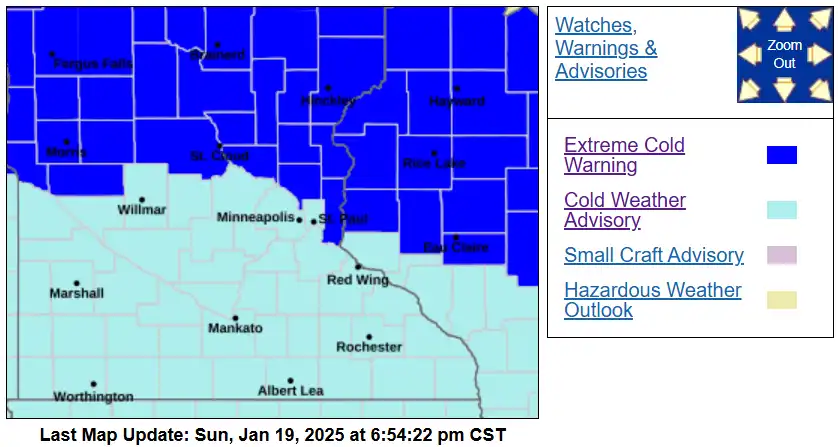
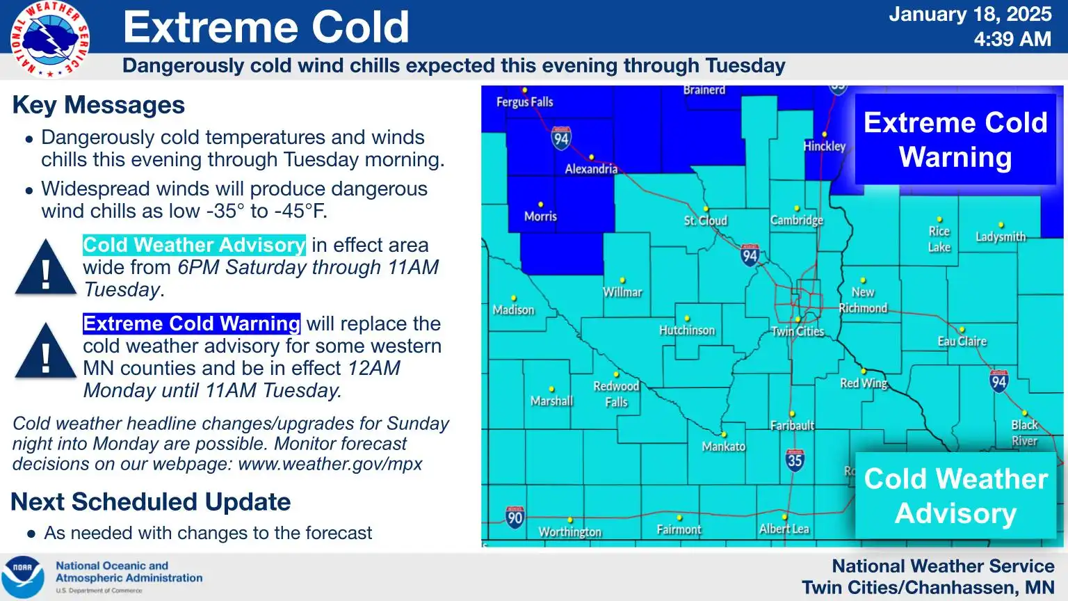
The Upper Midwest continues to be gripped with extreme cold warnings and advisories in effect until midday Tuesday, with dangerously cold wind chills expected to reach 30 to 40 degrees below zero. The coldest air arrives overnight Monday into Tuesday morning, followed by potential snowfall midweek as temperatures gradually rise.
Go Deeper.
Create an account or log in to save stories.
Like this?
Thanks for liking this story! We have added it to a list of your favorite stories.
Cold weather advisories and extreme cold warnings remain in effect as the weekend comes to a close. Portions of the northern Twin Cities metro area are now included in the extreme cold warning. Highs will stay subzero through Tuesday morning, with a shift to milder air expected to bring light snow and more seasonal temperatures afterward.
Winter’s brutal grip continues as temperatures stay below zero, accompanied by frigid wind chills ranging from 30 to 40 degrees below zero. Light snow is forecast to return midweek, along with a rise in temperatures.
Another blast of winter weather is expected in parts of the U.S. in the coming days, including bone-chilling wind in the Northern Plains and unusual snow and ice in the Gulf Coast area.
Frigid Arctic air will envelop the region tonight, bringing temperatures below zero for a prolonged period of over 60 hours. Expect dangerously cold wind chills of 30 to 40 degrees below zero with a northwest wind.
The coldest air mass of the season has settled in, with temperatures remaining steady in the single digits above zero for Saturday. Dangerously cold wind chills will persist, ranging from 30 to 40 degrees below zero through Tuesday.
A dangerously cold air mass from the Arctic Circle blows into Minnesota this weekend. Low temperatures will bottom out between minus 10 and minus 15 in the Twin Cities on Sunday, Monday and Tuesday mornings.
Bundle up and prepare: People living “basically anywhere from the Rockies eastward” will see extremely cold temperatures over the next several days, a meteorologist says.
When it comes to staying informed in Minnesota, our newsletters overdeliver. Sign-up now for headlines, breaking news, hometown stories, weather and much more. Delivered weekday mornings.