Portions of southeastern Minnesota saw 4 to 7 inches of rain overnight, which has caused flooding: Very heavy rainfall of 4 to 7 inches has fallen across portions of Dodge, Olmsted, and Fillmore Counties, resulting in flash flooding. If flooding is observed, be prepared to seek higher ground, and remember to NEVER drive through flood…
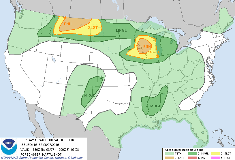
Portions of central and southern Wisconsin have a slight risk or an enhanced risk of severe weather Thursday evening and overnight. Temperatures and dew points ramp up Friday afternoon and it'll be steamy this weekend.
The Twin Cities metro area is in a marginal risk of severe weather Thursday afternoon/evening, meaning that an isolated severe thunderstorm will be possible.
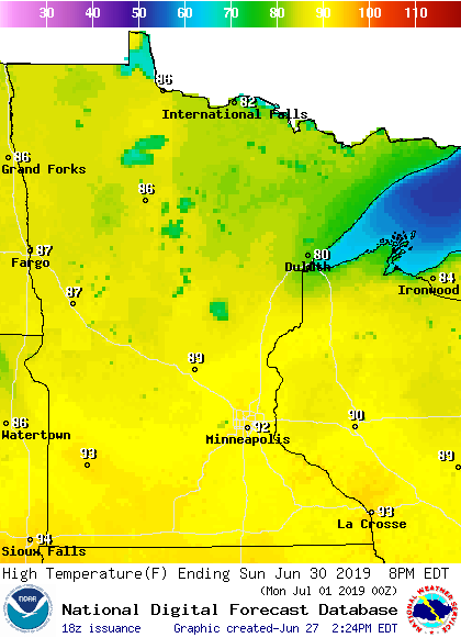
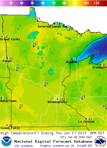
Twin Cities metro area temperatures reached the mid-80s late Wednesday afternoon, but dew point temperatures were in the comfortable 50s. We have some warmer temps and much stickier dew points in the forecast over the next few days. Temperature trends Most of Minnesota plus western Wisconsin will see highs in the 80s Thursday afternoon, with…
Most of Minnesota and western Wisconsin will see Wednesday afternoon highs in the 80s, with a few upper 70s in northeastern Minnesota. Some spots in the Twin Cities metro area could reach the mid 80s.
If you care about “good sleeping weather” you’ll want to get all the sleep that you can the next couple of nights. Anyone without air-conditioning will be dealing with steamy air later this week and this weekend. Dew points creep up a bit on Wednesday, then they’ll be in the sticky 60s across much of…
The warmup will begin Tuesday with just a gentle nudge on the thermometer up to seasonable temperatures. Afternoon high temperatures should range from the low and mid-70s across northern Minnesota to the low 80s in the south.
The Fargo-Moorhead Diversion Project encountered a major setback when the Buffalo-Red River Watershed District and its managers voted against a permit for the $2.75 billion project at a meeting Monday night.
Go Deeper.
Create an account or log in to save stories.
Like this?
Thanks for liking this story! We have added it to a list of your favorite stories.
As expected, the hot June sun activated an unstable atmosphere to fire up a scattering of showers and thunderstorms Monday afternoon from International Falls on the Canadian border to St. Cloud, the Twin Cities area and southeastern Minnesota. Lightning reports identify some of the thunderstorms. Note that we seem to be along the route of…
When it comes to staying informed in Minnesota, our newsletters overdeliver. Sign-up now for headlines, breaking news, hometown stories, weather and much more. Delivered weekday mornings.