Test your weather knowledge with MPR's annual weather quiz
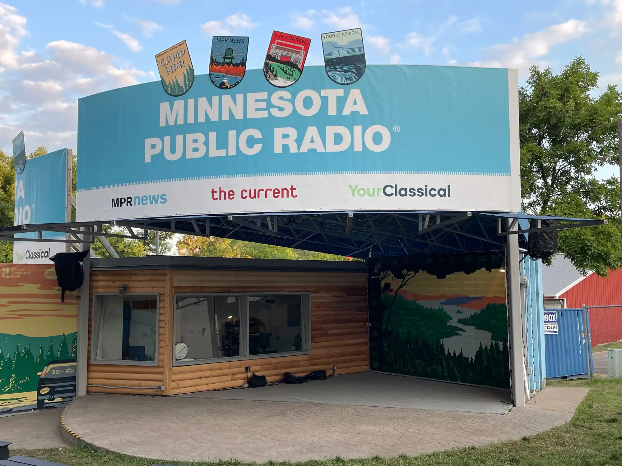
The Minnesota Public Radio booth at the Minnesota State Fair 2023 on Monday.
Kerem Yücel | MPR News
Go Deeper.
Create an account or log in to save stories.
Like this?
Thanks for liking this story! We have added it to a list of your favorite stories.
Audio transcript
[UPBEAT MUSIC] CATHY WURZER: This is Minnesota Now. I'm Cathy Wurzer. This is a special edition of the show today, recorded live at the Minnesota State Fair. It's our annual weather quiz, back for a 27th year. We're at the corner of Judson and Nelson at the fair, testing how much you know about Minnesota weather and climate.
Not a bad guess, but you're wrong, sorry to say.
And we're taking your questions from memorable weather events to how climate change is affecting our summers.
AUDIENCE: What was the coldest day ever recorded in St. Peter history?
CATHY WURZER: Ooh.
And Dr. Kenny Blumenfeld from the State Climatology Office is here with me, answering questions and throwing back some trivia.
KENNY BLUMENFELD: That was a hard question, so I'm going to pay you back.
CATHY WURZER: Keep listening. It's Minnesota Now on MPR News.
Hey, everybody. This is Minnesota Now from MPR News. I'm Cathy Wurzer here at the state fair, Minnesota State Fair, the corner of Judson and Nelson. So happy that you could be with us. What a great fair crowd. We appreciate you being here.
This has been really, for 27 years, one of the most popular things that we do at the Minnesota State Fair, the State Fair Weather Quiz. And that's what we're going to do in the next hour. Quiz you. You can quiz us. We've got prizes. We have a special guest.
Now, for 27 years, Dr. Mark Sealy, who I know you all know, who is beloved in the state of Minnesota, has conducted the state fair weather quiz. This year, there's a little bit of a change. Dr. Sealy is not able to join us today. He is under the weather, instead of being on top of the weather, as he normally is.
He sends his greetings and his regrets, but he also sends one of his friends to us today. I'm so happy that Dr. Kenny Blumenfeld is with us. Dr. Blumenfeld is a senior climatologist at the Minnesota State Climate Office and adjunct professor at the University of Minnesota's College of Food, Agricultural, and Natural Resources. Dr. Kenny Blumenfeld, everybody.
[APPLAUSE]
You picked a good day to be at the fair, my friend.
KENNY BLUMENFELD: Aren't they all good days, Cathy?
CATHY WURZER: Yeah, they are mostly good days. It's been a little bit hot and humid this summer, so at least this is OK, in terms of weather.
KENNY BLUMENFELD: Yeah, this is tolerable, and it's not dangerous, in any case.
CATHY WURZER: Yeah. It's a good thing. Say, for folks who don't know you, you've been on Almanac on Twin Cities PBS before. People have heard you on Minnesota Public Radio. You've been around for a while. Tell me, both of us are kind of weather nerds. We both love the weather. How did a guy who as a kid was scared to death of thunderstorms, how did he become the meteorologist he is today?
KENNY BLUMENFELD: I guess I wasn't smart enough to get out. I was always fascinated by storms, and I just for some strange reason decided that I had to make weather part of my career. And I just never gave up on that idea.
CATHY WURZER: What's the fascination with weather?
KENNY BLUMENFELD: Ooh, I mean, I think we could ask anyone here that question. What is it that we love about the weather? I think for me, it's a sense of our own powerlessness in the face of it.
You know, when the sky darkens and the lights have to come on because it's so dark, we think we're protected with all our technology and our buildings. And then there we are, extremely vulnerable. And I think I really caught on to that when I was quite young.
CATHY WURZER: For me, there's a sense of awe, right? You're kind of driving at that with your answer. There's a fair bit of wonder with the weather. And for me, that's part of the attraction.
KENNY BLUMENFELD: Oh, absolutely. I mean, it's amazing. Sometimes I just look up at the sky, and today's not a great day to do it. But it's amazing that we have this colorful sky, not just the blue that we normally see when there aren't any clouds in it.
But everything that we get when the sun goes down or the sun's coming up or after a storm when we can see a rainbow. And then we have multiple dimensions as the clouds grow and they shrink and they turn into storms and they change colors. I mean, all of that definitely does inspire awe and wonder.
CATHY WURZER: Did you used to be a storm chaser?
KENNY BLUMENFELD: [LAUGHS]
Yes.
CATHY WURZER: Yes.
KENNY BLUMENFELD: Yeah, I did chase some storms. They all went perfectly. Nothing ever went wrong.
CATHY WURZER: There is a rush of adrenaline. I used to do the same thing. And what's-- you were doing it, obviously, for science?
KENNY BLUMENFELD: No, that's generous. I was doing it as someone interested in the science who really just wanted to see storms close up and safely, obviously. But I wanted to kind of see things that I couldn't see growing up in the city.
CATHY WURZER: We should-- before we get into the weather quiz here, we should say, of course, that you're over at the University of Minnesota St. Paul campus, which is just right down the block here from the fairgrounds.
You work at the state climate office. There might be some people that might think, well, what the heck? Why do we need a state climate office? What do you all do over there?
KENNY BLUMENFELD: I guess the best answer I could give is the State Climatology Office serves the people of Minnesota. We are the official climate data authority for the state, so it's our job to collect, maintain, analyze, and then share information with Minnesotans about our state's climate.
That is its extremes, its averages, its records, how it's changing, the big news stories related to it, and how it fits in with the global climate.
CATHY WURZER: Your climate office has been so busy the past five, 10 years, if you think about it, with greater knowledge of climate change. You all are kind of on the front-- on the forefront of climate communication, in a sense, in this state.
KENNY BLUMENFELD: Yeah. I mean, we're no Mark Sealy. But yeah, we do a lot of communicating with Minnesotans. We get out. We've been to-- I think I've been to every county talking to folks about their climate, and we help them understand what just happened, what's going on now, and even to the extent that we can talk about it, where the climate appears to be going, too.
CATHY WURZER: Of course, now, weather is not climate. That's always good, to mention that to people again and again. Weather is not climate. Let's talk about 2023 for just a moment. How would you, to this point, try to sum it up? It's been kind of a weird season.
The winter was kind of strange. The summer's also been kind of interesting to see, with the smoke and the heat and the drought. How do you want to try to encapsulate it for us?
KENNY BLUMENFELD: I would say in Minnesota so far, 2023 started very stormy, very wintry, lots of heavy snow. And it was wet. We had a lot of precipitation. And then in May, it all just stopped. And since May, with a few exceptions, we have been dry, and we have been pretty much warm and also hot.
You know, we're used to going from one extreme to another in Minnesota, but that's a pretty dramatic shift to go from what was really one of the wettest and snowiest winters on record, and in some places, it was a record snowy winter. To go from that to one of the driest growing seasons so far on record is really quite a turnaround. Even that's a bit extreme for our normal extremes.
CATHY WURZER: This flash drought-- because we had one last year, too. Is that an imprint of climate change? Or hard to know?
KENNY BLUMENFELD: Yeah. I mean, it's interesting because I think we've talked about this before, that we haven't yet in Minnesota observed all of the ravages of climate change during our summers. Our summers have been the last to catch up.
And so the flash drought, what that refers to is usually drought takes months, sometimes even years to emerge. It's a slow process. And in the last two years, it emerged twice within a matter of weeks. And that's mostly because we got into these patterns where it just wouldn't rain. Didn't get any precipitation.
So it's hard to know if that, in and of itself, is a sign of climate change. Some of the indications are that as things change, we'll have more time in between precipitating weather events. So it does make some sense. But yeah, it's certainly hard to keep up with a drought that progresses this quickly.
CATHY WURZER: I hate to bring this word up, but I'll say it. Winter. We have to deal with winter somewhere along the line here in the next few months. What do the climate prediction center, what do they say about the winter to come? Are we looking at maybe a similar pattern from last year or something a little different?
KENNY BLUMENFELD: So most of the climate prediction center's official outlooks for the coming-- for the coming winter are based on the fact that we have El Niño building in the Pacific ocean. And El Niño tends to be associated with very mild winters here.
That said, we've already had extremely warm conditions this year, and we know that the El Niño doesn't really explain it, just because of the way that it's begun. And so there's something else going on, too. We've got the changing climate. You've got the El Niño phenomenon in the Pacific ocean.
And then there's something else that's been making the globe pretty extreme this year, so there's a little bit of uncertainty with that official forecast.
CATHY WURZER: OK. Say, if you're just tuning in, you are listening to a special edition of Minnesota Now here at the state fair. We are enjoying ourselves. We can hear the cicadas singing in the background. We've got a really great crowd here at the state fair, and we are about to launch the Minnesota State Fair Weather Quiz, the 27th-- 28th version of-- we're going to say it's year number 28, the version of it that we have here today.
With us is Kenny Blumenfeld. He's with the State Climatology Office. And we are going to launch into our quiz. Now, here's how we do this. We've got folks in the audience that are going to ask you a question, Kenny, OK? Either about the weather or the climate. And then you get to ask them a question. All right?
That's how we're going to do it. So if you've got a question for Kenny-- you're going to get a calendar no matter what, so you've got a free prize. You're going to get the Minnesota Weather Guide calendar from our friends at Freshwater.
We have our mic handlers. Where's Gretchen and Alana? Gretchen and Alana, come on up here. There we are. So if you've got a question, they will go right to you. Gretchen, right in front of us here, the gentleman with the powder blue shirt on.
Hello. What's your first name?
KIRK: Kirk.
CATHY WURZER: Hi.
KIRK: Question. I heard the European model of weather and the US model of the weather. Can you please explain that because I always question, why couldn't they decide one model versus two models?
CATHY WURZER: OK. The question, what's with the European versus the US model? All of these models. What's with the models?
KENNY BLUMENFELD: Sure. That is a very good question. What's the difference between the European model and the numerous American weather models? Why do we have so many different ones? It's a good question.
Think of it like this. The atmosphere that we have-- look up to the sky, and you can see. There's a lot between us and the clouds. And there's a lot more if you go from us to the area above the clouds. If you try to measure that, you can't really measure everything because there's too much.
So you have to simplify this thing that we call the atmosphere into a number of layers. And there's always some question about, well, what's the best way to simplify it? So one of the reasons we have so many different models is because the scientists working on each model have agreed or decided that certain things making this model run are really important, and we're going to let these things go.
And over in, say, Europe, for example, they have focused on other things that they think make their model better. There's some uncertainty here because if you can't capture everything going on, then you have to-- you can't use the equations fully that govern this thing we call the atmosphere. So you have to make some simplifications.
So these models, even with those simplifications, are very complex, but they end up-- they end up having some differences because one model will always produce more high temperatures and another one will produce more precipitation. And one will be really strong, maybe, in Minnesota and have a good track record, and another one will be lousy.
In general, it's well regarded that-- and I say this cautiously, but the European model is currently the best model for most weather situations on the market. And the American weather model's been doing a pretty good job, but it's got some catching up to do.
CATHY WURZER: Now, can we ask you a question, sir? OK, here we go. Are you ready? This is-- I bet you'll be able to get this one. The snow season this past winter, the snow season of 2022 to 2023 across Minnesota, as Kenny Blumenfeld just mentioned, we had a ton of snow, right? A lot of snow.
Which geographic area of Minnesota reported the highest snowfall totals? Is it northwestern Minnesota, northeastern Minnesota, or southwestern Minnesota?
KIRK: Northeastern. Duluth area.
CATHY WURZER: Very good. Thank you. More than 140 inches of snow. Think about that. Nicely done. Nicely done.
KENNY BLUMENFELD: Yeah, and that includes record snowfall in a number of stations. Yeah, it was a record year, not quite here in the Twin Cities, but up in northern Minnesota, they were setting records.
CATHY WURZER: Just crazy amounts of snow. We're going to go dive back into the audience. Gretchen and Alana, let's see. Who do we have here with my mic? Gretchen, go ahead. Who do you have?
BRIAN: Hi. I'm Brian.
CATHY WURZER: Hi, Brian.
BRIAN: My question is what's the latest point in the year we might have a day over 90 degrees?
CATHY WURZER: What's the latest date that we would have a temperature of 90 degrees or better?
BRIAN: That's right.
CATHY WURZER: Well, this year, who knows?
KENNY BLUMENFELD: So it depends on what part of the state you're interested in, and I would have to look at Dr. Sealy's weather almanac to be sure on the very latest date anywhere recorded in the state.
But on October 3, 1997, we had a 90 degree temperature here in the Twin Cities. And we have had 90s in October and even in late October in other parts of the state. Very good.
BRIAN: Thank you.
CATHY WURZER: Now, we've got a question for you, my friend. We're going to cool off now. What was the coldest windchill reported in the Twin Cities for this past winter? Is it 38 degrees below zero-- this is the windchill-- minus 48, or minus 58 degrees? Coldest windchill this past winter in the Twin Cities.
BRIAN: I'm going to go minus 48?
CATHY WURZER: Not a bad guess, but you're wrong, sorry to say. Minus 38 back on the 23rd of December.
KENNY BLUMENFELD: Yeah, right before-- right as we got into the holiday season, we had a snowfall come through. And then it got really cold. It was pretty well-hyped because we were worried about all this light, fluffy snow that had just fallen. And then the windchills were going to drop to 30 to 50 below zero across the state.
Just to follow up on that, getting down to a windchill, which is that's how cold it feels, not necessarily how low the air temperature is. Getting a windchill of negative 40 or lower in the Twin Cities only happens about every five, maybe every eight years, on average.
So negative 38's pretty good for us. We haven't been to negative 48 since 2019. Before that, it was 2014, and prior to that, it was over a decade.
CATHY WURZER: Perfect. Say, Alana-- producer Alana is out in the audience with-- who do you have with you?
STEVE: I'm Steve from Vadnais Heights.
CATHY WURZER: Hi, Steve from Vadnais Heights. What's your question or a comment for Kenny Blumenfeld?
STEVE: My question for Kenny is, how has climate change affected the smoke and the air quality that we've seen in Minnesota this summer?
KENNY BLUMENFELD: Yeah, that's a great question. So we're wondering about how the changing climate is affecting patterns of smoke and air quality. And think of it like this. As global temperatures rise, you have all these forests and even grasslands that have adapted to specific climate conditions.
As the temperatures rise, sometimes those forests and grasslands find themselves out of their normal range. Maybe it's too warm. Maybe it's too warm and dry. And they have a harder time surviving, and they end up with increased mortality. And that makes them more susceptible to burning.
So one of the things that's pretty well recognized is that as global temperatures continue rising, we're going to see more of our transitional landscapes, the ones that are no longer in their comfort zone, we're going to probably see more of them succumb to fire.
And that would present areas around them with, unfortunately, more opportunities to ingest some of that smoke. So it's not really good news. And when you think of the pattern of how the climate has changed in our hemisphere, we generally see more temperature rise compared to what's normal the farther north you go.
And so the areas this year that were burning in Canada are areas that have had much more change in their climate than even we have. And we're, of course, one of the fastest warming states in the country. But parts of central Canada have had even more warming than us.
So their forests are really susceptible and have really been weakened by decades of unusually high temperatures. Very good question.
CATHY WURZER: Very good question. Would you like a question from Dr. Blumenfeld? OK, I know you've got some pretty hard ones there, so give it your best shot.
KENNY BLUMENFELD: OK, that was a hard question, so I'm going to pay you back. All right.
STEVE: Bring it on.
KENNY BLUMENFELD: OK, we're talking about some recent changes. So in 2021, parts of Minnesota experienced what's called exceptional drought. This is also known as D4. It's the highest category of drought that's issued on the US drought monitor, and this was the first time since the drought monitor began that any part of Minnesota had gone into that drought category.
And that began in the year 2000. OK, so the question is, out of 128 years of record, where does 2021 rank for annual precipitation on a statewide basis? You get three choices. Is it A, 9th driest? Is it B, 2nd driest? Or is it C, 29th driest?
STEVE: I'm going to say second driest.
KENNY BLUMENFELD: OK, and the correct answer actually was 29th driest.
CATHY WURZER: What?
KENNY BLUMENFELD: Isn't that-- yeah, it's a little counterintuitive because what's happened-- and we found this last year, too. Even though we've had incredible drought during our growing seasons, that was last year. That was 2021, and so far this year, too.
At least in 2021 and 2022, we ended up going into a very wet regime after the growing season. So beginning last November, we just started getting pounded. And of course, the beginning of 2021 and 2022 were also quite wet.
So honestly, when you add it all up, even though we had a very dry growing season, the annual precipitation wasn't that low compared to other historical drought periods. And one of the things we're starting to see is that when you compare 2021, 2022 so far with other really dry periods, they look like downward spikes on a precipitation graph. This is actually one of the wettest dry periods on record in Minnesota.
CATHY WURZER: That is counterintuitive.
KENNY BLUMENFELD: It sure is.
CATHY WURZER: Good effort. Thank you so much. And you've got a state-- you got a weather guide calendar. Alana, behind you is a gentleman with a really cool Hawaiian shirt with shades. I just want to get you over there to get him.
OK. In the meantime, while you guys are figuring out which question you want to ask, Gretchen, who do you have over there?
SHERRY: Oh, right now? Sherry.
CATHY WURZER: Hi, Sherry.
KENNY BLUMENFELD: Hi, Sherry.
SHERRY: Since you're saying we're in El Niño, I'm wondering if our winter will get a lot of rain and ice.
KENNY BLUMENFELD: Oh, wow.
CATHY WURZER: Ooh.
KENNY BLUMENFELD: That's a seasonal weather forecast that's a little bit out of my range. The joke that I usually get to tell is that they always say, well, meteorologists are paid to be wrong half the time. But I'm a climatologist, so we mostly look at what just happened.
CATHY WURZER: So you're always right.
KENNY BLUMENFELD: Always right. Correct. Correct.
CATHY WURZER: Nice.
KENNY BLUMENFELD: In general, during especially the first year of an El Niño, what we see is mild conditions, including a potential snow drought during the winter time, but then a quick uptick as you get into spring where precipitation starts picking up.
And usually the first full year of an El Niño is pretty wet. So that's one thing we're watching. If we go from this really dry pattern to-- if we continue in sort of a traditional El Niño progression trajectory, we would end up very wet next year, which would be another stunning turnaround for us.
CATHY WURZER: But I would really hate to see that precipitation in the form of ice. I think that's what you're referring to.
KENNY BLUMENFELD: That's right.
CATHY WURZER: I hate that. Ugh.
KENNY BLUMENFELD: Usually when we have El Niño conditions, it's mild enough. If it's really going to be what the climate prediction center is forecasting, those are often mild enough that we don't even have any snowpack around for part of the winter, at least in southern Minnesota.
Is anyone here from the Arrowhead? Yeah, you're going to have snow this winter, and it's going to stick around for at least 100 days, just like it always does. But down here in southern Minnesota, where we're more marginal, I would expect if it's a normal El Niño, we would have not even enough snowpack to produce that ice.
I mean, there will definitely be nights with ice. But right now, there isn't any indication it would be worse than what we had, say, last year, which was horrible.
CATHY WURZER: So while we're on the subject of cold weather, would you like a question?
SHERRY: Sure.
CATHY WURZER: I've got a good one here. What was the coldest official temperature reported in Minnesota during this past winter? Is it minus 39 degrees below zero, minus 49, or minus 59?
SHERRY: Air temperature, correct?
CATHY WURZER: Air temperature. Yes.
SHERRY: Minus 39.
CATHY WURZER: Very good. Kabetogama, Minnesota, February the 4th, 2023. 39 degrees below zero at Kabetogama.
KENNY BLUMENFELD: What do you think of 39 below? What do you think of that, Cathy?
CATHY WURZER: Minus 39, that would be a little chilly.
KENNY BLUMENFELD: It is cold.
CATHY WURZER: Yeah, I wouldn't go out without a coat. Yeah.
KENNY BLUMENFELD: For a place like Kabetogama or International Falls, that would rank as one of the warmest coldest days of the year on record. Yeah, for them, that's nothing. For us down here in the Twin Cities, that would be terrible. But northern Minnesota, they are used to that.
CATHY WURZER: Hey, if you're just tuning in, this is a special edition of Minnesota Now. We are at the Minnesota State Fair at the MPR booth. We're at the corner of Judson and Nelson. We're having a good time. A lot of people are out here. You can-- well, we've got all kinds of stuff here at the booth.
We've got shirts and mugs. We've got a prize wheel that you can spin. Classical MPR, The Current's out here. We've got this special edition state fair tote bag because, really, what's public radio without a tote bag? We have a special edition state fair tote bag that you can order for just a $10 contribution to MPR.
They're wildly popular, these tote bags, so get one before the end of the state fair. Let's go back and take another question. What do you think? OK, Alana, are you out there? All right. Who do we have?
JIM: I'm Jim from Duluth. This is--
DYLAN: Dylan from St. Paul.
JIM: And we were wondering, what were the meteorological circumstances that led to the big rains and the floods in Duluth in 2012?
CATHY WURZER: Oh, wow.
KENNY BLUMENFELD: Oh, yeah. Very good question. So Duluth-- for those who didn't know, Duluth got pounded by rain in mid-June, right around the summer solstice, in 2012. And it ended up being what's called a thousand year rainfall in some areas.
There were broadly 5 to 10 inches of rain across not just Duluth, but into Two Harbors, and also all the way down towards Moose Lake, so it was a really widespread heavy rain. And if you remember anything, you might remember that the water came so fast that everything-- the water rose, and it pushed some of the animals out of the zoo. And then there was the picture of the seal--
CATHY WURZER: Oh, gosh. I remember--
KENNY BLUMENFELD: --flopping around on the street.
CATHY WURZER: The morning of, after that, I got a picture-- I knew that-- that's when I knew we were in trouble, when the seal was on Superior Street, I believe. You know--
AUDIENCE: Grand Avenue.
KENNY BLUMENFELD: Grand Avenue. Yeah.
CATHY WURZER: The poor seal was on Grand Avenue in Duluth. And I thought, oh, my gosh. What the heck is this?
KENNY BLUMENFELD: Yeah. It was a very photogenic seal, though.
CATHY WURZER: It was.
KENNY BLUMENFELD: Very cute. So the circumstances that lead to that situation and also most of our big flash floods are kind of similar. You get very warm and humid air on the south side of a boundary. You hear about warm fronts, cold fronts, stationary fronts.
Those are all boundaries that just separate air of one type from air of another. So we had very warm, humid air across the southern 2/3 of Minnesota. In the northern third of Minnesota, it was fairly mild. And then the winds aloft, which are winds off the ground, a few thousand feet up, all the way to maybe five miles up, these are the winds that drive our weather around.
Those winds were very light. So you had a lot of moisture flowing right onto this boundary, where there was a strong temperature contrast and moisture contrast that enabled thunderstorms to develop. And they just formed right along that boundary. And with very weak winds aloft, they didn't move much, and they just kind of parked over the same area.
So in some areas, it was raining hard for more than 12 hours straight. So really a phenomenal storm. And we saw things like that happen in southeastern Minnesota in 2007 and in southern Minnesota in the fall of 2010, near the Minnesota River. It's usually some variation on that same concept, where you have a boundary separating really warm from cooler air, storms get stuck there, and there's very little in the way of motion aloft or winds aloft to push those around.
CATHY WURZER: That was just another storm where you just couldn't believe what you saw. Do you have a question for our friend?
KENNY BLUMENFELD: Oh, sure. That was--
CATHY WURZER: Can we quiz you?
KENNY BLUMENFELD: --very good question. I have one that's a little closer to home here. All right. What memorable weather greeted fairgoers in 1977 right here at the fair? On August 31st of 1977, what would you have seen?
Would you have seen flooding? Would you have seen snow? Or would you have seen tornadoes that were visible from the sky ride?
JIM: I'm going to have to go with a tornado. What do you think?
DYLAN: Snow seems amusing.
JIM: Well, I guess--
DYLAN: It's-- that would be memorable.
JIM: It would.
CATHY WURZER: It would be.
KENNY BLUMENFELD: I love that you're disagreeing.
JIM: We're probably both wrong, right?
KENNY BLUMENFELD: Yes. Yes.
CATHY WURZER: Excellent.
KENNY BLUMENFELD: It was a flood. It was actually, at the time, it was the biggest flood in Twin Cities area history. They had over 7 inches at the airport. Here on campus, just a mile north of the fair, they measured over 4 inches of rain.
And there was water just flowing down all the streets, knee high to waist high. They had to basically shut down the grandstand, cancel the performances. And then the people who were trying to get out, they had a hard time leaving because all the roads were backed up and because the parking lots were full of water.
So just imagine that. There were also not quite as many people as we have.
CATHY WURZER: Oh, my gosh. That was a mess. Say, if you're just coming by the state fairgrounds here, and you're looking at kind of the situation we have here on the stage at the booth. Judson and Nelson is where we are with the MPR booth, and we have the State Fair Weather Quiz going on right now with Dr. Kenny Blumenfeld of the State Climatology Office. And we are giving away Minnesota weather guide calendars.
Let us go back into the audience. And this time, Gretchen's over here. Gretchen, who do you have?
DAVE: My name is Dave from Lakeville.
KENNY BLUMENFELD: Hello, Dave.
DAVE: Greetings. Lots of fires have resulted in a lot of smoke in the atmosphere in general. And lots of smoke, of course, means lots of particulates. So I was wondering if all those particulates in the air will have any effect on our snowfall this winter?
KENNY BLUMENFELD: That is a really good question. The question is, is all the particulate matter from the wildfires and the smoke going to affect how much snow we get this winter? And that's a hard question to answer because if you get to enough fire and enough small particulates, they will hang out in the atmosphere for a longer time than the larger ones.
With things like volcanoes, where you get lots of particulates lofted miles and miles and miles high into the atmosphere, and they cover the whole world, that can be a situation that lasts for 2 to 4 years. Sometimes even longer, if it's a really extreme volcano.
With fire, we haven't seen much of that season to season residence time yet, but we also haven't necessarily seen the worst of wildfires, either. If we had something much more widespread than even what we had this year, you could expect that some of the particulates would make it into winter.
And depending on where they resided in the atmosphere, they could either encourage more precipitation development by serving as what's called seeding or cloud condensation nuclei, or they could actually help disperse precipitation by stabilizing the atmosphere a little bit.
So unfortunately, with a lot of these really good questions, I have to fall back on uncertainty. There's some uncertainty in that. But my guess is that most of the particulates that we've seen kind of coming and going in the northern hemisphere would be gone by the time we get into winter, unless there's an even worse fire season ahead of us somewhere.
CATHY WURZER: Ugh. That'd be a relief. The smoke is just really, really tough sometimes.
KENNY BLUMENFELD: It's been one of the big stories of this year.
CATHY WURZER: Absolutely. Can we ask you a question?
DAVE: Yes.
CATHY WURZER: OK, here we go. I bet you're going to be able to get this one. From our Minnesota climate history, based on average daily wind speeds, what is the windiest month of the year in the state of Minnesota? Is it November, April, or June?
DAVE: April.
CATHY WURZER: Very good. Nicely done, sir. Congratulations. I just couldn't stump him. See, the audience really-- our audience, they're the best.
KENNY BLUMENFELD: You want to take a guess at why? Why is April so windy? What do you think?
CATHY WURZER: I'm going to assume that it's because it's a changeover month. You know, probably you're leaving-- March is really kind of a stormy month, and there's probably that changeover.
KENNY BLUMENFELD: You must study meteorology or something.
CATHY WURZER: You know what? I went-- I tried. I tried, and I just couldn't quite get to the point where you are today.
KENNY BLUMENFELD: Well, you're doing a great job. So yeah, April tends to be our windiest and dustiest month because of all the change. We're going from a fast-moving season with a lot of cold air in the wintertime to the slower moving summer season, and that transition can be very stormy.
And the jet stream-- we all hear about the jet stream. That's the kind of river of energy that powers our weather systems. It's usually very close to overhead, which means that the centers of low pressure systems are passing close to us, and that means their cold fronts are at their strongest right near us.
And whenever we go through a big temperature change, it gets windy. And that happens a lot in April.
CATHY WURZER: Wow. Say, Alana, who do you have in the audience?
JEAN: Hi. I'm Jean.
CATHY WURZER: Hi, Jean.
JEAN: We lived in Memphis for seven years, and the summers were hot and humid. And I understood where their humidity came from. This summer, it has been like Memphis, even though we're in a drought. Where is this humidity coming from, and is it going to last?
CATHY WURZER: Jean, a good question.
KENNY BLUMENFELD: That's a really good question. So our humidity comes from two primary-- two main locations. The first one is from the Gulf of Mexico. When the wind blows out of the south or south-southeast, it comes off of the Gulf of Mexico.
And we basically get to import the air that's normally sitting in Louisiana, and we get to import it-- we call it free of charge. There's no-- it doesn't pass over any mountains. It comes right to us, and we can be right there in the swamp in July or August. So that's one source of our humidity.
The other source is we get it from right here. If you look at the trees and the grasses, all of that living, green matter during the summertime, during the growing season, when that thing that we learned about in junior high is active called photosynthesis, that actually all leads to the transmission of water through these plants into the air.
And that definitely adds significant humidity. So we can see-- you know, we kind of say a 60 degree dew point here is kind of entry level muggy, entry level uncomfortable. If you're exerting yourself, you'll notice it. 65 is pretty humid. 70 is where it starts to feel tropical, and 75 can be oppressive.
And in the summertime, if we just relied on the air from the Gulf of Mexico to do all that work, we would rarely have dew points get above 65 or 70 degrees. But when you throw in that transpiration of the water from the plants, from the grasses, from the trees, and from the crops, you can add up to 10 degrees of dew point to an already muggy day.
So that can put us over the top a bit. And that's true-- that's true across any part of the world that has a lot of plants and trees in it.
CATHY WURZER: So that's what-- that's part of what we hear when we hear the term corn sweat? Corn actually doesn't sweat, but those acres and acres and acres of corn along I-90 probably add to the dew point down there.
KENNY BLUMENFELD: Yeah. I just want to throw a shout out to my colleague, Pete Boulay, who gets called for every corn sweat interview because he helped-- I think he helped coin it, the term, a decade or so ago. But yes, it's exactly right.
If you were to go into a field of corn with weather sensors, you would actually find the temperature would drop a little bit versus if you were on a bare field, but the humidity would be much higher. So it really gives off a noticeable amount of moisture.
CATHY WURZER: Would you like to ask Jean a question?
KENNY BLUMENFELD: Sure, Jean. Thank you. That was a-- that was a good question. I'm going to follow with along the lines of what Cathy asked the last time. So in April of 2023, this past April, how many days during the month-- there's 30 days in the month, of course. How many days produced wind gusts of 30 miles per hour or greater in the Twin Cities? Was it 18, 22, or 26?
CATHY WURZER: Ooh, that's a good question.
JEAN: 22?
KENNY BLUMENFELD: Close. It was-- it was 26. I like that all the answers are close, so you get to be close no matter what you answer. Yeah, it was-- so this was actually one of the windiest months on record, gustiest months on record in the Twin Cities.
CATHY WURZER: It was terrible.
KENNY BLUMENFELD: Now, we know that some of this is because we were in a pattern that was extremely windy, and we also know that some of this is that we have new sensors at our airports that are much more sensitive to picking up some of those high wind gusts.
So that's posed an interesting phenomenon for climatologists trying to figure out how much of this is actually the climate going bonkers, and how much of it is just really high quality equipment that could see things that old equipment couldn't see?
CATHY WURZER: The State Fair Weather Quiz continues here on MPR News. This is a special edition of Minnesota Now live from the state fair. I'm Cathy Wurzer, along with Kenny Blumenfeld.
[APPLAUSE]
Yeah. Kenny, you're doing a great job.
KENNY BLUMENFELD: I have very, very big shoes to fill. And I mean, Mark really does have massive feet.
CATHY WURZER: Well, he's a big guy. Dr. Mark Sealy, for those of you who are just tuning in, would have been here. He's a little under the weather. And we will have him back of course for next year's weather quiz, obviously.
Let me see. Gretchen, who do you have out there, Gretchen?
KATHY: Hi. I'm Kathy.
CATHY WURZER: Nice name, Kathy. I like that.
KATHY: My question is we know that the airport is the official recording spot for rainfall and snowfall. Now, I heard on one of the local weather stations that when we had so much hail-- I think it was back in July-- that it piled up enough out at the airport so that they measured it, and it became part of the snowfall measurements. Is that true?
KENNY BLUMENFELD: Yeah. This is one of the artifacts of how we measure-- how weather is measured around the country and even in other parts of the world, that you have precipitation, which is assumed to be water or rain.
And then you have snow, which technically is snow, sleet, or hail. So if it ever sleets, it's counted as snow. But also if it hails, it usually shows up in the record. They don't make a measurement and measure the depth, but it will show up in the record as a trace of snowfall, usually.
That was a-- it's kind of an unfortunate consequence of just the way that these things have been measured and jotted down for decades now, but yeah, the big hail storm that we had also August 11th, a lot of observers reported-- they had something in the snowfall column.
CATHY WURZER: Oh, that's cheating.
KATHY: So does that mean we've had snow every month of the year in Minnesota?
KENNY BLUMENFELD: No, we are real-- [LAUGHS] that's a great question. Have we had snow every month of the year? No. We are quite the sticklers on that issue, and my colleague Pete Boulay often battles these legends of the 4th of July snowfall that everyone's got a story about, but no one has evidence about.
And so no, we know of no snowfall anywhere in Minnesota during the month of July.
CATHY WURZER: Thank goodness, is all I can say to that. Say, Kathy, I've got a question for you, and I think this is a good one. This is from Dr. Sealy, OK? From which direction does the wind blow most frequently during the 12 day run of the Minnesota State Fair? Does it most frequently blow from the southeast, the northeast, or the northwest? I know. You have to think about it.
KATHY: Southeast.
CATHY WURZER: Very well done. Nicely done. Southeast, about a third of the time. Unless you're near a politician's booth, then the wind blows--
KENNY BLUMENFELD: Hot.
CATHY WURZER: All right, yeah. There you go. I'm glad you said that. Well done, Kathy. Thank you so much. Getting back to that August hailstorm, wasn't that something?
KENNY BLUMENFELD: Oh, yeah.
CATHY WURZER: I mean, hail the size of baseballs.
KENNY BLUMENFELD: It was big hail. We had tennis ball size hail in downtown-- near downtown Minneapolis. Just in many of the nearby suburbs, and both downtowns got hit by hail, which dispels one of my favorite myths to dispel, which is that, oh, big, severe storms never hit the inner cities. They absolutely do.
CATHY WURZER: Exactly.
KENNY BLUMENFELD: Yeah, that was one of the biggest kind of metro-wide thunderstorm outbreaks we've had in a while. It definitely rivals anything of the last decade or so.
CATHY WURZER: Let's see. I know Alana's out there. Hi, Alana. Who do you have with you in the audience?
LEE: I'm Lee.
ADIA: I'm Adia.
KAYA: And I'm Kaya.
CATHY WURZER: OK, a trio. I love it.
LEE: We're all friends from Duluth, so our question was--
KAYA: Why is our weather always better than yours?
[LAUGHING]
KENNY BLUMENFELD: Why is their weather always better than ours?
CATHY WURZER: OK, why is the weather worse?
KENNY BLUMENFELD: Better.
CATHY WURZER: Better. Oh, I'm sorry. Why is the weather better up there than here?
KENNY BLUMENFELD: That's easy, because the lake that helps produce that weather is Superior.
[LAUGHING]
CATHY WURZER: Nice. Thank you, Kenny.
[APPLAUSE]
Nicely done. You're the only place I know-- in fact, I was just in Duluth. Was it last week, earlier in the week? I don't know. My time is all screwed up. When you guys had really thick fog and it was, like, 60 degrees, and I thought, perfect Duluth weather. Super thick fog. Couldn't see in front of you.
KENNY BLUMENFELD: For those of you who haven't-- show me your hands if you've ever been to Duluth in the summertime. In the summer-- OK, that's most of you. That's great. If you're one of the people who didn't raise your hand, try it sometime.
And if you can-- if you can time it during a heat wave, just try going from the top of the hill in Duluth down into the harbor, and watch what happens because sometimes, it might be 85, 90, even 95 degrees up on top of the hill, and down in the harbor, if the wind's coming off the lake, it'll be in the 50s. It's a huge difference.
CATHY WURZER: It really is. I got to love it. OK, now are you three willing to take a question? All right. Do you want to-- do you have one for them? You have a hard one?
KENNY BLUMENFELD: Sure.
CATHY WURZER: OK.
KENNY BLUMENFELD: Sure. This is also-- most of these questions were provided by Dr. Sealy, who could not be here today. But I did add quite a few. And I think this one, I'll go with one of his.
On June 14th-- so that was just this year-- both the city of Minneapolis and city of St. Paul recreational sports departments and others across central and southern Minnesota canceled all outdoor games and activities for what reason? Was it because there were hailstorms? Was it because of tornadoes? Or was it because of unhealthy air quality?
KAYA: Unhealthy air quality.
CATHY WURZER: Yes.
KENNY BLUMENFELD: Yes.
CATHY WURZER: Nice.
KENNY BLUMENFELD: Do they get three calendars?
CATHY WURZER: Yes, they do.
KENNY BLUMENFELD: Very good. Yes.
CATHY WURZER: Do we have three calendars? Yes. Yes, that air quality was just abysmal. Abysmal that day.
KENNY BLUMENFELD: Yeah, and--
CATHY WURZER: Not in Duluth. I mean, Duluth has had smoke, though, this past year.
KENNY BLUMENFELD: Oh, they've had some tough conditions. And they had-- there have been some days where Duluth had it worse than the rest of the state because the lake would hold on to some of that poor air quality and not let it go.
And this has been a tough summer across the country with many major cities who'd never experienced really bad smoke before getting in on it and getting those pictures from New York, right?
CATHY WURZER: Yeah, really crazy. Thank you for joining us here at the state fair. This is the state fair weather quiz, the 27th version of it. 27 years-- wow-- from the state fair. This is MPR News. I'm so glad you're with us. It's a special edition of Minnesota Now.
We have a few minutes left on the Minnesota state fair weather quiz, so I'm going to go back to-- there is Alana. Who do you have with you?
LORELAI: Hi. I'm Lorelai. I have a farm in Chisago City, and I love watching the radar. And this year, I've been watching these huge, obviously rain-laden clouds come towards us with-- and I'm so hopeful, and then they just fall apart, and we get no rain. So what's causing that?
KENNY BLUMENFELD: Great question. This question is one-- so the question is, how come it looks like on the radar, there's a storm coming towards me, and then it dissolves or disappears? And we are at a near record number for those kinds of questions coming into our office this year.
It's the most we've heard in a long time. And the reason is because we're in drought. And when you're in drought, you have basically just enough moisture, just enough lift, just enough instability to maybe generate a thunderstorm, but not enough to keep it around for a long time.
So a lot of times, what we've been seeing is these storms that appear to be going places. They just cease to exist after a half an hour. So it's giving a lot of us this experience of watching a storm come near us, and then it just vanishes. Or maybe it re-emerges somewhere to the south or to the east, but doesn't hit us.
This is happening all over the state. And really only-- there's only less than 1% of Minnesota has actually had enough of those storms to have anything that resembles normal precipitation this year, and the other 99-plus percent of the state is very short on precipitation for that exact reason. We just can't sustain these showers and thunderstorms the way we can in wet conditions.
CATHY WURZER: You don't know how many Minnesotans are cheering those little rain clouds on. Come on, little rain cloud! Come on! And then it just kind of peters out. OK, do we have a question?
KENNY BLUMENFELD: Oh, sure. OK, are you ready for a question?
CATHY WURZER: All right.
KENNY BLUMENFELD: For this last winter, the 2022-2023 snow season, at Gunflint Lake-- this is up in Cook County. How many consecutive days did they report continuous snow cover of at least 1 inch on the ground? Was it 145 days, 155 days, or 175 days?
LORELAI: I'll say 175.
KENNY BLUMENFELD: You are correct.
CATHY WURZER: Nice.
KENNY BLUMENFELD: Very good.
CATHY WURZER: Good job. Good job.
KENNY BLUMENFELD: Yeah, it was-- one of the things about this winter, it was actually pretty warm. As winters go, it was mild. But there was so much snow on the ground that it stuck around for a long time, everywhere.
CATHY WURZER: Everywhere. It was really great to get rid of it by July. It was fantastic. Say, Gretchen, I see you've got a guest out there.
JOHN: John.
CATHY WURZER: Hi, John.
JOHN: My question is I've had the opportunity to look at national hazard index published by FEMA, and when you overlay them all, the northern midwest has the least hazard across a variety of hazards. And most scientists-- weather scientists expect certain of these hazards to continue to increase in frequency and severity.
So I'm wondering if people in Minnesota are expecting an increase in real estate values from climate refugees from the rest of the country?
KENNY BLUMENFELD: It's a great question. It's already been-- there have been folks who've kind of looked at this. I don't know about the real estate value. I mean, we've got population growth anyway and other market forces that are driving real estate values.
But Minnesota has been identified as a relatively favorable location, which is interesting because Minnesota has had some difficulty keeping up with the changes that have been happening here. All those rainfall events, the big ones, they wash out roads and culverts and bridges, and they have to be rebuilt. And that's extremely expensive.
And we're still not fully prepared for heat waves. But the fact is when you when you compare that with coastal regions that have rising sea levels and tropical weather systems that are bringing more of that risen sea inland as rain, they just have much greater hazard exposure, as we call it, than we do.
And you also look at places like California, where their swings between wet and dry are just much more extreme than ours are, and their hazard exposure tends to be higher, too. And you look at the Southwest, which has more heat waves and drought naturally, and their exposure tends to be higher than ours, too.
So it makes Minnesota look good. But we've already had people come here who've said, wow, this is hard.
CATHY WURZER: It's a harsh climate.
KENNY BLUMENFELD: It is a harsh climate.
CATHY WURZER: Sir, I have a question for you. You ready?
JOHN: Ready.
CATHY WURZER: Following up on last year's election, how many meteorologists now serve in the Minnesota senate? None, one, or two?
JOHN: One?
CATHY WURZER: Not quite. There are two, Nicole Mitchell, who you all heard on MPR. She's a senator from District 47. And Rob Kupec from District Four. So you still get a weather guide calendar just because you asked that question.
KENNY BLUMENFELD: Very good.
CATHY WURZER: Nicely done. Thank you so much. You know, you did a fine job, Dr. Blumenfeld. A fine job, sir.
KENNY BLUMENFELD: Sometimes under pressure, things can work.
CATHY WURZER: Very nice. Kenny Blumenfeld is the senior climatologist at the Minnesota State Climate Office and an adjunct professor, assistant professor at the University of Minnesota. You did such a good job on short notice. Mark Sealy would be very proud of you.
Mark, we know you are listening, so get well soon, and we'll have you on the air and for year number 28 in the fair next year. We have a great team at the booth that has put this show on. And of course, my producers. I love them. Gretchen and Alana and Alisa have been with us. Thank you so much, our Minnesota Now producers.
We appreciate you all coming out to the state fair and being with us. The State Fair Weather Quiz will be posted at MPRNews.org. And of course, you can listen to Minnesota Now Monday through Thursdays at noon here on MPR News. Thank you all. Take care of yourselves. I'm Cathy Wurzer.
Download transcript (PDF)
Transcription services provided by 3Play Media.
