
Tracking weather
Go Deeper.
Create an account or log in to save stories.
Like this?
Thanks for liking this story! We have added it to a list of your favorite stories.


[image]
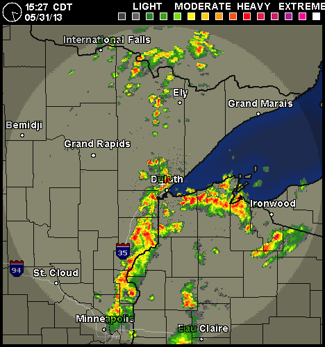
Normally, predictions of severe weather have to be calculated to subtract the human tendency of weather experts to blow things out of proportion, but today feels different. Even without media, weather radios, and sirens, any trick knee will reveal that today's weather is going to be bad.
That's the weather radar for Duluth. Let's see what it looks like as it moves through.
Here's the Webcam image at 9:43
Turn Up Your Support
MPR News helps you turn down the noise and build shared understanding. Turn up your support for this public resource and keep trusted journalism accessible to all.
9:51, via this Webcam:
9:57: The red/orange on the map is over Duluth. What does it look like on the ground? Not much.
10:08: The "green" moves in. It looks suspiciously like the "red" and "orange" weather. So far, we're unimpessed, though we're presently cowering in the basement.
10:18: We'll assume the sudden appearance of tourists constitutes the Duluth version of an "all clear."
Click on any of those images for a larger view.
If you're following via Twitter, you can find weather updates here.
I'm looking for your weather photos through the day. Send them to me at bcollins@mpr.org or use this form.

