
Colorado fires from space
Go Deeper.
Create an account or log in to save stories.
Like this?
Thanks for liking this story! We have added it to a list of your favorite stories.


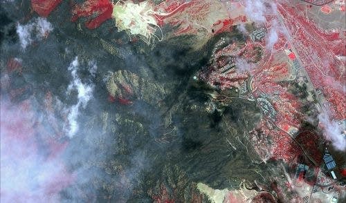
A picture released today by the satellite company, Digital Globe, captures the extent of the Waldo Canyon wildfire near Colorado Springs. You'll want to click the image for a bigger version.
Google's crisis maps is using Digital Globe's infrared imagery to help people determine if they've lost their homes.
Unseen from space, however, is the breathtaking randomness of what burned and what didn't ...
Turn Up Your Support
MPR News helps you turn down the noise and build shared understanding. Turn up your support for this public resource and keep trusted journalism accessible to all.

