
October chill ahead; heavy rain potential by Sunday night
Widespread frost next week?
Go Deeper.
Create an account or log in to save stories.
Like this?
Thanks for liking this story! We have added it to a list of your favorite stories.


We’re coming up for air across the Upper Midwest. Tuesday night’s storms left a trail of destruction across southeast Minnesota and Wisconsin.
Much of Minnesota enjoys a sunny but cooler respite. Temperatures run as much as 15 degrees cooler than Tuesday highs in the low 80s.
We warm up again Sunday and Monday before the bottom drops out next week.

Heavy rains threaten Sunday and Monday
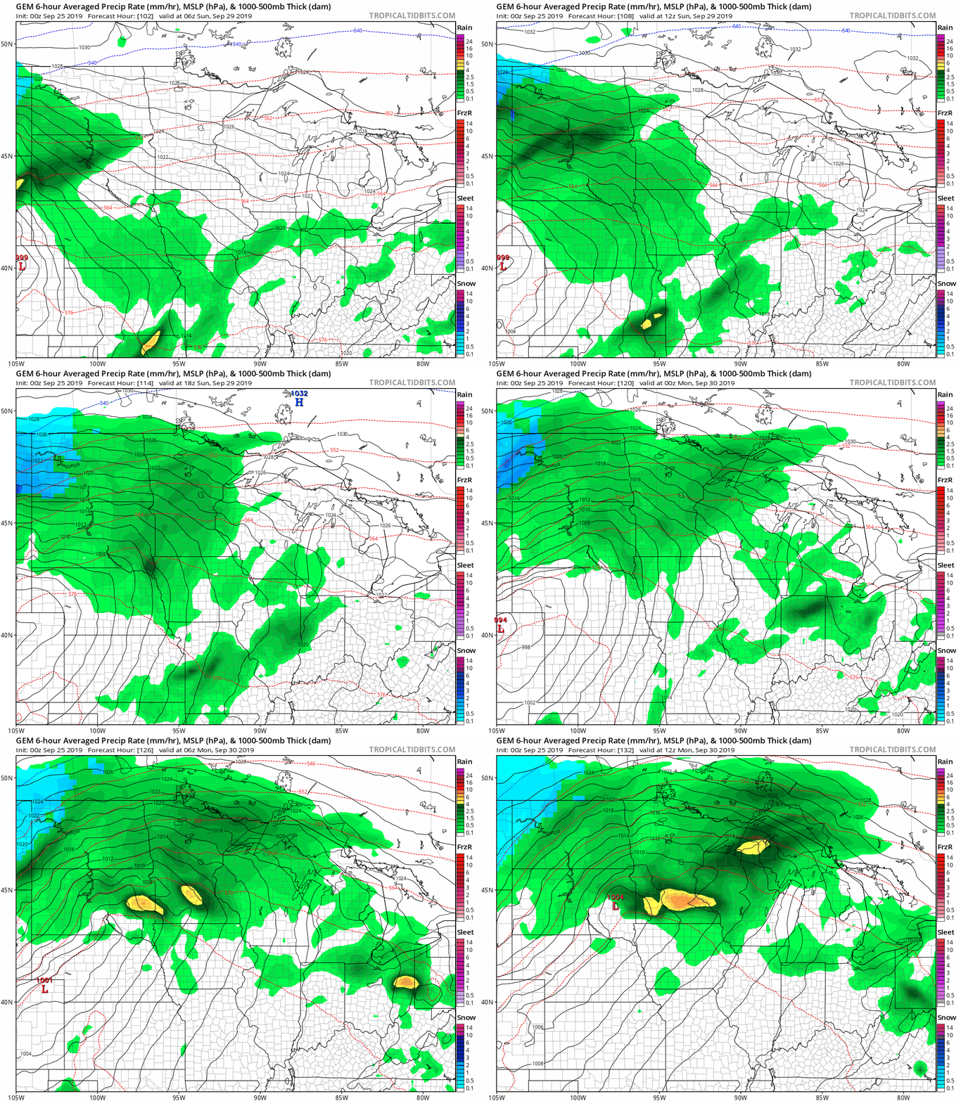
Forecast models have been cranking out another strong low-pressure system Sunday night and Monday. The Canadian model suggests a sunny dry Saturday, followed by heavy rains Sunday night into Monday.
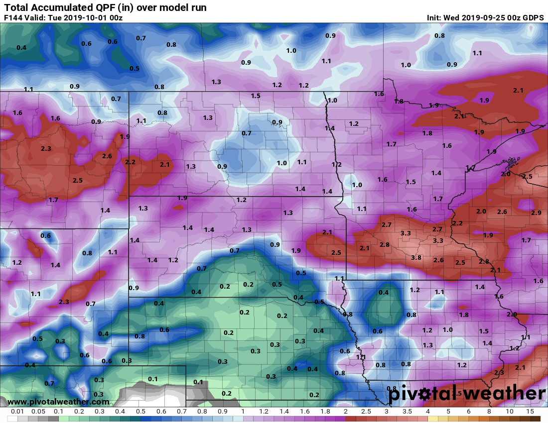
If the Canadian model is right, another swath of 1 to 3 inches of rain could fall across southern Minnesota by next Monday.
Widespread frost next week?
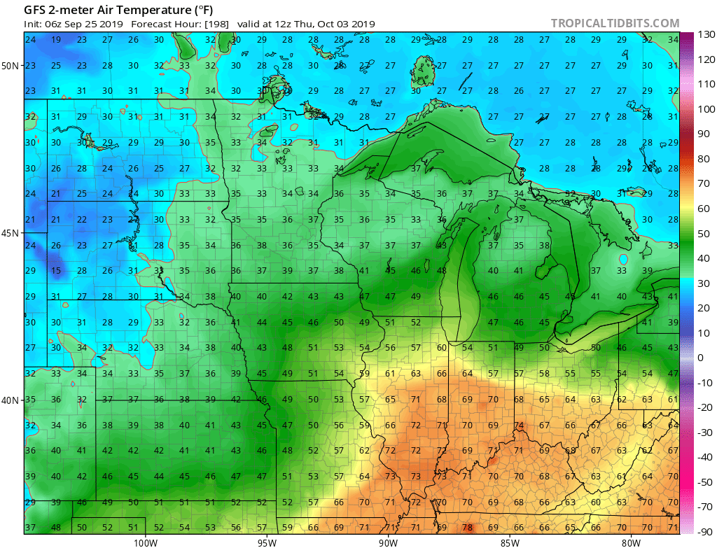
The medium-range models continue to hint at much colder air by next Thursday.
Stay tuned.
Turn Up Your Support
MPR News helps you turn down the noise and build shared understanding. Turn up your support for this public resource and keep trusted journalism accessible to all.

