
From 80s to frost: September roller coaster temperatures ahead
Weather maps showing big swings between summery days and frosty mornings.

Go Deeper.
Create an account or log in to save stories.
Like this?
Thanks for liking this story! We have added it to a list of your favorite stories.


Get ready to ride the September temperature roller coaster.
The weather maps appear to realize that it’s September in Minnesota. That means the battle for seasonal weather turf across Minnesota has begun.
Summer still has ideas about warm, sunny, lake-worthy September afternoons. Autumn insists that frosty mornings are now in vogue. The shove of alternating air masses over Minnesota now begins.
Mostly summery weekend
Turn Up Your Support
MPR News helps you turn down the noise and build shared understanding. Turn up your support for this public resource and keep trusted journalism accessible to all.
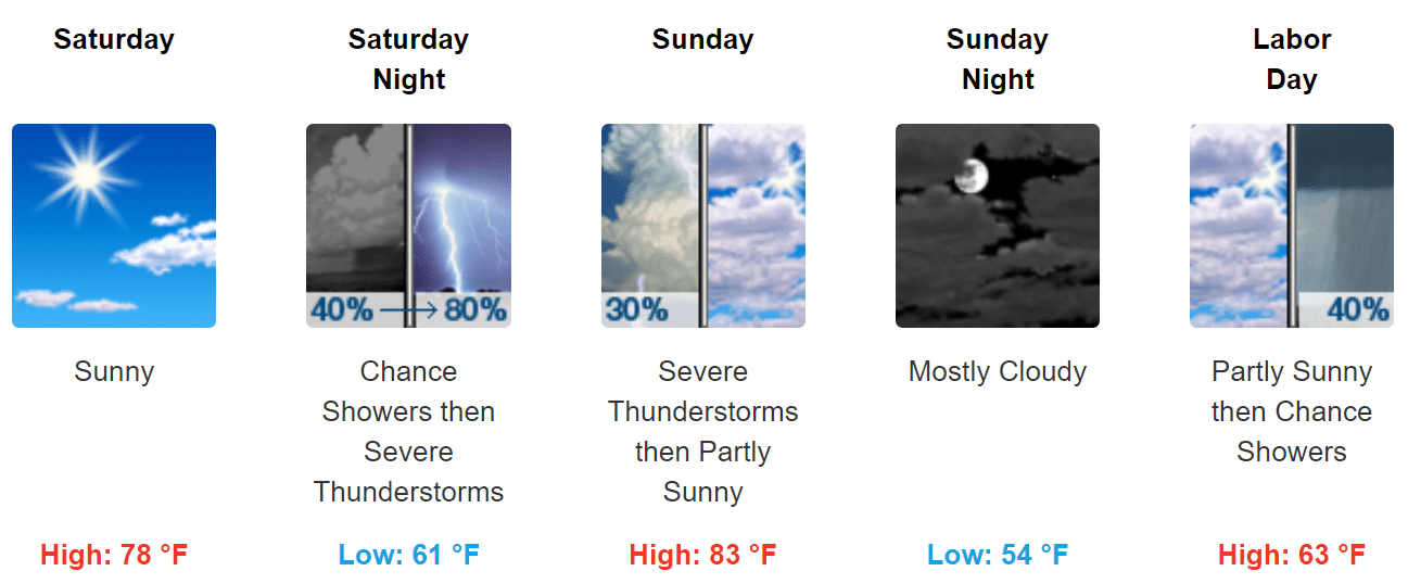
Saturday and Sunday feel like summer. A cold front sweeps across Minnesota by Labor Day will noticeably cooler breezes.
Strong to severe storms favor Saturday night in the southern half of Minnesota.
Frosty up north next week
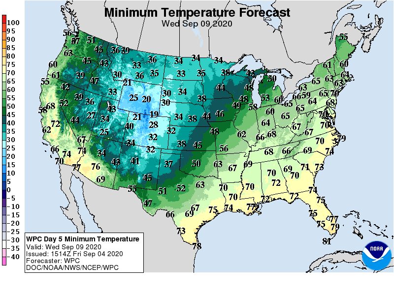
The air mass behind our Labor Day cool front brings attention-getting cold to the central U.S. next week.
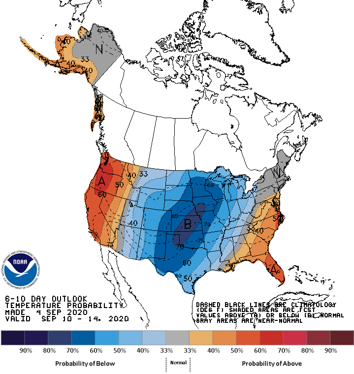
Highs will not climb out of the 50s by next Tuesday across much of Minnesota.

Frost is likely up north next week as temperatures dip into the 30s in the morning hours.
Summery again?
The upper air maps support a return of warmer air between about September 12-20.
NOAA’s week 3-4 temperature maps suggest warmer than average temperatures in late September.

Meteorological summer may be over, but we may not be done with summer temperatures just yet.
Stay tuned.

