
Zero to 10 inches for Twin Cities Thursday?
Forecast models all over the place on snowfall totals
Go Deeper.
Create an account or log in to save stories.
Like this?
Thanks for liking this story! We have added it to a list of your favorite stories.


Meteorologists expect variability in forecast model snowfall totals. But this is a little extreme.
I posted earlier Tuesday about this weekend’s cold wave, and our snowfall chances on Thursday. It still looks like the Twin Cities may ride the edge of accumulating snows.
But check out the afternoon (18Z) forecast model runs snowfall output. There is an extreme variance between two of the American forecast models. Depending on which forecast turns out to be right, if either, the solutions range from no snowfall, to over 10 inches in parts of the Twin Cities.
Here’s NOAA’s GFS model snowfall forecast. It suggests little to no snow through the northwest half of the Twin Cities.
Turn Up Your Support
MPR News helps you turn down the noise and build shared understanding. Turn up your support for this public resource and keep trusted journalism accessible to all.

Now look at NOAA’s NAM 3 km resolution snowfall. This model suggests a more westward storm track, and cranks out heavy snow over 10 inches into the Twin Cities area.
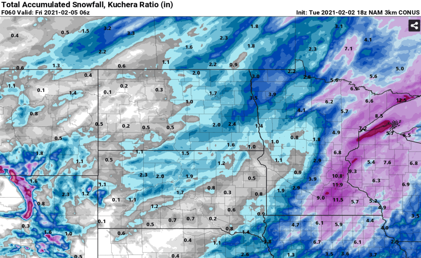
So how do we interpret these differences 48 hours before a possible snow system?
We look at other models and sanity check the solutions. At this point, the NAM model (suggesting heavier snow) seems to be the outlier. Most solutions are closer to the GFS model above and suggest a cutoff between little or no snow in the northwest Twin Cities, to a few inches southeast.
Stay tuned.

