
Nowcast: Line of storms likely to develop southeast of Twin Cities
NOAA says 60% chance of a severe weather watch soon

Go Deeper.
Create an account or log in to save stories.
Like this?
Thanks for liking this story! We have added it to a list of your favorite stories.


It’s going to be an interesting evening of radar watching just east of the Twin Cities area.
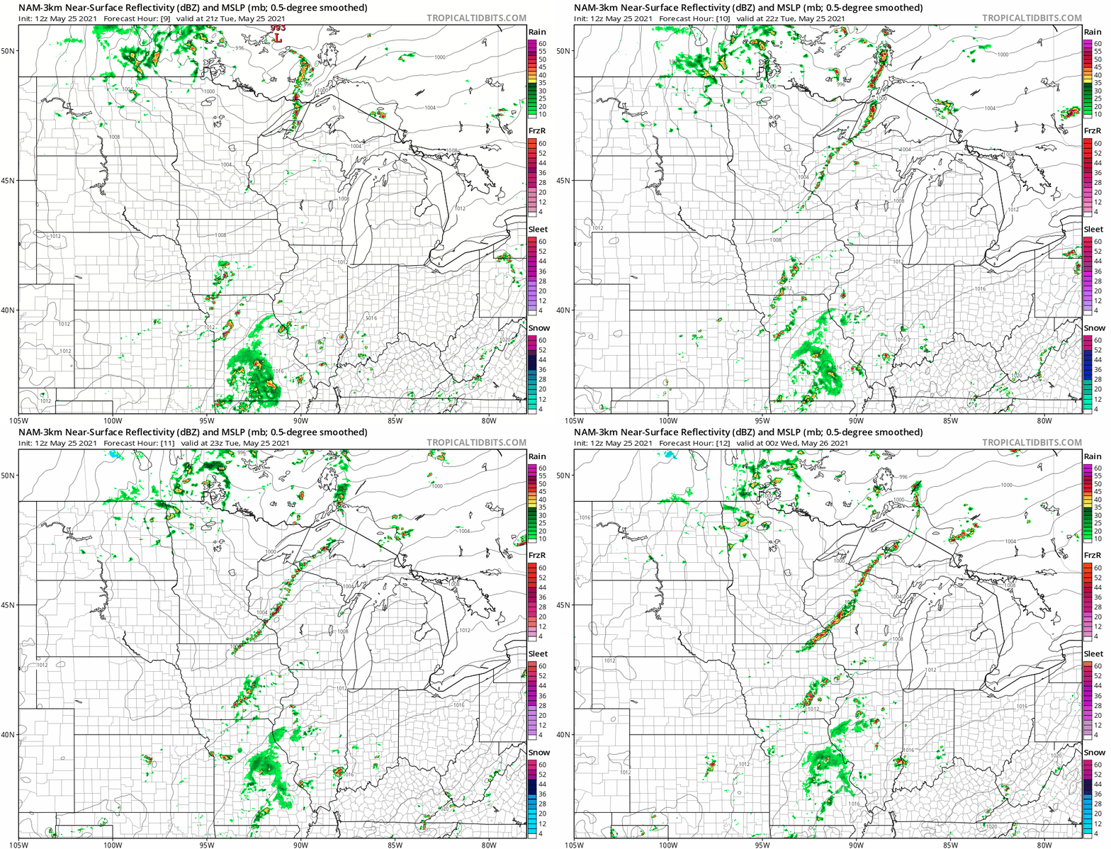
Our breezy warm July-like afternoon gives way to a cold front sweeping across Minnesota. Short-range models show a possible narrow line of storms developing along the boundary as it sweeps eastward into this evening.
The National Oceanic and Atmospheric Administration’s Storm Prediction Center estimates a 60 percent chance of a severe weather watch from the eastern Twin Cities into Wisconsin and southeast Minnesota Tuesday afternoon and evening.
NOAA’s NAM 3 km resolution model paints the narrow developing line just east of the Twin Cities Tuesday afternoon, then sweeps it east across southeast Minnesota and Wisconsin Tuesday evening.
NOAA’s Storm Prediction Center assesses a slight risk for severe storms across parts of southeast Minnesota in Wisconsin, with a marginal risk brushing into the eastern Twin Cities.
Most of the Twin Cities will stay dry this evening but watch for a narrow band of thunderstorms to sweep through southeast Minnesota and Wisconsin.
Fire weather
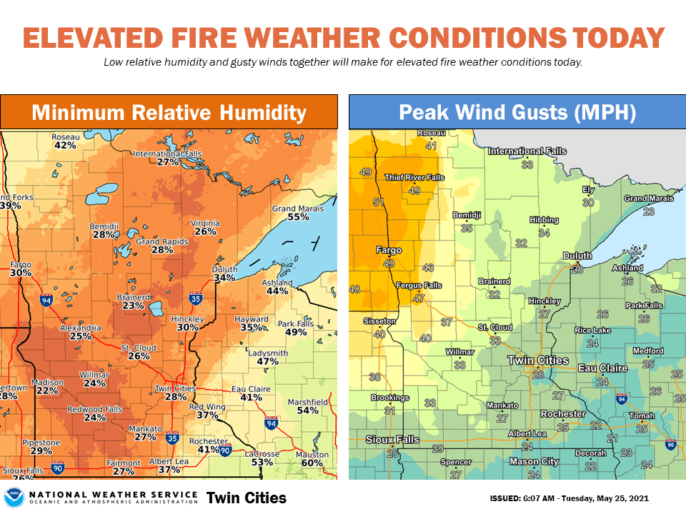
There is much drier air and high winds behind the front. That means elevated fire danger across western Minnesota Tuesday afternoon and evening. Wind gusts over 30 mph and relative humidity under 25 percent combine to produce high fire spread danger in these areas.
Turn Up Your Support
MPR News helps you turn down the noise and build shared understanding. Turn up your support for this public resource and keep trusted journalism accessible to all.

