Minnesota sees another week of heat-related problems

An elevated fire risk and the potential for heat illnesses stay a concern

Reece Riebel, 13, of Lewiston, Minn.
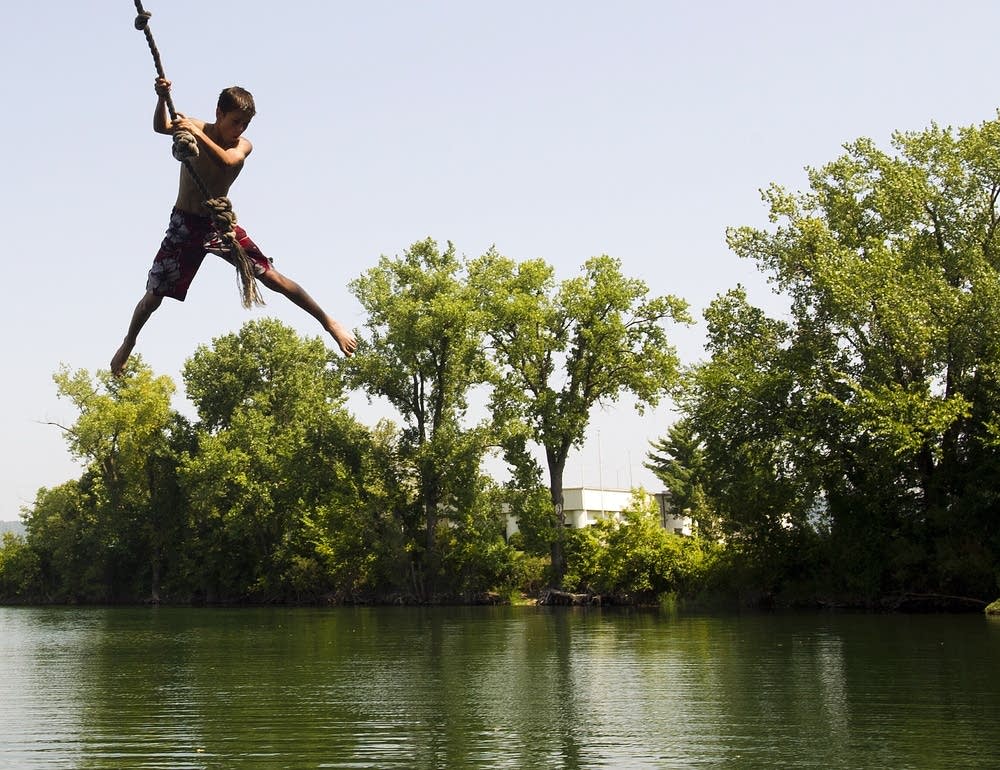
Reece Riebel, 13, of Lewiston, Minn., swings on a rope swing over Airport Lake while swimming in Winona, Minn. The heat wave Minnesota has experienced since last week persists in the days ahead.
Andrew Link | AP 2013

The heat wave Minnesota has experienced since last week persists in the days ahead. This excessive heat is also continuing to contribute to everything from heat-related illnesses to a fire risk and potential severe weather.

Monday’s forecast

Under clear skies and lower dew points, northern Minnesota dropped down to almost seasonable lows overnight, with widespread 50s and even a few 40s. 

However, dew points trend higher as you head south, and the resulting higher humidity kept much of southern Minnesota unseasonably warm overnight, with 60s and even a few 70s, including around the Twin Cities. 

Highs stay 10 to 20 degrees above average again Monday, with a few 80s north, but most of the state in the 90s again.

Create a More Connected Minnesota

MPR News is your trusted resource for the news you need. With your support, MPR News brings accessible, courageous journalism and authentic conversation to everyone - free of paywalls and barriers. Your gift makes a difference.

weather graphic
Monday high temperatures
National Weather Service

Because of the warm start, elevated humidity, and hot daytime weather, the Twin Cites and surrounding areas are under a heat advisory all of Monday.

Although the humidity is higher in parts of southern Minnesota, most of the state will have a combination of hot weather, lower humidity, and breezy conditions, which is elevating the fire risk for almost all of the state.

An area of low pressure will start moving showers and storms into northwestern Minnesota by Monday evening, and across the northern edge of the state overnight. 

Those storms do carry a risk for severe weather, especially damaging winds and possibly hail, but any associated rain would be very beneficial.

weather graphic
Severe weather risk Monday
National Weather Service

Staying hot

Although records are less likely to be as widespread as Minnesota saw late last week, the week ahead stays very hot for early June, with much of the state the in 90s through at least Thursday.

Overnight lows remain warm also, with most places staying in the 60s, and southern Minnesota especially can expect some 70s.

Here is that forecast for the Twin Cities, showing the hot weather and the comparison to record highs:

weather graphic
Twin Cities forecast versus record highs through Friday
National Weather Service

Because there is little relief form the heat even in the overnights, the Twin Cities and surrounding counties are in a heat advisory straight through to Thursday evening. 

weather graphic
Heat advisory through Thursday evening
National Weather Service

That area may be expended or the time frame extended as conditions warrant. 

Meanwhile, there are a couple chances for showers or storms, especially in northern Minnesota, but nothing that is forecast to be widespread. The first state-wide rain chance currently looks to come Friday with scattered showers and storms. 

weather graphic
Friday forecast precipitation
Tropical Tidbits

Although most places will probably see less than one-quarter inch of rain and there will be plenty of dry breaks during the day, the extra clouds and rain may help drop more of Minnesota into the 80s by Friday or Saturday. 

While still warmer than average, it would bring some relief from the current heat. Even with fewer 90s likely, next week also looks likely to stay well above average, meaning more 80s are possible.

weather graphic
Temperature probability outlook June 12 to 16
National Oceanic and Atmospheric Administration

Programming note

You can hear my live weather updates on Minnesota Public Radio at 7:49 a.m. Monday through Friday morning.