
January chill this week, more like April next week
As much as 40 degrees warmer next week?

Go Deeper.
Create an account or log in to save stories.
Like this?
Thanks for liking this story! We have added it to a list of your favorite stories.


Welcome to March in Minnesota. Here, you can shiver in brittle breezes one week, and bask under springtime sunshine and balmy temperatures the next week. Don’t believe me?
Check out the coldest and warmest temperatures ever recorded in the Twin Cities during the month of March.
Coldest: minus 32 degrees (March 1, 1962)
Warmest: 83 degrees (1910, 1968, 1982)
That’s a 115-degree historical temperature swing during the month of March in the Twin Cities.
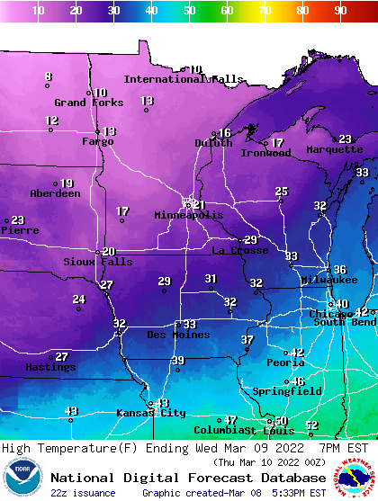
This week feels more January than March. Our average high and low temperatures this week for the Twin Cities are about 38 and 22 degrees.
Turn Up Your Support
MPR News helps you turn down the noise and build shared understanding. Turn up your support for this public resource and keep trusted journalism accessible to all.
The inbound air mass behind Tuesday’s and Friday’s cold fronts will keep temperatures about 10 to 15 degrees below average through Saturday.
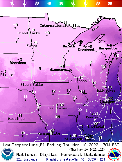
Overnight lows reach January levels across Minnesota. Expect subzero temperatures up north, with single digits in the south for much of this week.
We may see a few snow showers again Friday, but little or no significant precipitation is likely this week.
Spring fever next week
I’ve detailed the big change ahead next week in my earlier post Tuesday. The most conservative forecasts crank out highs in the 50s next week for the Twin Cities and southern Minnesota.
The National Oceanic and Atmospheric Administration’s Global Forecast System model pushes 60s up into the Twin Cities.
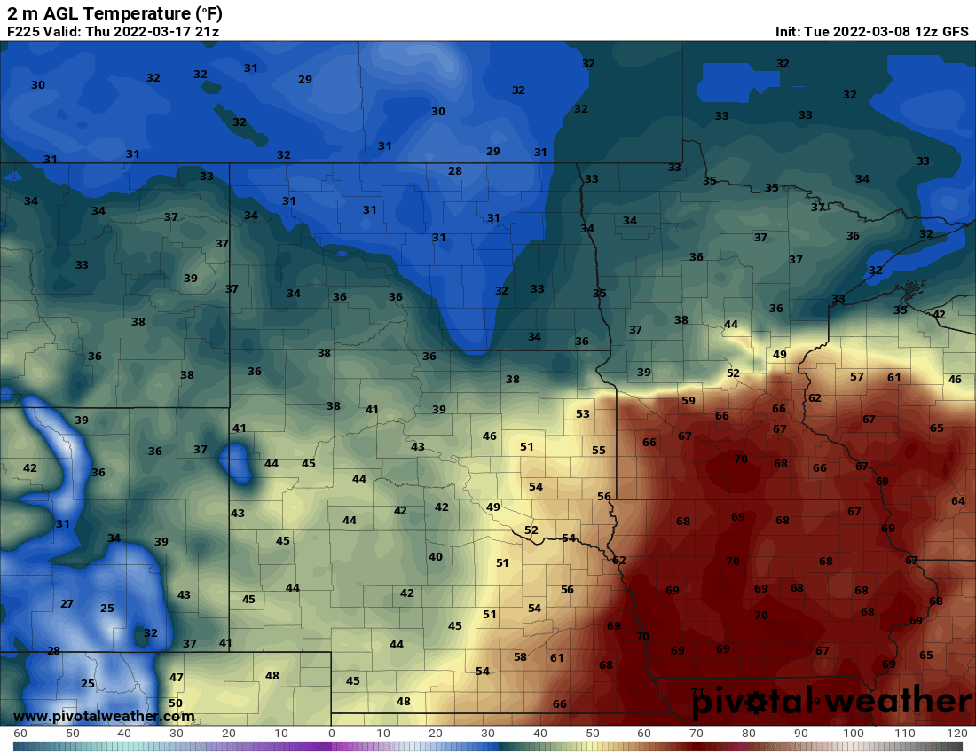
One interesting trend to watch next week will be how quickly snow cover melts. Our strong March sun will do a number on the snow. There’s still plenty of deep snow up north. But my best estimate is snow cover will be scarce from the Twin Cities southward by next Thursday.

Stay tuned.

