
Slight severe weather risk favors northern Minnesota and Wisconsin Tuesday
"Conditional" severe weather risk Tuesday. A cool front cutting into our heat and humidity may blow up a few severe cells.

Go Deeper.
Create an account or log in to save stories.
Like this?
Thanks for liking this story! We have added it to a list of your favorite stories.


Our latest hot front brings another torrid day Tuesday.
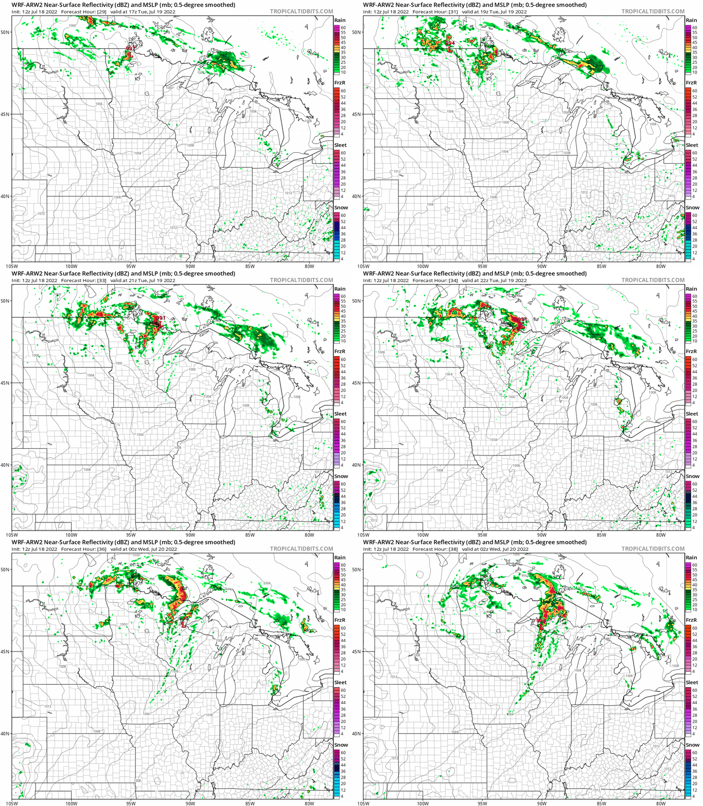
A slightly but noticeably cooler front will sweep through Minnesota by Tuesday evening. A low-pressure system will dive near the Canadian border Tuesday. The trailing cool front should spark a few thunderstorms favoring areas north of a Brainerd to Hinckley to Eau Claire line through Tuesday evening. NOAA’s Storm Prediction Center posted a slight risk (2 of 5 categories) for severe storms in that area Tuesday.
Overall storm coverage may be only 20 to 30 percent, but any storms that fire in our hot steamy air mass will have a chance to go severe with 60 plus mph winds and large hail greater than 1” in diameter.
NOAA’s WRF model paints a few scattered storms across northern Minnesota and Wisconsin Tuesday. The forecast model loop below runs between noon and 9 p.m.
Turn Up Your Support
MPR News helps you turn down the noise and build shared understanding. Turn up your support for this public resource and keep trusted journalism accessible to all.
Twin Cities: Marginal risk zone
Forecast models say instability and forcing for storms are more limited across central and southern Minnesota Tuesday. That means storm chances are lower around the greater Twin Cities.
That’s why there's just a marginal risk for severe storms from Fargo, through St. Cloud, and along the I-94 corridor into the greater Twin Cities, down to Rochester.

To my eye it looks like to cool front will push through the Twin Cities area late tomorrow afternoon before storms will have an opportunity to develop. The front looks more likely to spark scattered storms into Wisconsin as we move into Tuesday evening.
So keep an eye and ear out for severe storms potential Tuesday especially north and east of the Twin Cities.

