
Strong thunderstorms possible late Sunday afternoon/Sunday evening
Timing of storms will vary across Minnesota
Go Deeper.
Create an account or log in to save stories.
Like this?
Thanks for liking this story! We have added it to a list of your favorite stories.


Parts of the Twin Cities metro area, southeastern Minnesota and western Wisconsin saw downpours and damaging thunderstorm winds Saturday evening.
There were reports of trees down in several locations, including Lakeville, Apple Valley and Eagan in Dakota County and Maplewood in Ramsey County.
A tree fell on a mobile home in Apple Valley Saturday evening:
A 61 mph wind gust was reported Saturday evening at the Minnesota State Fair, and downpours caused some flooding:
Turn Up Your Support
MPR News helps you turn down the noise and build shared understanding. Turn up your support for this public resource and keep trusted journalism accessible to all.

A storm survey crew from the Twin Cities NWS office will go out today and assess wind damage from the Saturday evening storms.
Another round of storms later today
We could see another batch of strong to severe thunderstorms late Sunday afternoon and Sunday evening in parts of Minnesota and western Wisconsin.
There are a few lingering showers Sunday morning in parts of the Twin Cities metro area plus southeastern Minnesota and western Wisconsin. Those same areas could also see an isolated thunderstorm. An isolated shower or thunderstorm is possible early this afternoon in Minnesota and western Wisconsin, but the main weather event will be later today.
A more organized area of showers and thunderstorms is expected to develop in western Minnesota by late Sunday afternoon and move eastward Sunday evening and overnight Sunday night.
NOAA’s North American Mesoscale (NAM) forecast model shows the potential rain pattern from 1 p.m. today to 1 a.m. Monday:
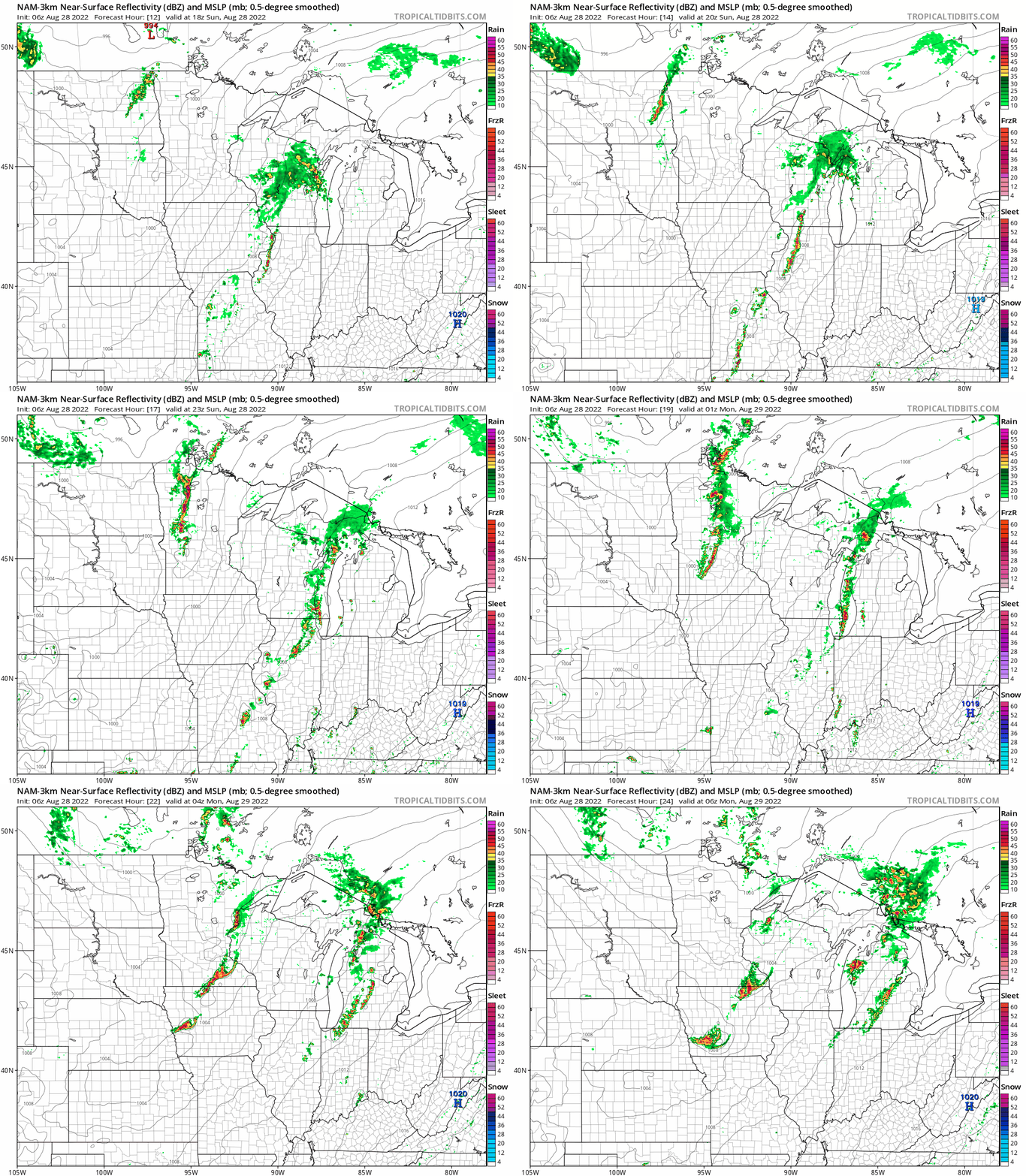
Thunderstorm coverage may be more extensive than what is shown in the NAM model.
Here’s the NWS chart of rainfall timing today:

Severe weather outlook
The NWS Storm Prediction Center shows a slight risk (shaded yellow) of severe weather Sunday afternoon and Sunday evening for much of Minnesota (including the Twin Cities metro area) and portions of western Wisconsin:

Slight risk means that scattered severe thunderstorms are possible:

An isolated severe thunderstorm is possible in the dark-green shaded areas on the map. Our severe weather risk in the Twin Cities metro area will be mainly Sunday evening.
You can track showers and thunderstorms on the new interactive radar on the MPR weather page. You can pan and zoom the radar display on our site to see precipitation at your location, across all of Minnesota and western Wisconsin and beyond.
We have updated weather information for Minnesota and western Wisconsin on the Minnesota Public Radio News network, and on the MPR News live weather blog.
Sunday temps and dew points
Sunday highs will be mainly in the 80s, with 70s in northeastern Minnesota:

Sunday afternoon dew points will be in the 60s and lower 70s:

Programming note
You can hear my live weather updates on MPR News at 7:35 a.m., 9:35 a.m. and 4:39 p.m. Saturday and Sunday.

