
Weekend weather: Plenty of sun, comfy temps Saturday through Labor Day
Dew points return to the comfortable range for Saturday and Sunday

Go Deeper.
Create an account or log in to save stories.
Like this?
Thanks for liking this story! We have added it to a list of your favorite stories.


We have warm temps and sticky dew points Friday, but cooler and drier air will move in Friday night.
There is a chance of occasional scattered showers and thunderstorms mainly in the southeastern half of Minnesota and western Wisconsin Friday afternoon and evening. The National Weather Service Storm Prediction Center shows a marginal risk (shaded dark-green) of severe weather from southeastern Minnesota into Wisconsin:
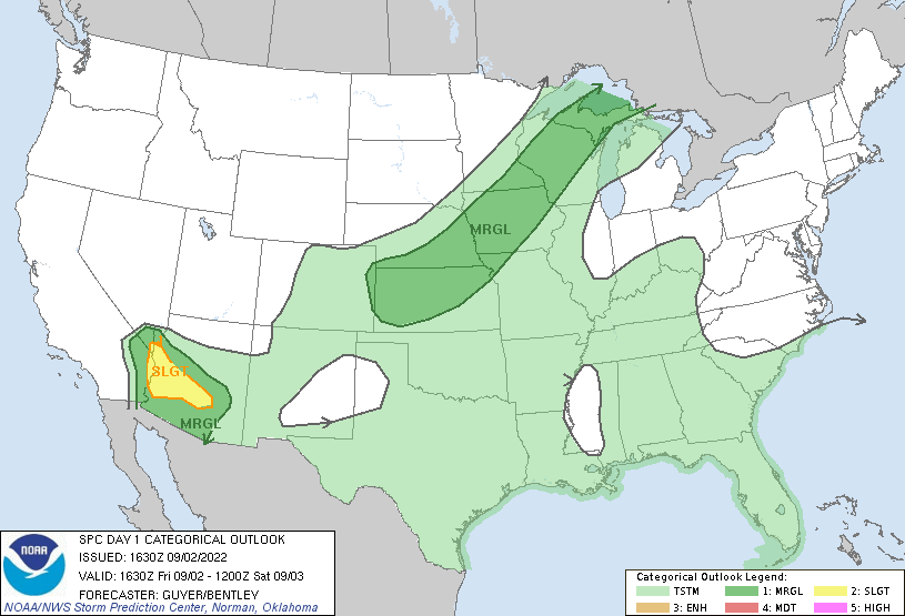
Marginal risk means that an isolated severe thunderstorm is possible.
You can track showers and thunderstorms on the new interactive radar on the MPR News weather page. You can pan and zoom the radar display on our site to see precipitation across all of Minnesota, western Wisconsin and beyond.
Turn Up Your Support
MPR News helps you turn down the noise and build shared understanding. Turn up your support for this public resource and keep trusted journalism accessible to all.
We have updated weather information for Minnesota and western Wisconsin on the Minnesota Public Radio News network, and on the MPR News live weather blog.
Quiet weather from Saturday into Labor Day
A nearby high-pressure system will deliver plenty of sunshine to Minnesota and western Wisconsin on Saturday and Sunday. The National Oceanic and Atmospheric Administration’s North American Mesoscale forecast model still looks rain-free in our area from 4 a.m. Saturday to 7 p.m. Sunday:
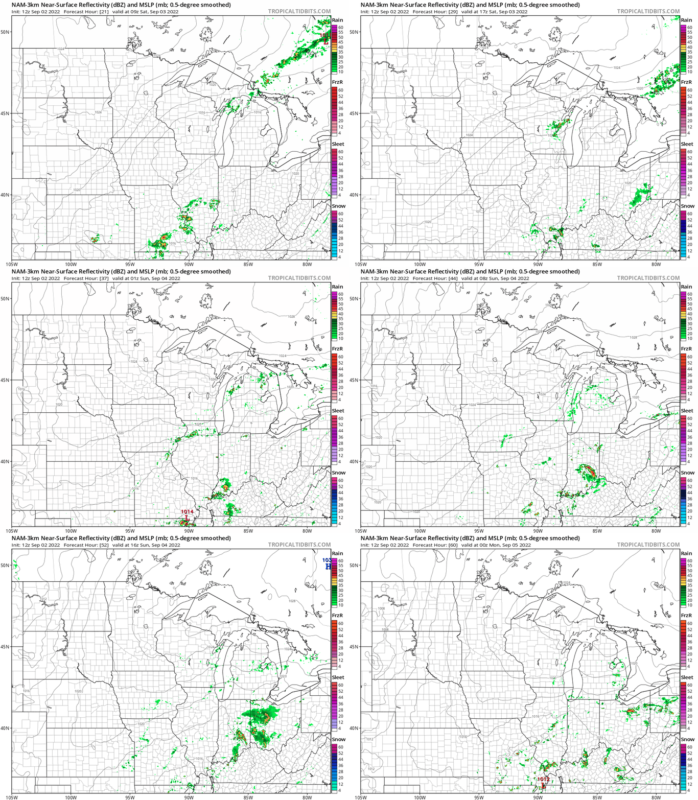
Labor Day also looks rain-free in Minnesota and western Wisconsin. Check forecast updates.
Temps and dew points
Our average Twin Cities high temperature is 77 degrees on Sept. 3. Saturday highs will be in the mid-70s across much of the metro area.
There’ll be a lot of 70s in central and southern Minnesota, plus west-central Wisconsin on Saturday, with 60s in far northern Minnesota and parts of northwestern Wisconsin:

Saturday afternoon dew points will be in the comfortable 40s and lower 50s:

Sunday highs will be mainly in the 70s, with 60s in parts of northeastern Minnesota:

Sunday afternoon dew points will remain in the comfortable 40s and lower 50s:

Labor Day highs range from mid-80s in parts of southwestern Minnesota to 70s in the northeast:

Some spots in the metro area could top 80 degrees on Labor Day.
Monday afternoon dew points creep up into the lower 60s in the metro area and southeastern Minnesota, with 50s elsewhere:

Programming note
You can hear my live weather updates on MPR News at 7:35 a.m., 9:35 a.m. and 4:39 p.m. Saturday and Sunday.

